



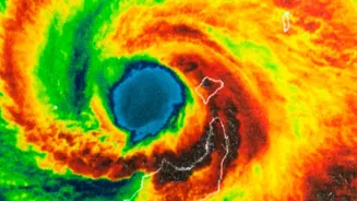

Eyes in the Sky Deliver a Clear Verdict
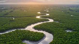
For decades, we have understood that the Sundarbans, the vast mangrove forest spanning India and Bangladesh, is vital. But quantifying its exact contribution has been challenging. Now, a new generation of high-resolution satellites is changing the game.
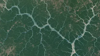
By analysing images and data from missions like Sentinel-2, scientists can peer into the forest's health, density, and structure with unprecedented detail. This remote sensing technology allows researchers to conduct a large-scale health check-up without setting foot in the dense, complex terrain. By measuring indicators like the Normalised Difference Vegetation Index (NDVI), which acts as a marker for plant health, scientists can track changes over seasons and years, assessing everything from cyclone damage to the forest's overall resilience. This technology moves beyond estimation, providing verifiable data on the Sundarbans' crucial functions.
A Super-Powered Carbon Sponge
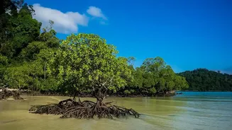
One of the most significant findings confirmed by satellite data is the Sundarbans' incredible capacity for carbon storage. Mangrove forests are known as 'blue carbon' ecosystems, and they are superstars in the fight against climate change, capable of storing up to four times more carbon per hectare than mature tropical rainforests. The recent studies, integrating satellite imagery with on-ground data, estimate that the Sundarbans sequester millions of tonnes of CO2 equivalent annually. This carbon is locked away not just in the trees themselves, but more significantly in the deep, complex root systems and the oxygen-poor soil they anchor. This makes the forest a globally important carbon sink. However, these studies also carry a warning: the data reveals that this carbon-capturing ability is under stress from factors like increased salinity and reduced freshwater flow, highlighting the urgency of conservation.
The Green Wall Against the Waves
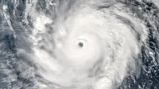
Beyond its role in climate mitigation, the Sundarbans serves as a life-saving physical barrier for millions of people in coastal West Bengal and Bangladesh. When cyclones barrel in from the Bay of Bengal, the dense network of mangrove trunks, roots, and canopy acts as a natural breakwater. Studies have modeled and measured this effect, showing that mangroves can significantly reduce the height and energy of storm surges. Depending on the width and density of the forest, storm surge heights can be reduced by anywhere from 5 to 50 centimetres for every kilometre the surge travels through the mangroves. The dense vegetation effectively dissipates wave energy, slowing down the wall of water and reducing the extent of inland flooding. For a region that has been hit by 13 supercyclones in the last two decades, including the devastating Cyclone Amphan in 2020, this natural defence is priceless.
From Data to Decisive Action
The verification provided by this satellite data is more than an academic exercise; it is a powerful tool for policy and conservation. By putting a clear, quantifiable value on the ecosystem services provided by the Sundarbans, these studies provide a compelling economic and social argument for its protection. The data can pinpoint areas of the forest that are losing resilience or are most vulnerable to threats like erosion and human encroachment. This allows for targeted conservation efforts, from mangrove replanting initiatives to better management of upstream river flows. The IUCN has already classified the Indian Sundarbans ecosystem as 'endangered', facing threats from historical deforestation and ongoing climate pressures. The new wealth of satellite information reinforces the fact that protecting this natural shield and carbon sponge is not just an environmental issue, but a critical matter of national security and economic stability for India.