






An Unseen Climate Challenge
Methane is the main component of natural gas, but when it escapes into the atmosphere unburned, it becomes a powerful climate pollutant. It is responsible for roughly 30% of global warming, with a warming potential more than 80 times that of carbon dioxide
over its first two decades in the atmosphere. The Permian Basin, a massive oil and gas producing region spanning West Texas and southeastern New Mexico, is one of the largest sources of these emissions in the United States. For years, the true scale of these leaks was unknown, relying on company estimates and infrequent on-the-ground inspections. This wasted gas not only accelerates climate change but also represents a significant loss of product for operators, amounting to millions of dollars in unsold fuel.
Technology's Watchful Gaze
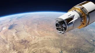
A growing constellation of advanced satellites is changing the game entirely. Companies and non-profits like GHGSat, Carbon Mapper, and the Environmental Defense Fund's MethaneSAT are now equipped with sophisticated sensors that can pinpoint methane emissions from orbit. These instruments work by using a technology called spectroscopy. As sunlight reflects off the Earth, the sensors can detect the unique spectral 'fingerprint' of methane gas in the atmospheric column, distinguishing it from other gases. This allows them to not just detect a leak but also measure its size and, crucially, trace it back to a specific facility, whether it's a well pad, compressor station, or a segment of pipeline. This capability to monitor vast, remote areas frequently and accurately provides a level of transparency that was previously impossible.
Connecting Dots from Orbit to Ground
The raw satellite data is just the first step. The real accountability comes from turning that data into actionable information. When a satellite detects a significant methane plume, data analysts get to work. They overlay the plume data with detailed maps of energy infrastructure, which can include thousands of individual wells and hundreds of miles of pipelines. By combining data from different satellites—some offering wide-area scans and others providing high-resolution focus—they can often narrow down the source of a major leak to a single operator. Organizations like the Environmental Defense Fund make this data publicly available, sometimes within days of detection, putting the information in the hands of regulators, investors, and the public.
The Accountability Engine in Action
This new firehose of data creates pressure from multiple directions. When MethaneSAT revealed that emissions in the Permian were potentially four times higher than EPA estimates, it triggered a congressional investigation into the practices of the basin's largest operators. This regulatory scrutiny forces companies to justify the discrepancy between their self-reported figures and what the satellites observe. Beyond government, investors and financial institutions are using this data to assess the environmental, social, and governance (ESG) risk of their holdings. A company with a documented history of unaddressed leaks may be seen as a riskier investment. This market pressure provides a powerful financial incentive for operators to clean up their act, independent of formal regulations.
A Shift in Corporate Strategy
Faced with nowhere to hide, pipeline operators are being forced to adapt. Many are now proactively investing in advanced leak detection and repair (LDAR) programs that go beyond minimum regulatory requirements. The satellite data has also highlighted the effectiveness of strong policy. For instance, data from MethaneSAT showed that the methane intensity (the amount of methane leaked relative to production) on the New Mexico side of the Permian was less than half that of the Texas side. Researchers attribute this difference to more stringent methane regulations implemented by New Mexico, providing clear evidence that policy changes can drive measurable results. This is compelling companies to move away from mere compliance and toward a strategy of continuous monitoring and emissions management, knowing their performance is visible to the world.