



A Constant Eye in the Sky
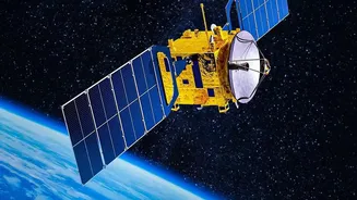
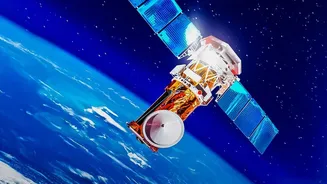
What makes the EOS-05 mission special is its destination: a geostationary orbit approximately 36,000 kilometres above the Earth's equator. Unlike conventional remote sensing satellites that circle the planet in lower orbits and can only view a specific
location for a few minutes each day, a geostationary satellite moves in sync with the Earth's rotation. This allows it to appear stationary over a fixed point, providing a constant, unblinking eye over the Indian subcontinent. This capability, often called geo-imaging, is a technological leap, enabling near-continuous monitoring of a vast area. The satellite, also known as GISAT-1A, is designed to image the entire Indian landmass every half-hour and a select region of interest every five minutes, offering data at an unprecedented frequency.
A Game-Changer for Disaster Management
The primary benefit of this constant watch is a revolutionary upgrade to India's disaster management capabilities. For rapidly evolving events like cyclones, floods, and forest fires, intermittent satellite passes are often not enough. EOS-05 will provide a stream of images that can track the formation and movement of cyclones, monitor floodwaters in near real-time, and detect the spread of large forest fires. This high-tempo data stream is crucial for providing timely warnings, planning evacuation routes, and coordinating relief and rescue operations on the ground. By observing cloud patterns, ocean surface temperatures, and atmospheric conditions continuously, the satellite will significantly enhance the accuracy and timeliness of weather forecasts.
Beyond Weather: Mapping a Nation's Resources
The mission's scope extends far beyond disasters. EOS-05's multispectral and hyperspectral imaging payloads will gather data across various light frequencies, providing rich insights into India's natural resources. This includes applications for agriculture, such as monitoring crop health, assessing soil moisture, and predicting yields. It will also aid in forestry management by tracking vegetation cover and deforestation. Furthermore, the satellite's data can be used for urban planning, monitoring water bodies, and mineral prospecting. While its primary role is civilian, the ability to frequently monitor large areas of strategic interest also provides a significant national security advantage.
A Story of Resilience and Redemption
The EOS-05 launch carries profound significance for ISRO, as it is a second attempt to achieve this ambitious goal. Five years ago, in August 2021, the nearly identical GISAT-1 satellite (then known as EOS-03) was lost during launch. A technical anomaly in the GSLV rocket's cryogenic upper stage prevented the engine from igniting, and the satellite could not be placed into orbit. The failure was a major setback. The successful launch of EOS-05 would therefore be a moment of redemption, demonstrating ISRO's perseverance and its mastery over the complex cryogenic launch technology. This mission is a testament to the organisation's ability to analyse failures, implement corrections, and return to the launchpad with renewed confidence.
Part of a Broader Space Vision
EOS-05 does not operate in isolation. It complements India's extensive constellation of Earth observation satellites, which is already one of the largest in the world. This includes the Resourcesat series for resource monitoring, the Cartosat series for high-resolution mapping, and the Oceansat series for oceanographic studies. It also fits into a global context of advanced space-based monitoring, including the joint NASA-ISRO Synthetic Aperture Radar (NISAR) mission, which is designed to observe environmental changes on a global scale. By adding a persistent geostationary asset to this powerful fleet, India solidifies its position as a major space power committed to using technology for national development and scientific advancement.