






A Sharper, Hotter View from Space
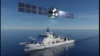
For decades, scientists have monitored the oceans, but the latest data represents a quantum leap in clarity. Missions like the Surface Water and Ocean Topography (SWOT) satellite, a joint effort between NASA and international partners, are revolutionizing
oceanography. Instead of just measuring broad temperature zones, SWOT uses advanced radar to measure the height of the ocean's surface with centimetre-level accuracy. Since water expands as it warms, these height measurements provide a direct and incredibly detailed map of where heat is accumulating. This technology allows scientists to see smaller ocean features like eddies and currents that play a huge role in how heat is absorbed and moved around the planet, details that were previously invisible from space.
The Pacific Sounds the Alarm
The most dramatic story in the recent satellite data comes from the tropical Pacific. As of mid-2026, images from the Sentinel-6 Michael Freilich satellite show a massive expanse of warmer-than-average water, a tell-tale sign of a powerful El Niño event taking shape. This isn't just a surface-level phenomenon. The satellite detects a rise in sea level across this region, indicating a deep reservoir of heat that could fuel extreme weather patterns globally for months to come. Scientists are noting that the conditions are reminiscent of past major El Niño events, which have been linked to severe droughts in some regions and devastating floods in others.
More Than Just Temperature
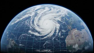
The data tells us that about 90% of the excess heat from global warming has been absorbed by the oceans, a staggering figure that highlights the sea's role as a climate buffer. However, this service comes at a high price. The thermal expansion of seawater is a primary driver of global sea level rise, which has accelerated in recent years. According to NASA's analysis, the rate of rise has more than doubled over the past three decades. This directly translates to increased coastal flooding, even on sunny days, threatening communities and infrastructure around the world. The added heat also provides more energy for hurricanes, potentially making them stronger and more destructive.
An Ecosystem Under Stress
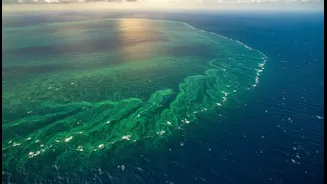
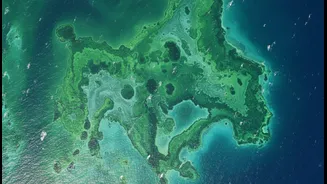
Beyond the physical changes to our coastlines and weather, the warming water is pushing marine ecosystems to their limits. Coral reefs, which are vital for biodiversity and coastal protection, are experiencing widespread bleaching events as temperatures exceed their survival threshold. Warmer waters can also lead to the proliferation of harmful algal blooms and disrupt the food web from the bottom up. Satellites can track the health of phytoplankton, the microscopic plants that form the base of the marine food chain, and the latest imagery shows significant changes in their distribution, which has cascading effects on fish populations and the livelihoods that depend on them.
What Scientists Are Watching Next
With this firehose of new, high-resolution data, scientists are working to refine their climate models. A key focus is understanding the fine-scale ocean dynamics that SWOT can now see, as these small eddies are thought to be responsible for transporting a significant amount of heat and carbon into the deep ocean. Researchers are also closely monitoring the developing El Niño, using the latest satellite information to provide more accurate forecasts of its potential intensity and global impacts. The continuous stream of data from these missions is crucial for predicting regional changes and giving communities advance warning of hazards like marine heatwaves and the risk of intensified storms.