




A World on the Brink
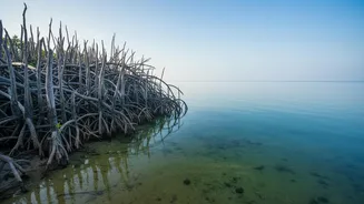
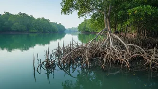
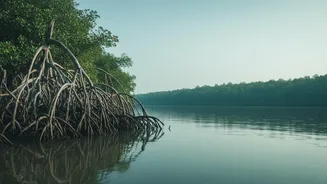
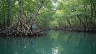
The Sundarbans, the world's largest contiguous mangrove forest and a UNESCO World Heritage Site, is a land of dualities. It is both resilient and extraordinarily fragile, a protector of coastal communities that is itself in desperate need of protection.
For the 4.5 million people living in and around this unique delta, life is dictated by the rhythm of the tides. But this rhythm is changing. Sea levels here are rising at more than twice the global average, and the land itself is sinking. A dual assault of coastal erosion and reduced sediment flow from rivers is causing the delta to shrink. Since the mid-1960s, the region has lost hundreds of square kilometres of land, and entire inhabited islands have vanished beneath the waves, creating thousands of climate refugees. This relentless land loss is compounded by an increase in the frequency and intensity of cyclones, which smash into a coastline that is losing its primary natural defence: the mangroves themselves.
The View from Above
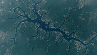
For decades, the sheer scale and inaccessibility of the Sundarbans made comprehensive monitoring a near-impossible task. Traditional ground surveys could only ever capture a small piece of a constantly shifting puzzle. This is where modern satellite technology, or telemetry, has become a game-changer. Using data from a suite of satellites, including the Landsat and Sentinel series, scientists can now track changes across the entire region with remarkable precision. These satellites are not just taking simple pictures; they are equipped with sophisticated sensors—including optical, radar, and LiDAR—that can measure the landscape in incredible detail. This allows researchers to see through clouds, penetrate vegetation, and gather data day or night, creating a continuous, dynamic map of this vulnerable frontier.
How Satellites Read the Landscape
The technology works by analysing different types of data collected from orbit. By comparing images taken over months, years, and even decades, automated algorithms and machine learning can detect subtle shifts. High-resolution imagery allows for the precise mapping of the land-water boundary, calculating rates of erosion down to metres per year. This reveals not just where land is being lost, but how quickly. Furthermore, techniques like the Normalised Difference Vegetation Index (NDVI) measure the 'greenness' of the forest, acting as a health check for the mangroves. A decline in NDVI can indicate that trees are stressed, possibly due to rising soil and water salinity, long before the forest area itself begins to shrink. Joint missions like the ISRO-NASA Synthetic Aperture Radar (NISAR) are set to provide even more detailed data, monitoring ground deformation, soil moisture, and flooding with unprecedented accuracy.
The Alarming Data Picture
The data streaming back from these satellites paints a stark picture. Studies have quantified significant loss of mangrove cover over the past few decades due to erosion. Between 2000 and 2020 alone, erosion claimed about 110 square kilometres of mangroves. The data also shows that cyclones cause the most damage along shorelines that are already eroding, creating a vicious cycle of degradation. Beyond just land loss, satellite telemetry is crucial for tracking high-tide flood hazards. By creating detailed topographic and hydrodynamic models, scientists can simulate how far tidal waters and storm surges will penetrate inland. This allows for the identification of the most vulnerable villages, which are often those in low-lying areas or near tidal creeks. With this information, authorities can pinpoint where the risks are greatest and which communities are in the most immediate danger.
From Data to Defence
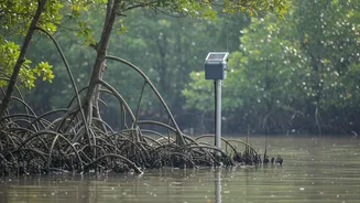
This wealth of satellite data is not merely academic; it is a critical tool for survival and adaptation. It provides clear, quantifiable evidence that can guide policy and on-the-ground action. For instance, by understanding the direct link between mangrove health and coastal stability, authorities can better justify and target investment in mangrove restoration projects. The data helps pinpoint exactly where reforestation will be most effective and where engineered structures like embankments are most needed. Furthermore, the detailed flood hazard maps enable the development of more effective early warning systems and evacuation plans, helping to protect the 4.5 million people who call this region home. In essence, the 'eyes in the sky' are giving planners the foresight needed to build resilience in one of Earth’s most precarious landscapes.