








The Latest IMD Forecast
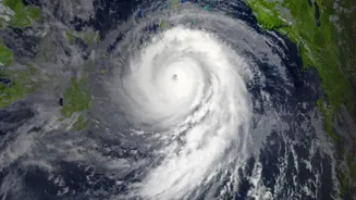
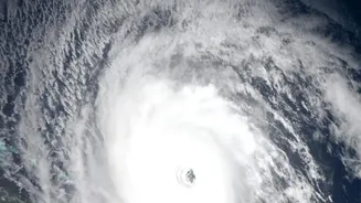
According to the latest bulletins from the India Meteorological Department (IMD) as of Wednesday, November 18, Cyclone Akvan has intensified into a Severe Cyclonic Storm. It is currently moving over the west-central Bay of Bengal. The storm is projected
to continue its path northwestwards, intensifying further into a 'Very Severe Cyclonic Storm' by the morning of November 19. The forecast predicts landfall along the Andhra Pradesh and Yanam coasts, specifically between Nellore and Tuni, around noon on Friday, November 20. At the time of crossing the coast, the cyclone is expected to bring maximum sustained wind speeds of 120-130 kmph, with gusts reaching up to 145 kmph.
Why the Nellore-Tuni Stretch is Critical
The coastal belt from Nellore in the south to Tuni in the north covers a vast and densely populated region of Andhra Pradesh, encompassing several districts. This nearly 500-kilometre stretch includes major cities, numerous fishing villages, and extensive agricultural lands. Districts like Prakasam, Bapatla, Krishna, West Godavari, Konaseema, and Kakinada are on high alert. The geography of this low-lying coastal plain makes it particularly vulnerable to the combined impact of gale-force winds, extremely heavy rainfall, and storm surges, which can lead to widespread flooding and significant damage.
Understanding Cyclone 'Akvan'
The name 'Akvan' was contributed by Iran to the list of cyclone names for the North Indian Ocean region, which is managed by the World Meteorological Organization (WMO). The name itself is drawn from Persian mythology, referring to a demon-like character in the epic poem 'Shahnameh'. This system is the third cyclonic storm to form over the Bay of Bengal in less than a month, following Cyclones Arnab and Murasu, a pattern that experts note can be consistent with El Niño years.
Potential Impact and Official Warnings
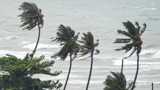
The IMD has issued warnings for extremely heavy rainfall in the coastal districts of Andhra Pradesh, particularly on Thursday, November 19, and Friday, November 20. Gale winds are expected to commence along the coast from the evening of November 18, steadily increasing in intensity. Authorities are preparing for significant damage, including to homes, infrastructure like power and communication lines, and standing crops. A storm surge of 1 to 1.5 metres above astronomical tide is possible, which could inundate low-lying areas. Neighbouring Odisha has also been placed on high alert, with precautionary measures being taken in its southern districts.
Government Prepares, Advises Caution
The Andhra Pradesh government is taking extensive precautionary measures. Chief Minister Y.S. Jagan Mohan Reddy has instructed officials to monitor the situation continuously and prepare for all eventualities in vulnerable areas. The Andhra Pradesh State Disaster Management Authority (APSDMA) has been activated, and National Disaster Response Force (NDRF) teams are being positioned. Fishermen have been strictly warned to suspend all offshore operations and return to the coast immediately. The Home Minister has placed all coastal districts on high alert.
How to Stay Safe
Residents in the affected areas are advised to stay indoors and follow all official advisories. It is crucial to secure your home by reinforcing doors and windows. Prepare an emergency kit containing essential items like drinking water, non-perishable food, a first-aid kit, torches, and batteries. Keep mobile phones charged and stay informed through official channels like IMD bulletins and announcements from local disaster management authorities. Avoid spreading or believing rumours. For any cyclone-related assistance in Andhra Pradesh, the government has provided a Mana Mitra WhatsApp number (9552300009) and the general emergency number 112.