


The Mission in the Mist
Imagine trekking through a cloud forest in Sikkim or Arunachal Pradesh, surrounded by the vibrant spectacle of rhododendrons in full bloom—fiery reds, delicate pinks, and ghostly whites. For adventurers, it’s paradise. But many of these trails are unmapped,
undocumented, and often treacherous. This is where a growing movement of young, eco-conscious individuals is stepping in. Armed not with traditional compasses but with smartphones and GPS devices, they are embarking on a mission: to digitally chart these remote pathways. Their goal is twofold: to make these natural wonders accessible to the world and to create a framework for their preservation. They are walking, recording, and uploading, turning their passion for nature into a valuable digital archive.
Technology Meets Tradition
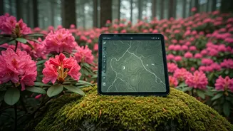
This isn't just about dropping a pin on a map. These volunteer mappers, often students or members of local conservation groups, use sophisticated Geographic Information System (GIS) tools. On the trail, they use apps like Gaia GPS or Avenza Maps to record precise tracklogs. But the data they collect goes far beyond a simple line on a screen. They geotag specific landmarks: a tricky river crossing, a viewpoint offering a panoramic vista, a safe spot to camp, or a source of fresh water. More importantly, they are documenting the biodiversity. Each new species of rhododendron encountered is photographed and its coordinates logged. This information is invaluable not only for trekkers but also for botanists and conservationists monitoring the health of these fragile ecosystems. It’s a perfect fusion of indigenous knowledge, passed down by local guides, and modern, data-driven methodology.
Cultivating Sustainable Tourism
The impact of this work extends far beyond the trekking community. By creating reliable, detailed maps, these young innovators are laying the groundwork for a new wave of sustainable ecotourism. When trails are well-documented, it reduces the risk of trekkers getting lost or creating new, damaging paths. It allows for better management of visitor numbers, preventing overcrowding that can harm the environment. Furthermore, this initiative empowers local communities. The maps can be used to develop guided tours, promote homestays, and create jobs that depend on a healthy forest. Instead of seeing the forest as a resource to be extracted, it becomes a living asset to be protected. This economic incentive is one of the most powerful tools for long-term conservation, ensuring that the people who live nearest to these natural treasures benefit directly from their preservation.
Challenges on the High Path
The work is far from a simple walk in the park. The terrain in the Eastern Himalayas is notoriously unforgiving. The mappers face steep ascents, dense undergrowth, and the region’s famously unpredictable weather, from sudden downpours to disorienting fog. Mobile connectivity is often non-existent, meaning all data must be collected offline and synced later. There is also the physical toll and the risk of encounters with wildlife. The process of verifying the data is painstaking. Each trail must be walked multiple times to ensure accuracy. Every data point—from the elevation to the name of a local landmark—must be cross-checked. This dedication transforms the act of mapping from a technical exercise into an act of profound commitment to the region's heritage.