





A Calculated Glance Homeward
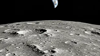
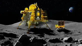
On its path to the Moon, India’s Chandrayaan-3 spacecraft performed a fascinating pirouette. It turned its instruments away from the vast, dark expanse of space and focused them on a familiar, reassuring sight: the bright, blue marble of Earth. The resulting
images, released by the Indian Space Research Organisation (ISRO), were stunning. While missions like the Lander Imager (LI) camera captured a view of Earth on launch day, a key instrument on the Propulsion Module had a very specific job to do by looking at our planet. This was far more than a simple photo opportunity; it was a series of crucial, pre-planned operations essential to the mission's success and its broader scientific goals.
The Primary Mission: A Scientific Dress Rehearsal
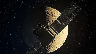
The main reason for this backward glance was to use Earth as a practice target. The Propulsion Module of Chandrayaan-3 carried a unique scientific payload called SHAPE, which stands for Spectro-polarimetry of HAbitable Planet Earth. This instrument was designed to study the specific light signature of Earth—a known habitable planet teeming with life. Its goal was to capture the spectral and polarimetric measurements of our world from a great distance. By doing this, scientists can create a baseline data set for what a life-sustaining planet looks like from afar. This information is invaluable for future missions that will search for potentially habitable exoplanets orbiting distant stars. In essence, Chandrayaan-3 was using Earth as a perfect model to fine-tune an instrument designed to find other Earths.
Calibrating for Deep Space
Looking at Earth also served a vital technical purpose: calibration. Spacecraft instruments endure extreme conditions during launch and the subsequent journey through space. To ensure they are working correctly, engineers need to point them at a known, consistent source. Earth, with its well-understood atmosphere, oceans, and landmasses, provides a perfect calibration point. By observing Earth, the SHAPE payload's team could verify that the instrument's sensors were functioning as expected and that its measurements were accurate. This process ensures that when the instrument is used for its primary scientific observations—or in the case of other cameras, for navigating a lunar landing—the data it sends back is reliable. It is a standard practice in space missions, akin to a musician tuning their instrument before a concert.
A Bonus Science Opportunity
While the Propulsion Module's SHAPE instrument was designed to view Earth from lunar orbit, the act of looking back provided a wealth of data for Earth science itself. Observing our planet from a unique vantage point allows scientists to study its atmosphere and cloud cover on a global scale. These observations can contribute to climate models and our understanding of Earth as a complex, interconnected system. The SHAPE instrument, operating in the near-infrared wavelength, was specifically designed to gather data that could reveal signatures of habitability. These practice runs were not just for testing; they were a chance to gather bonus scientific data about our own home, turning a technical necessity into a valuable scientific endeavor.
The Undeniable Human Connection
Beyond the technical and scientific justifications, there is an undeniable human element to these images. For the public, seeing our planet floating in the blackness of space, as captured by a homegrown spacecraft, is a powerful and inspiring moment. It connects the nation to the mission, transforming an abstract scientific endeavor into a shared journey. These images serve as a 'postcard' from the mission, fostering a sense of pride and wonder. They remind us of the ingenuity required to leave our world and the unique beauty of the home we are exploring from afar. This public engagement is a vital, if unofficial, part of any major space mission, creating a legacy that extends beyond scientific papers and into the collective imagination.