



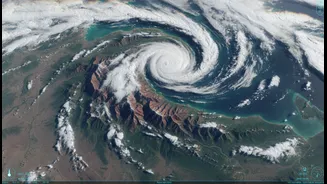


Eyes in the Sky Over India
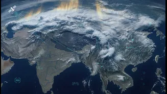
The days of relying solely on ground-based observations to track the monsoon's epic journey are long gone. Today, a new generation of sentinels watches from orbit. Satellites operated by the Indian Space Research Organisation (ISRO), such as the INSAT-3DR,
along with international counterparts from NASA and EUMETSAT, provide a continuous, high-resolution stream of data. These aren't just simple cameras; they are equipped with sophisticated instruments that see far beyond what the human eye can. They measure cloud-top temperatures, atmospheric moisture content, wind patterns, and sea surface temperatures. This constant monitoring allows meteorologists at the India Meteorological Department (IMD) to see the monsoon not as a single event, but as a living, breathing system of immense scale and complexity.
From Raw Data to a Rich Narrative
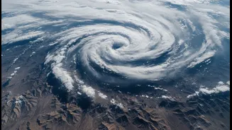
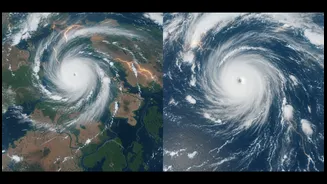
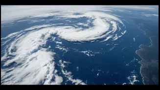
The true revolution lies in how this torrent of data is translated into a story we can all understand. Raw satellite feeds are processed into vibrant, colour-coded visuals that reveal the monsoon's inner workings. Infrared imagery, for instance, shows the temperature of cloud tops; extremely cold, bright white clouds often indicate deep, towering cumulonimbus formations capable of dumping immense amounts of rain. Water vapour channels track the invisible rivers of moisture flowing from the Arabian Sea and Bay of Bengal, the lifeblood of the monsoon. When you see a swirling, colourful animation on a news broadcast or weather app, you are watching a scientific narrative unfold. It's the story of low-pressure systems forming, of moisture-laden winds making landfall, and of the monsoon's relentless push across the subcontinent, all told through the powerful and intuitive language of visuals.
More Than Just a Pretty Picture
This enhanced visual understanding has profound real-world consequences. The ability to see and analyse monster monsoon systems as they form over the sea provides critical lead time for disaster management authorities. Pinpointing areas of deep convection helps in issuing specific, timely warnings for heavy rainfall, thunderstorms, and potential flooding. For India's farmers, whose livelihoods depend on the monsoon, more accurate, hyperlocal forecasts—now being enhanced with AI models fed by this satellite data—can inform crucial decisions about when to sow, irrigate, or apply fertilisers. This technology moves forecasting from a broad, regional prediction to actionable intelligence that can save lives, protect property, and support the agricultural backbone of the nation.
A New Public Understanding
The accessibility of satellite imagery has also changed the public's relationship with the monsoon. It's no longer an abstract phenomenon discussed in terms of millimetres of rainfall. People can now see the bands of clouds approaching their city or witness the formation of a cyclone in the Bay of Bengal in near real-time. This shared visual experience fosters a greater appreciation for the sheer scale of the weather systems that govern our lives. It demystifies the science and empowers citizens with a better understanding of the risks and realities of the season. When the IMD issues a warning, the accompanying satellite loop provides immediate, compelling evidence, making the forecast more tangible and the advice more likely to be heeded.
The Future is Higher Resolution
The story is far from over. As satellite technology continues to advance, so too will our ability to see and predict the monsoon. Future satellites promise even higher spatial and temporal resolution, allowing for more granular forecasts. The integration of artificial intelligence and machine learning is set to revolutionise analysis, enabling faster processing of vast datasets to identify patterns that might be missed by human forecasters. Studies are already using long-term satellite data to analyse how cloud patterns are changing over decades, providing invaluable insights into the impact of climate change on the monsoon's intensity and behaviour. Through the unblinking eye of our weather satellites, the monsoon is revealing its secrets, one pixel at a time, ensuring we are better prepared for whatever it brings.