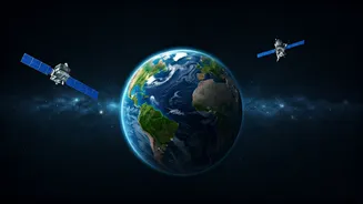


A New Perspective From Orbit
The single greatest advantage a satellite offers is perspective. From hundreds of kilometres above, satellites can monitor vast, remote, and inaccessible areas of our planet with a consistency that is impossible on the ground. This bird's-eye view allows
scientists, governments, and environmental groups to see the big picture, tracking changes over days, months, and decades. Instead of relying on small, localised data points, we can now observe entire ecosystems in near real-time. This capability has fundamentally changed our approach to environmental science, turning it from a reactive field into a proactive one. We can now spot problems as they emerge, from illegal logging in the Amazon to the early stages of a harmful algal bloom in the ocean.
Tracking Key Climate Indicators
Space missions are our front-line observers in the fight against climate change. Satellites provide the hard data that underpins our understanding of a warming world. For instance, NASA’s ICESat-2 mission uses lasers to measure the exact height of ice sheets in Greenland and Antarctica, revealing the alarming rate at which they are melting. Other missions, like the joint US-European Jason series of satellites, use radar altimetry to precisely track global sea-level rise. Furthermore, spacecraft like NASA's Orbiting Carbon Observatory (OCO) missions are designed to map carbon dioxide concentrations in the atmosphere, helping scientists identify major CO2 sources and sinks. This data is not just academic; it’s essential for creating accurate climate models and holding nations accountable for their emissions pledges.
Guarding Forests and Oceans
Deforestation and ocean pollution are two of the most visible environmental crises, and satellites are crucial tools for managing them. In Brazil, data from earth observation satellites has long been used to detect and combat illegal deforestation in the Amazon rainforest. High-resolution imagery can distinguish between different types of land use, allowing authorities to spot new clearings almost as soon as they happen. Similarly, satellites are used to track massive oil spills and monitor the vast garbage patches of plastic swirling in our oceans. The European Space Agency's (ESA) Copernicus Sentinel missions, for example, provide free and open data that is used by environmental agencies worldwide to monitor water quality, detect pollution, and protect marine biodiversity.
Making Agriculture More Sustainable
Feeding a growing global population without further damaging the environment is a monumental challenge. Here too, space technology offers solutions. The concept of 'precision agriculture' relies heavily on satellite data. By analysing multispectral images, farmers can get a detailed picture of their crop health, soil moisture, and nutrient levels across their fields. This allows them to apply water and fertiliser only where they are needed, reducing waste, preventing chemical runoff into rivers, and increasing yields. In a country like India, where agriculture is a cornerstone of the economy and water is a precious resource, these efficiency gains can have a massive positive impact on both food security and environmental health.
Pinpointing Methane 'Super-Emitters'
While CO2 gets most of the attention, methane is a far more potent greenhouse gas in the short term. A major source of methane is leaks from oil and gas infrastructure. The problem is that these leaks are often invisible and hard to find. New, highly specialised satellites are changing that. Organisations like Carbon Mapper and MethaneSAT are launching constellations specifically designed to detect and pinpoint large methane leaks from space. By identifying these 'super-emitters', companies and regulators can quickly fix the leaks, achieving a significant and immediate reduction in greenhouse gas emissions. This turns an invisible threat into a solvable problem.
ISRO's Earth Watch
India's own space programme, led by ISRO, is a major player in this field. ISRO operates one of the largest constellations of remote sensing satellites in the world. Its Earth Observation Satellites (EOS) are workhorses that provide critical data for the country. This data is used for everything from urban planning and water resource management to disaster prediction and damage assessment during cyclones and floods. By providing timely information on forest cover, agricultural output, and environmental changes, ISRO’s missions are a vital national asset for sustainable development and environmental stewardship.