






The Doomsday Glacier's Warning
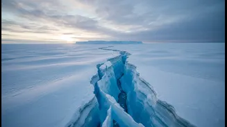
Much of the world's attention is focused on West Antarctica, and for good reason. This region is home to the Thwaites Glacier, an immense river of ice the size of Great Britain. Nicknamed the "Doomsday Glacier," its complete collapse could raise global
sea levels by over half a metre. Scientists are particularly concerned because its grounding line—the point where the ice lifts off the seabed and begins to float—is retreating rapidly. Warm ocean water is seeping underneath, melting the glacier from below in a process that is hard to stop. To get a better look, international teams are undertaking daring missions, drilling hundreds of metres through the ice to deploy instruments that can send back real-time data on ocean temperatures and currents in this critical, unstable zone.
A Continent of Contrasts
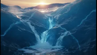
While West Antarctica shows dramatic signs of change, the situation across the continent is complex. The much larger East Antarctic Ice Sheet, which holds enough water to raise sea levels by over 50 metres, was long considered stable. However, recent studies show that this "sleeping giant" is beginning to stir. Satellite observations have revealed that some glaciers along the East Antarctic coast have doubled their rate of melting in recent years. Scientists have also found evidence of hidden channels beneath the ice that can trap warm ocean water, accelerating melt in areas previously thought to be safe. While the changes here are smaller than in the west, they signal that no part of the continent is immune to the effects of a warming world.
Technology on the Ice
Understanding a continent this vast and hostile requires a technological arsenal. Scientists are using an array of tools to get the full picture. High-resolution satellites, like NASA's ICESat-2, use lasers to measure the changing height of the ice sheet with incredible precision, revealing areas of thinning. Radar satellites can peer through clouds day and night to track the speed of glaciers and the movement of grounding lines. On the ground and under the ice, the work is even more challenging. Robotic submarines are sent into the murky depths beneath floating ice shelves, while hot-water drills bore through kilometres of ice to deploy sensors and retrieve ancient sediment cores that hold clues to past climate changes. Recently, researchers have even begun using GPS signals in innovative ways to monitor surface melt conditions across the ice.
Why It Matters for India
The fate of Antarctica's ice is not a distant problem; it has direct consequences for India. With a coastline stretching over 7,500 kilometres, and home to bustling metropolises like Mumbai, Chennai, and Kolkata, India is highly vulnerable to rising sea levels. Even a modest rise in sea level can lead to increased coastal flooding, erosion, and contamination of freshwater sources with saltwater. When a massive ice sheet like Antarctica loses mass, its gravitational pull on the surrounding ocean weakens. This causes sea levels to fall near the continent but rise disproportionately in far-flung locations—a phenomenon that puts coastal nations in the Northern Hemisphere, including India, at greater risk. The data gathered by scientists in Antarctica is therefore crucial for creating accurate projections that can help India plan and adapt to the inevitable changes ahead.