







A New Orbit, A New Perspective
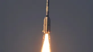
The first major difference with EOS-05 is its address in space. Launched aboard the powerful GSLV-F17 rocket, the satellite was placed into a geosynchronous transfer orbit. From here, it will position itself roughly 36,000 kilometres above the Earth's
surface. Unlike previous Indian imaging satellites that circle the globe in Low Earth Orbit (LEO) and pass over a location periodically, EOS-05 will remain in a fixed position relative to India. This high-altitude perch allows it to function like a dedicated, unblinking eye, capable of monitoring vast swathes of the Indian subcontinent continuously. This makes it India's first imaging satellite to operate from such a high orbit, a significant strategic advantage.
Seeing Through Clouds and Darkness
The second revolutionary aspect of EOS-05 is its vision. Instead of relying solely on conventional optical cameras, which are useless in cloudy weather or at night, this new satellite is equipped with advanced imaging technology, including Synthetic Aperture Radar (SAR). Think of SAR as a form of radar that can paint a detailed picture of the Earth's surface regardless of weather conditions or time of day. While ISRO has used SAR on previous satellites like the RISAT series, placing this all-weather capability in a geosynchronous orbit is a powerful combination. It means that whether it's a cyclonic storm, dense fog, or the dark of night, EOS-05 can provide clear, uninterrupted imagery—a critical upgrade for a monsoon-heavy country like India.
A Game-Changer for National Security
The strategic implications of a satellite that provides a constant, all-weather watch over a specific region are immense. For India's security apparatus, EOS-05 offers an unprecedented tool for real-time surveillance. Its ability to maintain a persistent gaze over border areas, maritime zones, and other sensitive locations adds a new dimension to national security. Military and intelligence agencies can receive timely updates on troop movements, infrastructure changes, and naval activity without the limitations of periodic satellite passes or obscuring cloud cover. This continuous monitoring strengthens India's strategic awareness and response capabilities, providing a vital layer of security in a complex geopolitical landscape.
A Lifeline in a Changing Climate
Beyond its strategic importance, EOS-05 is a powerful asset for civilian applications, particularly in disaster management and agriculture. With its ability to provide images as frequently as every five to thirty minutes for priority areas, it can track the rapid development of natural disasters. During cyclones and floods, authorities can get near-real-time data on the extent of inundation, helping to coordinate rescue and relief efforts more effectively. For agriculture, the satellite's instruments can monitor crop health, soil moisture, and the impact of droughts over large areas. This firehose of data will also be invaluable for urban planning, monitoring forest fires, and tracking environmental changes like the melting of Himalayan glaciers, making India more resilient to the challenges of a changing climate.