








The Monsoon's Hidden Threat
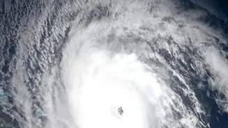
Every year, the monsoon brings life-giving rains to the subcontinent, but it also carries immense danger for coastal communities. Beyond the high winds and heavy rainfall of a cyclone lies a more insidious threat: the storm surge. This phenomenon is an abnormal
rise in sea level generated by a storm, over and above the regular tides. Powerful cyclonic winds push water towards the shore, creating a wall of water that can inundate low-lying areas, contaminate freshwater sources, and cause catastrophic damage to life and property. With a 7,500-kilometre coastline and dozens of major cities and towns at sea level, India is exceptionally vulnerable. The accuracy and speed of storm surge warnings are therefore not just a matter of scientific achievement, but of survival.
ISRO’s Eyes in the Sky
For decades, ISRO has been instrumental in disaster management through its fleet of Earth observation satellites. The INSAT series (including INSAT-3DR and 3DS) and the Oceansat series are the workhorses of India's weather monitoring and forecasting efforts. These satellites provide continuous data on cloud cover, sea surface temperature, and atmospheric conditions, which are critical inputs for the India Meteorological Department (IMD) to track the formation and movement of cyclones. Using instruments like scatterometers and altimeters, these satellites measure ocean surface winds and sea surface height, respectively, offering vital clues about a storm's intensity and potential to generate a devastating surge.
A Sharper, All-Weather Vision
The latest enhancements to India's coastal defence capabilities come from integrating more advanced and versatile satellite data. A key development is the operational use of the NASA-ISRO Synthetic Aperture Radar (NISAR) satellite. Unlike optical satellites that are hindered by cloud cover, SAR can see through clouds and darkness, providing an uninterrupted, all-weather view of the Earth's surface. On July 26, 2026, ISRO announced that data from NISAR's S-band SAR is now available to the public and researchers, significantly boosting resources for disaster management. This high-resolution radar data allows for incredibly precise measurements of the sea surface, helping to detect the subtle but critical changes in sea level that signal an approaching storm surge. This technology complements existing systems by providing a different, and often clearer, layer of information.
From Data to Actionable Warnings
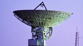
Gathering data is only the first step. The real strength of the system lies in how this information is processed and disseminated. Data from ISRO's satellites, including Oceansat-3 and NISAR, are channelled to ground stations and processed at centres like the National Remote Sensing Centre (NRSC). This information is then fed into sophisticated numerical models run by the IMD and the Indian National Centre for Ocean Information Services (INCOIS). These models simulate how a storm will behave and predict the height and extent of a potential storm surge. The integration of AI is also transforming this process, allowing for faster analysis of vast datasets and the generation of more accurate, real-time risk maps. This improved accuracy allows the IMD to issue its four-stage warning system with greater confidence, giving disaster management agencies and the public more lead time to prepare.
A New Era of Coastal Resilience
The impact of these technological enhancements is profound. More accurate and timely warnings directly translate into saved lives. A better forecast allows authorities to conduct targeted evacuations, moving people from the most vulnerable areas without causing widespread panic. It enables the pre-positioning of relief supplies and response teams, ensuring help arrives where it is needed most, immediately after a storm passes. Forecast accuracy for cyclone tracks and intensity has already seen significant improvement in recent years. By continuously upgrading its space-based assets, ISRO is not just observing the weather; it is actively building a shield of data-driven resilience for India's coasts, ensuring the country is better prepared to face the growing challenges of a changing climate.