







From Vague Averages to Local Alerts
Previously, weather forecasting in India operated on a grand scale. The IMD would issue forecasts at the state or, at best, district level. While useful for a national overview, this approach had significant limitations. A forecast for a whole district could
be misleading, as monsoon rainfall is notoriously patchy; one village might experience a downpour while another, just a few kilometres away, remains dry. This meant farmers couldn't confidently time their sowing, and local authorities had a blunt instrument for disaster planning. The national and regional averages provided context but lacked the actionable detail needed for day-to-day decisions.
The Dawn of Hyper-Local Forecasting
The IMD has introduced a new system that shifts predictions from broad estimates to highly localised forecasts at the 'block' level, a smaller administrative unit within a district. This new model, currently covering nearly 3,200 blocks across 15 states and one union territory, focuses on India's monsoon core zone, where agriculture is most dependent on rain. Using a blend of artificial intelligence, historical data, and global weather models, this system can provide probabilistic forecasts for up to four weeks in advance. In some areas like Uttar Pradesh, the resolution is even finer, with experimental models predicting weather for every one-kilometre grid.
A Game-Changer for Indian Agriculture
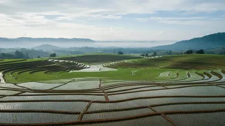
The primary beneficiary of this granular data is the agricultural sector. For millions of farmers, the monsoon's arrival is the single most critical event of the year. Precise, block-level forecasts empower them to make informed decisions about when to sow, how much to irrigate, and when to apply fertilisers. This shift from reactive to predictive farming helps reduce crop losses and improve water management, especially in rain-fed regions. Studies have shown that when farmers have access to accurate, long-range forecasts, they adjust their investments and crop choices, leading to better outcomes. The IMD's system aims to deliver this advantage at a national scale, with alerts disseminated through mobile apps and local agricultural networks.
Bolstering Disaster Preparedness
Beyond agriculture, hyper-local warnings are a crucial tool for disaster management. As climate change increases the frequency of extreme weather events like flash floods and intense thunderstorms, the ability to predict them at a local level becomes life-saving. Pinpointing which specific blocks or villages are at risk allows authorities to issue targeted evacuation orders, mobilise resources more effectively, and minimise loss of life and property. This represents a fundamental shift from a reactive to a predictive stance on disaster response, turning meteorological data into a direct line of defence for vulnerable communities.
The Technology Behind the Upgrade
This forecasting revolution is powered by significant technological advancements under initiatives like Mission Mausam. The IMD is integrating artificial intelligence and machine learning to process vast amounts of data from an expanding network of automatic weather stations, Doppler radars, and satellites. High-performance computing systems process this information, running complex models that can simulate weather patterns with greater precision. By blending these modern techniques with its century-long trove of meteorological data, the IMD has dramatically improved its forecasting capabilities, aiming to provide a seamless flow of information from seasonal outlooks to hourly alerts.