



A Land on a Tectonic Collision Course
The primary reason for Nepal's seismic vulnerability lies deep beneath the earth's surface. The country sits directly on the boundary where two massive tectonic plates, the Indian plate and the Eurasian plate, are crashing into each other. For about 50
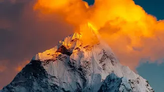
million years, the Indian plate has been pushing northward into the Eurasian plate at a rate of about 4 to 5 centimetres per year. This slow-motion, high-stakes collision is what created the Himalayan mountain range. However, the movement isn't smooth. The plates get stuck, and immense pressure builds up. When this accumulated stress is suddenly released, the ground shakes violently, resulting in an earthquake. This process is not a relic of the past; it is an ongoing force that continues to shape the region and poses a constant threat.
When the Earth Shakes Violently
Because Nepal is located at the heart of this tectonic battleground, earthquakes are an unavoidable reality. The entire country is located in a seismically active zone, making it one of the most earthquake-prone nations on the planet. The earthquakes here can be particularly destructive because they often occur at a shallow depth. A shallow quake means the energy is released closer to the surface, leading to more intense shaking and widespread damage. The devastating 2015 Gorkha earthquake was a tragic reminder of this vulnerability, but it was just one of many major seismic events in the region's history. Geologists know that huge amounts of strain are still building up along the Himalayan front, indicating that major earthquakes remain a certainty for the future.
The Fury of the Monsoon
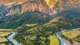
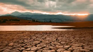
While tectonic forces create the seismic risk, Nepal's weather patterns introduce another layer of danger. The annual monsoon season, which typically lasts from June to September, brings intense and prolonged rainfall. While vital for agriculture, these downpours are a primary trigger for floods and landslides. The country's topography, with its steep descent from the world's highest mountains to the plains, means that rainwater rushes down slopes with incredible force. More than 6,000 rivers and streams can swell into raging torrents, causing widespread flooding, particularly in the southern Terai plains. Climate change is exacerbating this risk, making rainfall more erratic and extreme, leading to longer droughts followed by more intense downpours that the land cannot absorb.
A Deadly Combination: Unstable Slopes
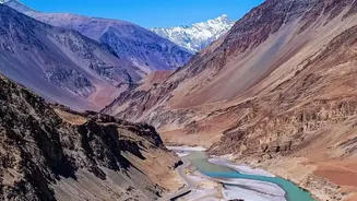
Landslides are the deadly consequence of Nepal's unique geology and climate interacting. The same tectonic activity that builds the mountains also shatters the rock, leaving behind steep, unstable slopes. When the intense monsoon rains saturate this fragile terrain, the soil and rock can give way in an instant, creating fast-moving rivers of mud and debris. These landslides can wipe out entire villages, block rivers to create temporary dams that later burst with catastrophic force, and destroy critical infrastructure like roads and bridges. An earthquake can also trigger thousands of landslides simultaneously, compounding the devastation as seen in the aftermath of the 2015 quake.
The Human Factor and A Changing Climate
Natural forces are the primary driver, but human activities and a warming climate are magnifying the risks. Deforestation for agriculture and fuel removes the tree roots that help hold hillsides together. Haphazard road construction often cuts into unstable slopes without proper engineering, creating new landslide risks. Furthermore, rapid and often unplanned urbanisation means more people are living in vulnerable areas like floodplains. At the same time, climate change is causing glaciers in the Himalayas to melt at an accelerated rate. This increases the risk of Glacial Lake Outburst Floods (GLOFs), where meltwater lakes burst through their natural dams, sending a tsunami-like wave of water and debris downstream.