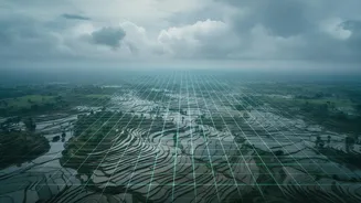








The Old Way: A Blurry National Picture
Previously, monsoon forecasts were issued for the country as a whole or for large sub-divisions. A forecast of a 'normal' monsoon nationally could often hide significant regional variations, with some areas facing drought while others experienced floods.
This broad-stroke approach was of limited use to a farmer deciding when to sow seeds or a district official preparing for potential flash floods. The reality of India's geography is that rainfall can vary dramatically even within the same district, making a single, regional average an unreliable tool for critical, on-the-ground decisions.
The New Era: Granular, Actionable Forecasts
The IMD has begun a significant shift towards providing forecasts at the district and even block level, a much smaller administrative unit. This hyper-local approach aims to provide actionable intelligence. Instead of just knowing the state might get rain, a farmer can now get a forecast for their specific block. This new system, developed with institutions like the Indian Institute of Tropical Meteorology (IITM), uses a blend of AI, historical data, and advanced weather models to predict rainfall with unprecedented detail. In May 2026, the IMD announced a system to provide these block-level forecasts for over 3,000 blocks across 15 states, focusing on the rain-fed agricultural core of the country.
A Lifeline for Indian Agriculture
The primary beneficiary of this revolution is the agricultural sector. With over half of India's farmland being rain-fed, precise weather information is crucial. These new advisories, part of the Gramin Krishi Mausam Sewa (GKMS) initiative, help farmers make critical decisions about when to sow, irrigate, or apply fertilisers and pesticides. Knowing the precise timing of rainfall can prevent wastage of expensive inputs, protect crops from extreme weather, and ultimately improve yields and financial stability. It represents a move from reactive farming based on chance to proactive, data-driven agriculture.
Bolstering Disaster Management
Beyond the farm, district-level warnings are a powerful tool for disaster preparedness. Specific, localised alerts about heavy rainfall can give district administrations crucial lead time to prepare for floods, evacuate vulnerable populations, and manage dam water levels more effectively. As extreme weather events like cloudbursts and flash floods become more frequent due to climate change, the ability to issue warnings for a specific district or block, rather than an entire state, can be the difference between safety and devastation, helping to save lives and property.
Technology Behind the Transformation
This leap in forecasting ability is powered by a significant technological upgrade. The IMD is expanding its network of Doppler Weather Radars and Automatic Weather Stations, providing more real-time ground data. This denser data network, combined with high-performance supercomputers and AI-driven models like the 'Mithuna' model, allows meteorologists to 'downscale' global predictions to a much higher resolution. In a pilot project in Uttar Pradesh, the forecast resolution has been refined to an incredible 1-kilometer grid, showcasing the potential for pinpoint accuracy.
Challenges on the Horizon
Despite the progress, challenges remain. The accuracy of hyper-local models depends on a dense network of ground stations, and there are still gaps in observational infrastructure in some parts of the country. Furthermore, ensuring this valuable information reaches the last mile—every farmer and local official—and is clearly understood requires overcoming connectivity and literacy barriers. Experts also note that India's tropical weather, driven by chaotic convective systems, is inherently harder to predict than the weather in temperate zones, making this a complex scientific endeavour.