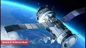


What is NavIC?
NavIC, also known as the Indian Regional Navigation Satellite System (IRNSS), represents India's sovereign leap into satellite-based navigation. This regional
system is meticulously designed to offer precise positioning data across the Indian subcontinent and its immediate vicinity. The constellation comprises seven satellites, strategically positioned with three in geostationary orbit and four in geosynchronous orbits, enabling an impressive position accuracy of better than 20 meters. Unlike global systems that rely on satellites spread far across the sky, NavIC's configuration, with satellites directly above the region, enhances signal availability, especially in challenging terrains like valleys and dense forests, providing a distinct advantage over systems like GPS where signals arrive at an angle.
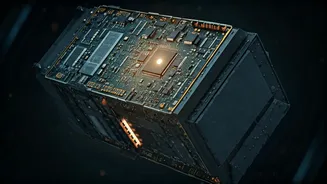
The Atomic Clock Anomaly
Recently, reports surfaced concerning a critical component failure within the NavIC constellation: an atomic clock on board one of its satellites has ceased functioning. Atomic clocks are the bedrock of any satellite navigation system, providing the ultra-precise timekeeping essential for triangulation and accurate location determination. The loss of such a vital instrument naturally sparks concerns about the system's overall performance and precision. This particular issue affects the IRNSS-1F satellite, launched in March 2016, which has now surpassed its intended 10-year mission life. While the satellite itself will continue to offer one-way broadcast messaging services, its positioning data contribution is lost.
ISRO's Assurance of Accuracy
Despite the atomic clock failure, the Indian Space Research Organisation (ISRO) has unequivocally stated that NavIC's accuracy and reliability remain unaffected. This confidence stems from the system's inherent architectural resilience and the sophisticated algorithms it employs. NavIC utilizes data from a network of multiple satellites, allowing it to compensate for the malfunction of a single component. By cross-referencing signals and time data from the remaining operational satellites and their functional atomic clocks, the system can seamlessly adjust and maintain its precision. This redundancy is a key design feature that safeguards the integrity of the navigation services provided to users.
Services and Applications
NavIC offers two distinct service tiers tailored to different user groups. The Standard Positioning Service (SPS) is readily available to all civilian users across India and surrounding regions, facilitating everyday navigation, mapping, and tracking. For more sensitive operations, there's the Restricted Service (RS), which is encrypted and exclusively accessible to authorized personnel, primarily for military and strategic purposes. The utility of NavIC extends across a wide spectrum of applications, including vehicle navigation, disaster management coordination, comprehensive mapping and surveying, and even the precise planning of large-scale construction projects. Its integration into smartphones and other mobile devices is steadily expanding its reach and accessibility to the general public.
Newer Satellites and Future
The challenges faced by the initial NavIC satellites, including atomic clock failures and aging components, have spurred the development of next-generation spacecraft. A key advancement in these newer satellites is the inclusion of indigenously developed atomic clocks, a direct response to past issues. These advanced satellites also boast a longer operational lifespan of 12 years, compared to the 10 years of their predecessors. Furthermore, they transmit signals on a third frequency band, L1, alongside the existing L5 and S frequencies. This multi-frequency capability enhances interoperability with other global navigation systems like GPS and is particularly beneficial for low-power wearable devices such as smartwatches. Despite past setbacks, such as the NVS-02 satellite failing to reach its intended orbit due to an electrical issue, ISRO continues to refine and strengthen the NavIC constellation.