


Scattered Showers Expected
Maharashtra is bracing for a bout of pre-monsoon activity, with scattered thundershowers anticipated across several districts. This weather shift is driven
by evolving meteorological conditions, including the inflow of moisture from both the Bay of Bengal and the Arabian Sea. Compounding this, a trough in the westerlies is extending from Madhya Pradesh down towards south Madhya Maharashtra. These combined atmospheric influences are pointing towards a likelihood of rainfall, particularly around May 7th and 8th. However, it's crucial to understand that this precipitation will not be uniform; rather, it will manifest as localized events, with certain areas experiencing showers while others remain unaffected. The India Meteorological Department (IMD) has issued yellow alerts for regions expected to receive this rainfall, signifying a watch for potentially impactful weather.
Pune City's Dry Outlook
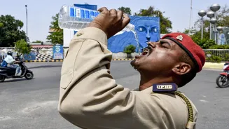
Despite the approaching pre-monsoon activity across the state, Pune city itself is projected to remain dry. The IMD's forecast, as of Monday, indicates no significant rainfall expected for the city in the coming days. This pattern, where surrounding regions experience weather while Pune stays dry, has been observed before. The current synoptic conditions, while favorable for thunderstorms elsewhere, are not aligning to bring significant precipitation to Pune. Residents of Pune can therefore expect current weather conditions to persist for the immediate future, with the focus of the thundershowers shifting to other parts of the state.
Impacted Regions Detailed
The areas most likely to experience the upcoming thundershowers include south Madhya Maharashtra and parts of Marathwada. Specifically, districts such as Kolhapur, Satara, Sangli, Beed, Latur, and Dharashiv are predicted to witness isolated thunderstorms accompanied by lightning, moderate rainfall, and gusty winds reaching speeds of 40–50 kmph around May 7th–8th. Furthermore, the ghat sections of Kolhapur, Satara, and Pune districts are also anticipated to receive light to moderate rain or thundershowers during this period. Moving towards the coastal belts, districts like Ratnagiri and Sindhudurg might experience light rain or thunderstorms towards the latter part of the forecast window. In contrast, the coastal districts of Palghar, Thane, Mumbai, and Raigad are expected to contend with hot and humid conditions.
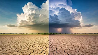
Understanding Pre-Monsoon Phenomena
The current weather patterns are consistent with typical pre-monsoon conditions. During this transitional phase before the arrival of the southwest monsoon, atmospheric dynamics often lead to localized thundershowers rather than widespread, uniform rainfall. The process involves a significant inflow of moisture from oceanic bodies like the Arabian Sea and the Bay of Bengal, coupled with atmospheric disturbances such as troughs in the westerlies. These elements converge to create instability in the atmosphere, triggering the development of cumulonimbus clouds that result in thunderstorms. These events are characterized by their localized nature, often affecting specific pockets of land with brief but intense periods of rain, lightning, and gusty winds, before dissipating.