


Mapping from Orbit
Traditionally, our knowledge of the moon's surface far exceeds that of our own planet's ocean depths, leaving vast areas of the seafloor largely a mystery.
However, this gap is rapidly closing thanks to a groundbreaking initiative by NASA. The space agency has introduced a novel map of the ocean floor, compiled from data gathered in orbit. This project is a significant component of a larger international endeavor aiming to achieve a comprehensive, highly detailed map of the entire seabed by the end of this decade. The Surface Water and Ocean Topography (SWOT) satellite, a collaborative venture between NASA and the French space agency CNES, is central to this effort. Launched in December 2022, SWOT continuously orbits Earth, capable of surveying approximately 90 percent of the planet's water surfaces every 21 days. While it doesn't directly photograph the seabed, it employs an ingenious indirect method by meticulously measuring minute fluctuations in water levels across oceans, lakes, and rivers. These subtle variations act as indicators, providing clues to the topography hidden beneath the surface.
Gravity's Underwater Clues
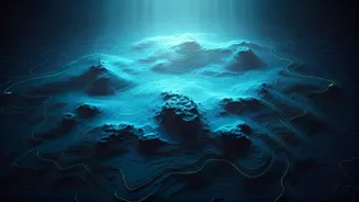
The revolutionary technique behind this new seafloor mapping relies on the principles of gravity. Massive underwater geological formations, such as submerged mountains (seamounts) and extensive underwater hills, possess greater mass compared to their surroundings. This increased mass exerts a slightly stronger gravitational pull. This localized gravitational anomaly subtly distorts the overlying water, causing it to bulge upwards in a barely perceptible way. By meticulously studying these minute water surface undulations, scientists can effectively deduce the shape and contours of the ocean floor beneath. David Sandwell, a geophysicist at the Scripps Institution of Oceanography, highlights the transformative impact of the SWOT satellite, stating it represents a substantial leap in our capacity to map the ocean floor. Previous satellite technologies were limited to detecting only exceptionally large features, like seamounts exceeding one kilometer in height. In contrast, SWOT's enhanced sensitivity allows it to identify underwater features that are less than half that size, thus providing a significantly more granular and detailed depiction of the ocean floor's landscape. Consequently, researchers anticipate a dramatic increase in the number of identified seamounts, potentially escalating from the current estimate of around 44,000 to as many as 100,000.
Why Seafloor Maps Matter
A detailed understanding of the ocean floor is not merely an academic pursuit; it holds profound practical implications across numerous domains. Enhanced seafloor maps are invaluable for optimizing maritime navigation and refining shipping routes, ensuring safer and more efficient sea travel. They are also critical for the strategic planning and installation of vital underwater communication cables, which form the backbone of global connectivity. Furthermore, these maps help in identifying potential geohazards on the seabed, such as underwater landslides or volcanic activity, allowing for better risk assessment and mitigation. Beyond infrastructure and safety, seafloor topography plays a pivotal role in deciphering complex oceanographic phenomena. It aids scientists in studying ocean currents, understanding tidal patterns, and characterizing marine ecosystems, which are often intimately linked to underwater geological features. Additionally, the process of mapping the seabed contributes significantly to our comprehension of plate tectonics and the dynamic geological processes that shape Earth's surface over geological timescales.
Towards a Global Seabed Map
The ongoing work utilizing data from the SWOT satellite is an integral part of a broader, ambitious international initiative with the explicit goal of creating a complete map of the entire ocean floor by the year 2030. While specialized ships equipped with advanced sonar technology remain essential for obtaining the highest resolution measurements, satellites like SWOT offer an unparalleled advantage in their ability to rapidly survey vast oceanic expanses. Dr. Sandwell further elaborates on this synergy, noting that while the complete ship-based mapping effort may not be finalized by the 2030 deadline, SWOT's contributions will be crucial in filling in the gaps, bringing the global objective much closer to realization. As an ever-increasing volume of data is collected and subjected to rigorous analysis, scientists are confident in their ability to progressively refine these emerging maps with greater accuracy and detail. For the present, this innovative satellite-driven approach signifies a monumental stride forward in our quest to explore and comprehend one of Earth's most enigmatic and least-understood frontiers.