


EOS-01 Mission Goals
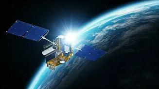
The primary objective of the EOS-01 mission was to deploy a sophisticated Earth observation satellite into orbit, designed to provide valuable data for
a multitude of applications. This satellite was intended to serve as a crucial tool for monitoring the Earth's surface, offering high-resolution imagery and multispectral data. Such capabilities are vital for a wide range of fields, including agriculture, forestry, disaster management, and urban planning. The mission aimed to enhance India's capacity for remote sensing, enabling more precise and timely assessments of natural resources, environmental changes, and disaster-stricken areas. By providing critical insights from space, EOS-01 was slated to support informed decision-making and proactive interventions, ultimately contributing to sustainable development and improved disaster response mechanisms across the nation and beyond.
Satellite Capabilities Explained
EOS-01 was engineered with advanced sensor technology, enabling it to capture detailed imagery of the Earth across various spectral bands. This multi-spectral capability allows for the differentiation of various land cover types, such as vegetation, water bodies, and soil, with remarkable precision. The satellite was designed to operate in a sun-synchronous orbit, ensuring consistent illumination conditions for repeated observations, which is essential for tracking changes over time. Its high spatial resolution meant that even relatively small features on the ground could be clearly identified and analyzed. This level of detail is instrumental for applications like crop health monitoring, deforestation tracking, and assessing the impact of natural calamities like floods or droughts. The data transmitted by EOS-01 was intended to be processed and analyzed to provide actionable intelligence, supporting scientific research and operational decision-making in diverse sectors.
Applications of Earth Observation
The data gathered by satellites like EOS-01 has far-reaching implications for numerous sectors vital to national progress. In agriculture, it aids in precision farming by monitoring crop health, predicting yields, and optimizing irrigation and fertilizer use, thereby boosting food security. For forestry, it enables the tracking of deforestation, forest fires, and the assessment of forest cover, crucial for conservation efforts. Disaster management agencies rely heavily on such imagery for early warning systems, damage assessment during and after events like cyclones, earthquakes, and floods, and for planning rescue and relief operations. Urban planners can utilize the data for infrastructure development, monitoring urban sprawl, and managing resources efficiently. Furthermore, environmental scientists benefit from continuous monitoring of climate change indicators, water resource management, and pollution tracking, making Earth observation a cornerstone of sustainable management and informed governance.