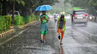








New Delhi: Karnataka is likely to receive more rain and thunderstorms over the next few days, according to the India Meteorological Department (IMD). Coastal
districts are expected to see scattered thunderstorms until October 10, while several other parts of the state may also receive rain.
Cloudy weather is likely to reduce from Wednesday, but evening thunderstorms could continue in many areas for another three to four days. The Malnad region and parts of south interior Karnataka are also expected to receive scattered rainfall, although the activity is likely to weaken from October 8.
Yellow alert issued for 9 districts
The IMD has issued a yellow alert for nine districts for today, warning of the possibility of good rainfall. The districts under the alert are Shivamogga, Chikkamagaluru, Hassan, Kodagu, Mandya, Mysuru, Chamarajanagar, Bengaluru Rural and Bengaluru Urban.
People in these districts can expect cloudy skies, along with spells of rain and thunderstorms, particularly during the evening. Residents have been advised to remain cautious during thunderstorms and follow local weather updates.
Light to moderate rain is also expected at some places in Dakshina Kannada, Udupi, Uttara Kannada and Ramanagara.
Coastal Karnataka to remain active
Coastal Karnataka is likely to remain the most active region over the coming days. The IMD has forecast scattered thunderstorms in the coastal districts through October 10.
In contrast, much of north Karnataka is expected to remain largely dry. Dry weather is forecast in Bagalkot, Belagavi, Bidar, Dharwad, Gadag, Haveri, Kalaburagi, Koppal, Raichur, Vijayapura and Yadgir.
Similar conditions are likely in Chikkaballapur, Kolar, Ballari, Chitradurga, Davangere, Vijayanagara and Tumakuru.
The weather situation is expected to change gradually from October 8, when rainfall activity in parts of the interior state may begin to weaken, although evening thunderstorms could continue in some areas.