


What is the story about?
What's Happening?
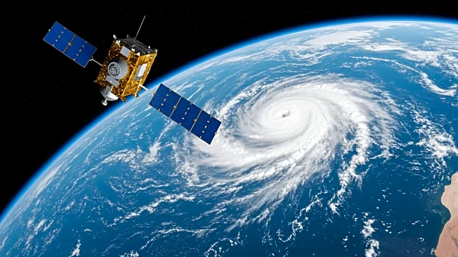
Tropical Storm Erin is being monitored by satellites as it intensifies over the Atlantic Ocean. The storm originated from a tropical wave that moved off Africa on August 11, and it has shown increasingly organized cloud bands and intensifying thunderstorm activity. NOAA's GOES-19 satellite has detected colder cloud tops and deep convection near the storm's center, indicating a strengthening system. Forecasts suggest that Erin may reach hurricane strength by late Thursday or early Friday, with maximum sustained winds currently near 45 mph. The storm is moving westward from the Cabo Verde Islands at about 20 mph and is expected to curve away from the United States, reducing the likelihood of landfall.
Why It's Important?
The development of Tropical Storm Erin is significant as it aligns with NOAA's forecast for an above-normal 2025 Atlantic hurricane season. The potential intensification into a hurricane could impact weather patterns and bring heavy rain and strong winds to parts of the U.S. East Coast. Additionally, swells generated by Erin may produce dangerous surf and rip currents along coastal areas. This event underscores the importance of satellite monitoring in predicting storm paths and intensities, which is crucial for preparing and mitigating potential impacts on affected regions.
What's Next?
Forecast models indicate that Tropical Storm Erin will continue moving west-northwest before curving away from the United States. While the chance of landfall is low, the storm could still affect coastal areas with heavy rain and strong winds. Forecasters will continue to monitor Erin's development and provide updates on its trajectory and potential impacts. The U.S. National Hurricane Center will offer the most current information as the situation evolves.