


What is the story about?
What's Happening?
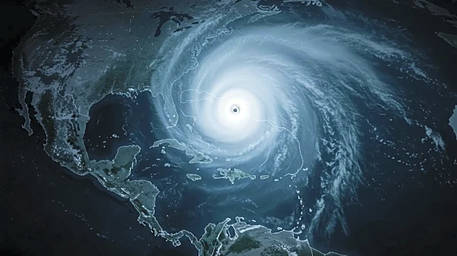
Hurricane Erin has rapidly intensified to a Category 5 storm as it moves above the northeastern Caribbean, bringing rough surf, rain, and gusty winds to islands south of its path. The National Hurricane Center reports Erin's sustained winds have reached 160 mph, doubling in speed within 24 hours. The storm is currently located about 105 miles north of Anguilla and is expected to fluctuate in intensity over the weekend. Erin is forecast to grow significantly in size by next week, potentially affecting ocean conditions over the western Atlantic. While Erin is unlikely to make direct landfall on Caribbean islands, tropical alerts are in place, warning of potential threats.
Why It's Important?
The rapid intensification of Hurricane Erin underscores the increasing frequency of powerful storms fueled by warmer ocean temperatures. This poses significant risks to coastal communities, infrastructure, and ecosystems in the Caribbean and potentially along the US East Coast. The storm's potential to cause life-threatening surf and rip currents highlights the need for preparedness and response measures. The intensification of hurricanes is a growing concern linked to climate change, emphasizing the importance of addressing environmental factors contributing to such extreme weather events.
What's Next?
Hurricane Erin is expected to track north over the western Atlantic next week, potentially affecting the US East Coast and Bermuda with rough surf and dangerous rip currents. The US Coast Guard has closed several ports in the US Virgin Islands and Puerto Rico to inbound vessel traffic. Authorities will continue to monitor the storm's path and intensity, adjusting safety measures as needed. The National Hurricane Center will provide updates on Erin's trajectory and potential impacts, while local governments may issue further advisories and evacuation orders if necessary.