


What is the story about?
What's Happening?
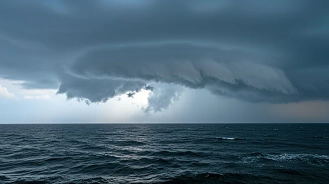
Tropical Storm Erin is intensifying in the central tropical Atlantic, with forecasts indicating it may become a hurricane by Friday. The storm is currently centered about 900 miles east of the northern Leeward Islands, moving west at 17 mph with sustained winds of 60 mph. Erin's path is expected to follow a northwest trajectory, potentially affecting coastal areas with swells, heavy surf, and rip currents. A tropical storm watch has been issued for several northeast Caribbean islands, including Anguilla and Barbuda. The National Hurricane Center predicts Erin will continue to intensify, possibly reaching Category 3 strength by Sunday.
Why It's Important?
The strengthening of Tropical Storm Erin is crucial as it poses a threat to coastal regions, potentially causing hazardous sea conditions and impacting marine activities. The storm's intensification could lead to significant weather disruptions, including flooding and property damage, particularly in areas close to its path. The issuance of a tropical storm watch underscores the need for preparedness among residents and authorities in the affected regions. Erin's development also highlights the broader implications of climate change, with warmer sea temperatures contributing to more intense storms.
What's Next?
Meteorologists will continue to monitor Erin's progression, with hurricane-hunter flights expected to gather more data on the storm's intensity and path. Coastal communities in the Caribbean and potentially affected areas in the U.S. are advised to remain vigilant and prepare for possible severe weather conditions. The National Hurricane Center will provide ongoing updates, which will be critical for emergency planning and response efforts.