
What's Happening?
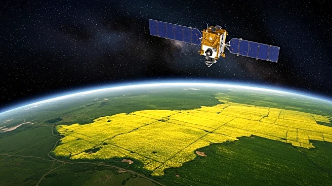
Hansanee Fernando, a graduate student at the University of Saskatchewan, is pioneering the use of satellite imagery to provide canola producers with unprecedented insights into their crops. By collecting images from open-source satellites, Fernando is mapping large sections of farmland across Western Canada. Her research focuses on identifying key growth stages and estimating yields early in the growing season. This approach aims to empower farmers to make informed decisions, optimize management practices, and potentially reduce costs. Fernando's work involves using radar images in conjunction with optical images, a novel technique in agricultural mapping that offers comprehensive data collection even in adverse weather conditions.
Why It's Important?
This innovative use of satellite imagery in agriculture could significantly impact the farming industry by providing more accurate and timely data to farmers. The ability to monitor crop growth stages and predict yields can lead to better resource management and increased productivity. This technology also holds potential benefits for municipalities and crop insurance companies, which could use the data to process claims more efficiently after adverse weather events. By enhancing decision-making capabilities, this research supports sustainable agricultural practices and could lead to economic benefits for farmers and related stakeholders.
What's Next?
Fernando plans to develop an application that will allow farmers to access detailed information about their fields, such as flowering dates and yield estimates. This app could become a valuable tool for farmers, enabling them to make data-driven decisions throughout the growing season. As Fernando continues her research, she aims to further refine the technology and expand its applications, potentially influencing agricultural practices on a broader scale.
Beyond the Headlines
The integration of radar and optical satellite imagery represents a significant advancement in precision agriculture. This approach not only improves data accuracy but also enhances the resilience of agricultural monitoring systems against weather-related disruptions. The research underscores the growing importance of technology in agriculture and highlights the potential for further innovations in crop management and sustainability.