
What's Happening?
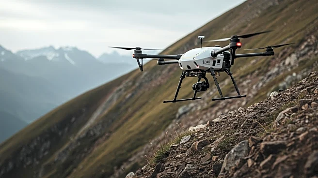
Researchers have developed a LiDAR-based quadrotor system designed for slope inspection under dense vegetation. This technology utilizes advanced LiDAR sensors to navigate and inspect areas that are typically challenging due to thick foliage. The quadrotor's ability to avoid obstacles and maneuver through complex environments has been validated through field experiments. This innovation represents a significant advancement in unmanned aerial vehicle (UAV) technology, offering practical solutions for civil engineering and environmental monitoring.
Why It's Important?
The development of LiDAR-based quadrotors for slope inspection addresses critical challenges in environmental monitoring and infrastructure maintenance. By enabling precise navigation in dense vegetation, this technology can improve the accuracy and efficiency of inspections, potentially reducing costs and enhancing safety. Industries such as construction, forestry, and environmental conservation stand to benefit from these advancements, as they provide new tools for managing natural and built environments.
What's Next?
Further research and development could lead to broader applications of LiDAR-based quadrotors in various sectors, including agriculture and disaster response. As the technology matures, it may become a standard tool for professionals requiring detailed environmental assessments. Collaboration between technology developers and industry stakeholders will be crucial in refining these systems and integrating them into existing workflows.