
What's Happening?
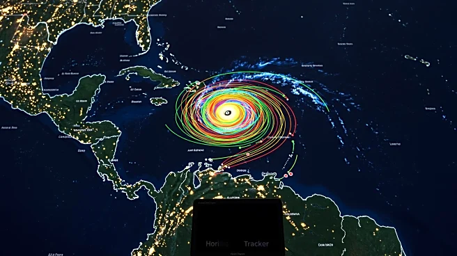
Hurricane Erin, the first Atlantic hurricane of the year, is being closely monitored as it moves through the northeast Caribbean. The storm is not expected to make landfall, but its trajectory is being tracked to assess potential impacts on the region. Meteorologists are providing updates on the hurricane's path and intensity, ensuring that residents and stakeholders are informed about any changes in its movement.
Why It's Important?
Tracking Hurricane Erin is crucial for preparedness and risk management in the Caribbean region. While the storm is not expected to hit land, its presence underscores the importance of monitoring weather patterns and potential threats. Accurate tracking helps mitigate risks and allows for timely responses to any changes in the hurricane's path. The event highlights the ongoing need for robust meteorological systems and international cooperation in disaster management.
What's Next?
Meteorologists will continue to monitor Hurricane Erin's movement and provide updates on its trajectory. Stakeholders in the Caribbean and surrounding areas will remain vigilant, ready to implement contingency plans if necessary. The focus will be on ensuring public safety and minimizing disruptions, with authorities prepared to respond to any developments in the storm's behavior.
Beyond the Headlines
The tracking of Hurricane Erin emphasizes the role of technology and international collaboration in weather forecasting and disaster preparedness. The event serves as a reminder of the challenges posed by natural disasters and the importance of proactive measures to protect communities. The ongoing monitoring of the hurricane reflects broader efforts to enhance resilience and adaptability in the face of environmental threats.