


The New Normal of Urban Flooding
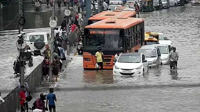
For many cities, devastating floods are no longer rare anomalies; they are becoming everyday occurrences. Driven by the mounting effects of climate change, the frequency and intensity of heavy downpours and unpredictable flash floods are increasing globally.
This shift creates a massive challenge for urban infrastructure, which was often designed for a climate that no longer exists. In densely populated areas, the problem is compounded by impermeable surfaces like concrete and asphalt, which prevent water from soaking into the ground, forcing it instead into constrained drainage systems that quickly become overwhelmed.
The Satellite Blind Spot
To manage these disasters, emergency responders often turn to space. Synthetic aperture radar (SAR) is a vital tool because it can see through thick storm clouds and operate in total darkness. In open fields or rural landscapes, SAR is incredibly reliable: floodwater acts like a mirror, reflecting radar signals away from the satellite and appearing as dark patches on a map. This 'dark-pixel' method makes it easy to spot where water has moved in. However, when that same technology is pointed at a city, the physics of the signal change entirely, creating dangerous gaps in our knowledge.
The Geometry of Chaos
In an urban environment, buildings act as obstacles that distort radar signals. Because SAR views the ground from an angle rather than directly from above, tall structures create 'radar shadows'—areas behind buildings where the signal simply cannot reach. This can make a flooded street look perfectly dry on a map. Conversely, a phenomenon known as 'double-bounce' can occur when radar signals bounce off both a building wall and the water surface before returning to the satellite. This can make a flooded area appear much brighter than it actually is. These distortions mean that a single brightness threshold cannot be used to reliably identify flooding across an entire city.
Closing the Information Gap
Because technology alone cannot provide a perfect picture, experts are moving toward more layered approaches to flood resilience. Instead of relying solely on satellite imagery, analysts now combine radar data with building footprints, terrain models, and hydraulic simulations to predict how water might flow through narrow streets and around corners. The goal is to move away from assuming an unmarked street is safe and toward creating 'confidence layers'—maps that tell responders not just where the water is, but where our data might be unreliable due to urban obstructions.