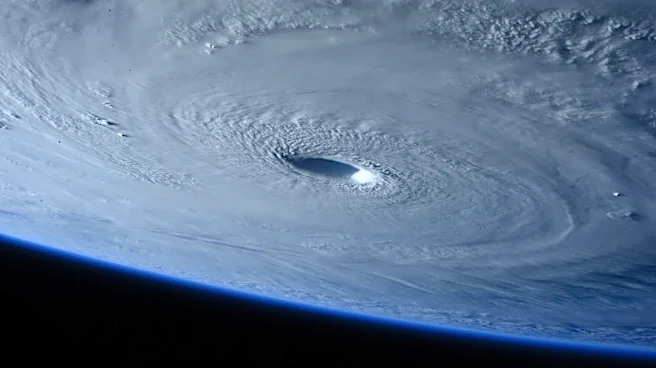




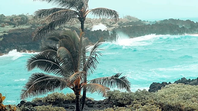
The Hawaiian Islands have felt the effects of five different storms during the 2026 hurricane season, and it isn't over yet, as a strengthening El Niño continues to build along the equator in the Pacific.
The remnants of two other systems are forecast to bring additional rain to Hawaii over the next several days. Leftovers from Tropical Storm Norbert are forecast to bring moisture and rain to the islands through Friday, Sept. 18, while the remnants of Tropical Depression 15-E are expected to bring more rain to the islands on Sept. 21 and 22, the National Weather Service in Honolulu said in its latest forecast.
Meanwhile the National Hurricane Center is watching another potential system far to the east of the Islands.
During repeated storm forecasts
and advisories this summer, visitors to Hawaii and mainlanders have watched the storm tracking maps and advisories, getting a refresher course in the geography of the nation’s 50th state and its associated islands, which stretch more than 1,500 miles across the Pacific.
A busy season continues in the Pacific
Including the recently formed Tropical Depression 15-E, 17 tropical systems have formed across the central and eastern Pacific Ocean this summer.
Why are there so many storms this year?
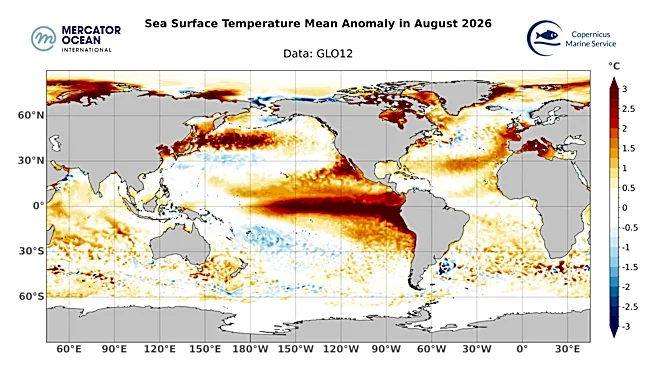
Just as the powerful El Niño in the Pacific Ocean is suppressing hurricane and tropical storm activity in the Atlantic, it's creating favorable conditions for storms to form in the Pacific.
El Niño conditions have contributed to "an extraordinary stretch of tropical activity" in the Pacific Basin this hurricane season, with three named storms impacting the Hawaiian Islands in less than a month, according to the private weather company AccuWeather.
Could the island chain set a record for tropical storm impacts this year? Perhaps. The previous busiest year was 2015, said Vanessa Almanza, a weather service meteorologist in Honolulu. The centers of six storms came within 300 miles of the islands that year, according to the National Oceanic and Atmospheric Administration's Historical Hurricane tracks. In 2018, there were five.
The El Niño pattern, which includes warmer-than-normal water along the equator, creates conditions that reduce wind shear and warm water temperatures, said Stephen Businger, a professor in the meteorology department at the University of Hawaii.
Weak wind shear allows storms to be ventilated and maintain their strength, Businger said. El Niño also is contributing to warmer sea surface temperatures farther to the north that are helping fuel the storms that do form, he said.
A lack of wind shear and warmer waters allowed Lala to keep going for a long distance, he said, until it eventually moved over cooler water.

How many islands are there in the Hawaiian Islands?
At times this summer, many of the 137 Hawaiian Islands have been under weather alerts, including the main islands and dozens of others, including islets, tiny areas that may only be a rock outcropping, patch of beach or coral reef. The geography can sometimes be confusing for visitors, Almanza said.
Seven of the islands are inhabited: Hawaii, Maui, Oahu, Kauai, Molokai, Lanai and Niihau. They’re part of a group of eight islands considered the main islands.
The entire chain stretches from Hawaii (the Big Island) to Kure Atoll, more than 1,500 miles to the west.
The northwestern Hawaiian Islands, scattered west of Kauai and Niihau, are an assortment of islands, atolls, reefs and shoals, according to the municipal code for Honolulu County, Hawaii. That includes islands ranging in size from the one-acre Maro Reef to the 913-acre Laysan Island.
The islands that are part of the Midway Atoll aren't considered part of the official state of Hawaii.
Which storms affected Hawaii this summer?
Hawaii has faced an extraordinary series of natural disasters this year, including severe rain events, the 6.0 magnitude Kona earthquake, and Hurricane Lala and Hurricane Lowell, Gov. Josh Green's office stated in a Sept. 11 news release.
Together, Lala and Lowell have caused billions of dollars in damage on the islands of Kauai and the Big Island (Hawaii), according to preliminary estimates from AccuWeather.
Hurricanes have previously moved through the islands as late as November and early December.
Hurricane Fausto – Brought surf and rain to the islands in late July.
Hurricane Lala – Passed just to the south of the Big Island, dropping more than 30 inches of rain in some locations, creating massive flood waves that cut off towns and swept homes off their foundations. Winds and flooding also were reported on Maui, Oahu and Kauai. In total, at least three deaths and three injuries were attributed to the storm, according to the weather service. AccuWeather preliminarily estimated the Lala damage at $3 to $5 billion.
Tropical Storm Moke – Prompted weather service warnings for potential rain and surf impacts as Hurricane Lala recovery efforts were underway.

Hurricane Lowell – With the center passing just 37 miles west of Niihau, the storm knocked out electricity to most of the island of Kauai and left devastating flood damage. As of Monday, Sept. 14, thousands of customers remained without electricity on Kauai, according to the governor's office. AccuWeather put the preliminary damage estimate for Lowell at $5 to 7 billion.
Hurricane Karina – Its remnants moved north of the islands, bringing swells from one direction as Lowell delivered swells from another.
El Niño's vastly different impacts in the Atlantic
While the central and eastern Pacific basins have experienced a busy season, the Atlantic hurricane season has been a record-setter and far less active than typical, with only five named storms.
USA TODAY national correspondent Dinah Voyles Pulver and graphics journalist Jennifer Borresen have covered hurricanes and other violent weather for decades. Reach them at dpulver@usatoday.com and jborresen@usatoday.com
This article originally appeared on USA TODAY: El Niño could fuel hurricane season record for Hawaii. See why