



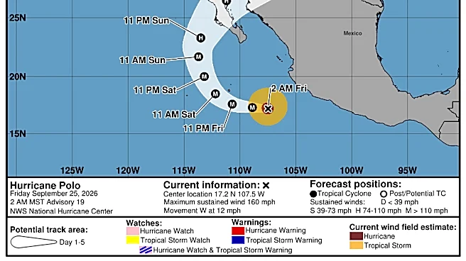

A soggy, potentially dangerous week is ahead for a "huge" section of the central United States, forecasters warned, as the remnants of Hurricane Polo interact with a separate, sprawling weather system to bring days of rain and possible flooding.
"As these features combine into a new, hybrid storm, the influx of moisture spreading across the central United States will pose the risk for flash flooding," AccuWeather meteorologist Alyssa Glenny said.
The National Weather Service explained that tropical moisture from the remnants of Hurricane Odalys and Hurricane Polo will surge over the Southwest into the central U.S. this week with several days of heavy to excessive rainfall, which may bring limited to "considerable" flooding. The threat area is "huge,"
the weather service said in an online forecast.
Flood watches have been issued through Sept. 30 across the Southwest U.S.
Weather systems combine
In addition to the moisture from Polo, the other system, known as an upper-level low, or trough, will be moving into the central U.S. from the West, Marc Chenard, a meteorologist with NOAA's Weather Prediction Center, told USA TODAY.
That low will help funnel plentiful moisture northward from the Gulf, he said. "This will produce a widespread area of heavy rainfall."
"Even if we didn't have Polo," there would still be a heavy rain and flood threat in the central U.S. this week, Chenard told USA TODAY.

Concerns about 'predecessor rain event'
Flooding could be exacerbated this week in some areas due to what's known in weather circles as a "predecessor rain event" (PRE), which is a swath of heavy rain that develops hundreds of miles ahead of a tropical cyclone when moisture from the storm interacts with other weather systems, often causing serious flooding before the storm itself arrives, according to theAmerican Meteorological Society.
"A predecessor rain event is shaping up over the Four Corners of the southwest U.S. today (Sept. 28) courtesy of abundant tropical air streaming northward from Polo and the remnants of once Hurricane Odalys to its west," said WPLG-TV hurricane specialist Michael Lowry in a Substack post.
Where will the heaviest rain fall?
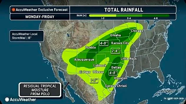
While rain is expected from Arizona through Chicago, the heaviest bands are expected in Texas, eastern Arizona, Oklahoma, southwestern Colorado, Kansas and Nebraska, AccuWeather said.
Parts of this region could see up to 8 inches of rain.
Where is the flooding expected?
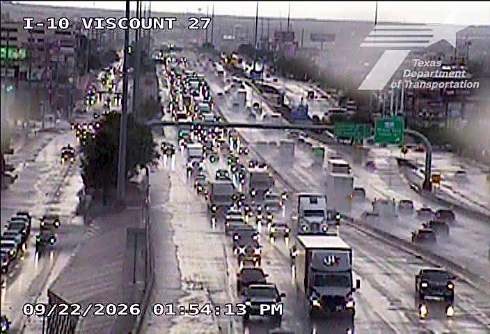
Considerable flash flooding is possible across portions of New Mexico and western Texas beginning Sept. 28 and continuing into mid-week, NOAA's Weather Prediction Center said in an online forecast. Flash flooding impacts are also possible elsewhere across the broader Southwest, particularly near burn scars, low-water crossings and areas of complex terrain.
Areas that have received significant rainfall in recent weeks and have saturated ground face an elevated risk, according to AccuWeather.
By Sept. 29 and Sept. 30 in eastern Nebraska and western Iowa, flash and urban flooding, along with river flooding is possible. "Flash, urban, and river flooding impacts may also be possible starting mid-week across central Texas and southern Oklahoma," the prediction center said.
Turn around, don't drown
Avoid travel through already flooded and vulnerable areas, the National Weather Service said. "Be especially cautious at night. If you encounter flooding while driving, turn around, don't drown" the weather service said.
Doyle Rice is a national correspondent for USA TODAY, with a focus on weather and climate.
This article originally appeared on USA TODAY: Huge 'hybrid storm' will form over the US