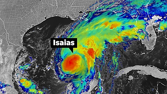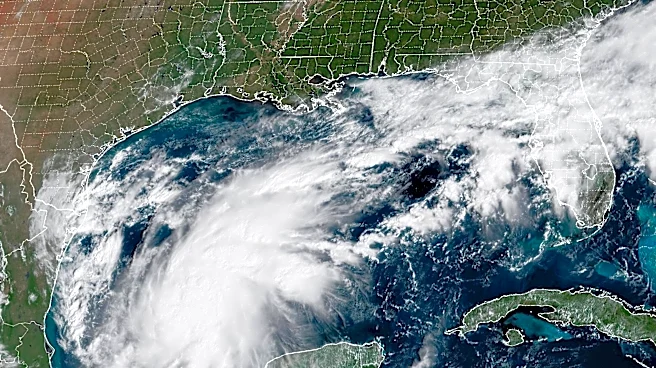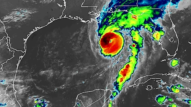

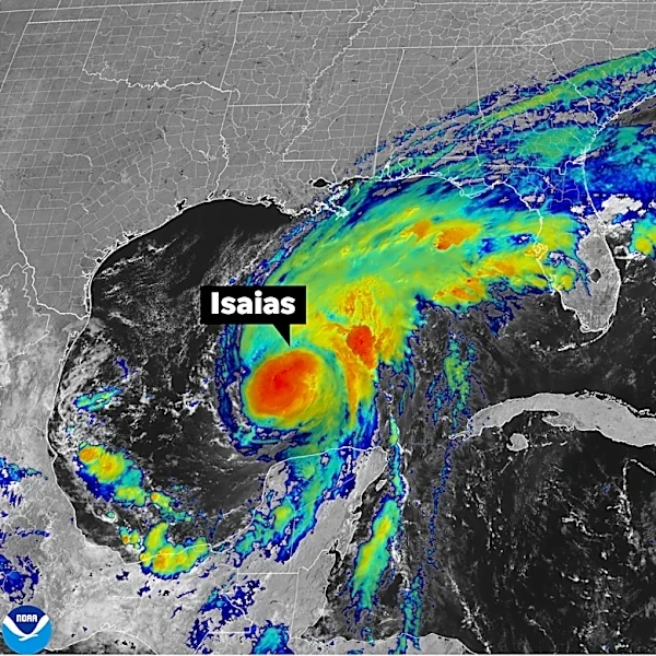
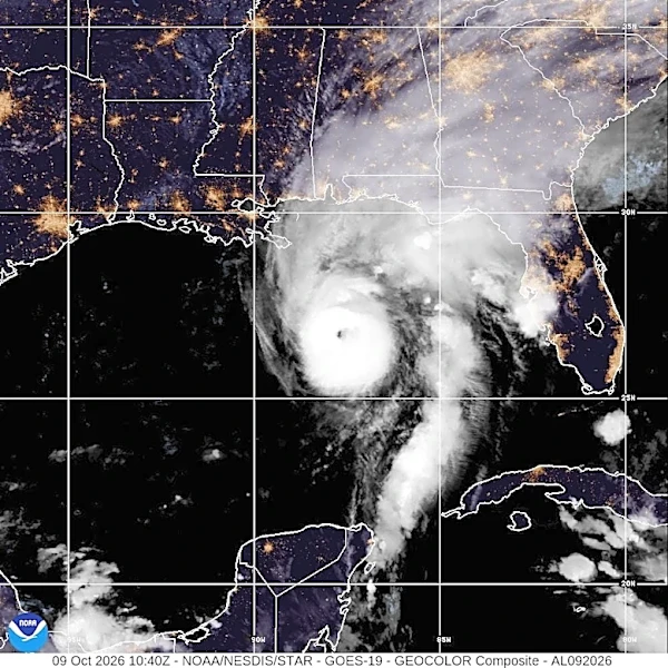

Hurricane Isaias is now a Category 2 storm and is continuing on its path to make landfall along the U.S. Gulf Coast late Friday, Oct. 9, or overnight into Saturday, Oct. 10, according to the National Hurricane Center.
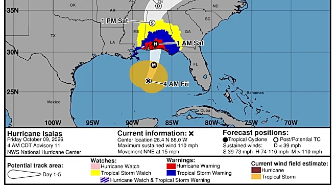
As of 5 a.m. ET on Friday, Oct. 9, the center of Isaias was located about 200 miles south-southeast of the mouth of the Mississippi River with maximum sustained winds near 110 mph with higher gusts. The storm is moving north-northeast around 15 mph, with a turn toward the north expected later Friday.
Forecasters said Isaias is expected to approach the northern U.S. Gulf Coast on Friday afternoon and make landfall within the warning area "tonight or early Saturday". The hurricane center said in its most recent bulletin the storm is "likely
to become a major hurricane this morning," and while some slight weakening is expected before landfall, it is still expected to remain a "dangerous" hurricane.
Isaias is the first hurricane of the 2026 Atlantic hurricane season, and forecast to be the first to strike the United States since Hurricane Milton, two years ago to the day in 2024.
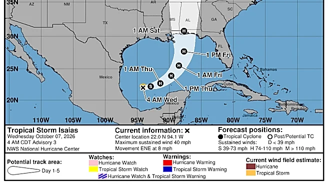
Hurricane Isaias path tracker
This forecast track shows the most likely path of the storm's center. It does not illustrate the storm's full width or its impacts, and the center can travel outside the cone up to 33% of the time.
Hurricane Isaias spaghetti models
Illustrations include an array of forecast tools and models, and not all are created equal. The hurricane center uses only the top four or five highest-performing models to help make its forecasts.
Hurricane Isaias forecast
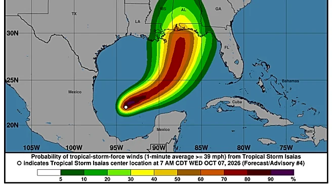
Isaias is expected to bring life-threatening storm surge, damaging winds, flooding rain and a chance for tornadoes to the Southeast later Friday, Oct. 9, and into Saturday, Oct. 10.
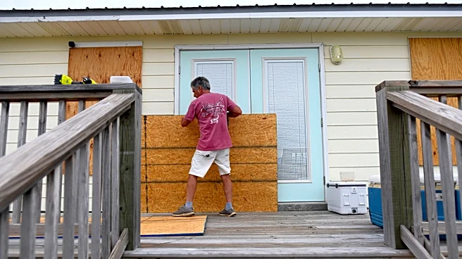
"Preparations should be rushed to completion as the weather will go downhill quickly today," the hurricane center advised early Friday morning.
The hurricane center said the combination of a "dangerous storm surge and the tide" will cause normally dry areas near the coast to be flooded by rising waters moving inland from the shoreline.
The greatest concern for storm surge is the area from Dauphin Island, Alabama, to Indian Pass, Florida, according to the NHC, with storm surge potentially reaching 5 to 7 feet above ground level.
Through the weekend, Isaias is expected to produce rainfall amounts between 4 to 8 inches across southern Alabama, the Florida Panhandle and Big Bend, and southwest Georgia. Localized totals up to 15 inches are possible, particularly across the Florida Panhandle and Big Bend, forecasters said.
Across much of the remainder of the Southeast, rainfall amounts between 2 to 5 inches are possible, especially across the Southern Appalachians and coastal Carolinas.
A tornado risk will also begin Friday afternoon and tonight into Friday night in coastal areas of Alabama, the Florida Panhandle, and far southwest Georgia, and the threat will continue Saturday across parts of eastern Alabama, the Florida Panhandle, Georgia and the Carolinas, according to the hurricane center.
Watches and warnings in effect
A storm surge watch is in effect for the Suwanee River to Yankeetown, Florida, while a storm surge warning is in place from the mouth of the Mississippi River to the Suwanee River.
A hurricane warning is in place from Ocean Springs, Mississippi, to the Bay/Gulf County Line, Florida. A tropical storm warning was issued from the Jefferson-Plaquemines Parish line in Louisiana to west of Ocean Springs, Mississippi, and also from east of the Bay/Gulf County Line in Florida to the Aucilla River.
Contributing: Doyle Rice, Dinah Voyles Pulver and Jeanine Santucci, USA TODAY
Gabe Hauari is a national trending news reporter at USA TODAY. You can follow him on X @GabeHauari or email him at Gdhauari@usatoday.com.
This article originally appeared on USA TODAY: Track Hurricane Isaias as it gains strength ahead of landfall