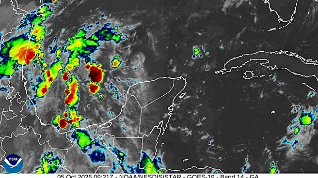

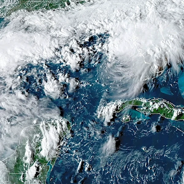



Tropical Storm Isaias has formed in the Gulf, the National Hurricane Center announced early Oct. 7. It's the ninth named tropical storm of the 2026 Atlantic hurricane season.
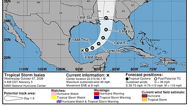
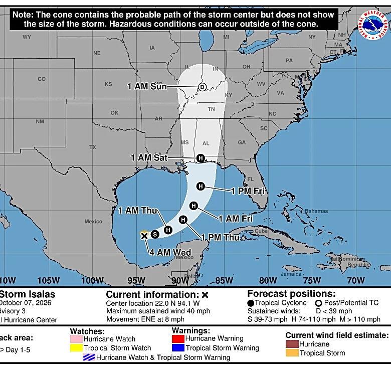
Unlike the previous eight storms, this one is forecast to strengthen into a hurricane and take aim at the Gulf Coast by Friday, Oct. 9 or early Saturday, Oct. 10.
Isaias could have winds of over 100 mph by Friday, Oct. 9, as it approaches the U.S. coast, according to the center's hurricane specialists. Forecasters said. It's forecast to peak before making landfall, but could still be a "significant" hurricane when it reaches the coast with strong winds and flooding rain, the hurricane center said. It should then dramatically weaken.
As of 5 a.m. ET, the center of Isaias was
located 580 miles southwest of the mouth of the Mississippi River and was moving to the east-northeast at 8 mph. Its maximum sustained winds were 40 mph.
Hurricane Isaias expected
The storm, expected to become Hurricane Isaias, is forecast to intensify over the open Gulf into a Category 1 hurricane on Thursday, Oct. 8, then become a Category 2 hurricane with 110 mph winds on Oct. 9.
Forecasters say the storm could still be a hurricane as it approaches the coast. Its exact track is not yet certain, but the hurricane center said residents from Louisiana to the Florida Panhandle should monitor closely and make sure they have a hurricane plane in place.
Isaias would be the first hurricane of the 2026 Atlantic hurricane season. Typical seasons feature seven hurricanes.

Impacts from rain and wind likely
Some of the heaviest rain, totaling 8-12 inches, is expected across southern Alabama and southern Mississippi, near where the storm makes landfall, AccuWeather said. Bands of 4-8 inches are forecast across much of Alabama and the Florida Panhandle as the storm tracks north toward the Appalachians.
Heavy rain can also spread into the Ohio Valley as far north as Kentucky and West Virginia before moving eastward into the Carolinas and southern Virginia.
Along the coast close to landfall, the storm is forecast to bring widespread wind gusts of 40-60 mph, according to AccuWeather.
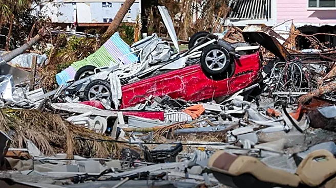
The rain and wind can lead to power outages, property damage, widespread flooding and mudslides in higher elevations of the Appalachians.

Florida to get drenched
Isaias is forecast to bring heavy rain to the coast from southeast Louisiana to southwest Florida.
That could be a problem in parts of Florida’s Panhandle, where heavy rain fell in several counties this week, the National Weather Service said. In Apalachicola, 11.84 inches of rain had fallen, including 7.49 inches on Oct. 5, tying the one-day rainfall record for October, reported the weather service office in Tallahassee.
People along the state’s Peninsula should also remain aware of the forecast, where a marginal risk of excessive rainfall exists through Oct. 8. Up to 7 inches of rain is possible along parts of the state’s west coast over five days, including in the Tampa Bay area, according to weather service forecasts.

Warm water helps fuel storms
Seasoned hurricane veterans know that when a potential system is looming in the Gulf, water temperatures can be important because warmer waters help fuel storms. In this case, average daily sea surface temperatures in the Gulf are still warmer than normal and breaking daily records.
But the temperatures have dropped nearly 2 degrees since mid-September, according to the Climate Reanalyzerby the University of Maine’s Climate Change Institute.
Set up several ways to get weather warnings
For those who might be in the path of the storm, don't rely just on your phone app to receive weather warnings.
Both the National Oceanic and Atmospheric Administration and the National Weather Service recommend at least two independent alert sources – such as Wireless Emergency Alerts plus a battery or hand‑crank NOAA weather radio.
Know your evacuation route
This is good advice for those who may be in the path of a hurricane (or its remnants), not just coastal residents.
According to NOAA, many hurricane deaths occur inland because of heavy rain and flooding – not storm surge. Even residents who live far from the coast should familiarize themselves with evacuation routes and flood‑prone roads.
Prepare a hurricane emergency supply kit
Emergency kits should be prepared well in advance of a storm so they are ready to grab if an evacuation is necessary, the National Weather Service said.
It should include several days of nonperishable food, water, medications, flashlights, batteries, a battery‑powered or hand‑crank radio, chargers and basic hygiene items. Emergency managers say this should be done before shelves empty or prices spike.
See the spaghetti models
The illustration includes an array of forecast tools and models, and not all are created equal. The hurricane center uses only the top four or five highest-performing models to help make its forecasts, and not all of them are publicly available.
This article originally appeared on USA TODAY: Tropical Storm Isaias forms in Gulf, could reach US as a hurricane