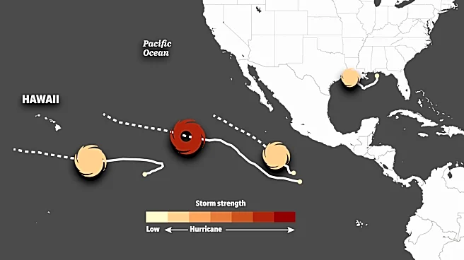


The Atlantic hurricane season continues to be on the quiet side, but that isn't the case in the Pacific, which has seen 15 tropical storms and hurricanes in 2026.
Three of those systems are currently spinning in the Pacific: Hurricane Lowell, Hurricane Karina and Tropical Storm Marie. While the official forecast is for all of them to stay away from land, some outlier computer models are indicating potential impacts to Hawaii and California.
Lowell a 'powerful hurricane'
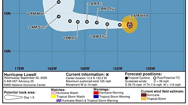
Category 4 Hurricane Lowell is now spinning well south of Hawaii. It's not expected to directly impact the Aloha State, but is forecast to kick up some rough surf there: "Swells generated by Lowell are likely to affect portions of the Hawaiian Islands beginning on Wednesday [Sept. 2]," the National Hurricane Center
said in a Sept. 2 bulletin. "These swells are likely to cause life-threatening surf and rip current conditions."
Now with 145 mph winds, the hurricane center said "there is a high likelihood that Lowell will remain a powerful hurricane for days to come … the storm could even make category 5 intensity on Wednesday," the center said. Category 5 hurricanes have sustained winds of 157 mph or higher.

Where is Lowell headed?
The official track forecast for Lowell shows it moving west to the south of the Hawaiian Islands, then making a sharp right turn toward the north. However, as the hurricane center said, "there is considerable uncertainty on how sharp that turn might be."
Most computer models show the storm staying well to the west of Hawaii, which is what the hurricane center's official track forecast shows. However, one model, the Canadian, shows it making a very sharp turn directly toward Hawaii by early next week.
"A lot of details on the timing and exact track of the system, coupled with associated impacts, remain to be ironed out," the National Weather Service in Honolulu said.
Karina and Marie also out there
Two other systems – Hurricane Karina and Tropical Storm Marie – are also spinning over the vast expanse of the Pacific. Karina, now a Category 4 with 145 mph winds, "is about 1,490 miles east of Hilo, Hawaii, early this morning, and the latest forecast from the NHC has it moving to the west-northwest through Friday [Sept. 4], before lifting further to the north over the weekend," the weather service in Honolulu said Wednesday morning Sept. 2.
It is not expected to have a major negative impact on Hawaii's weather. However, the weather service said that "as Karina moves northeast of the islands this weekend and early next week, it will help to disrupt the strong trade wind flow, helping our winds to return initially to more moderate levels."

Could Marie affect California?
Farther east, Tropical Storm Marie is forecast to stay well offshore of the Baja Peninsula of Mexico. The storm remains a question mark, however remotely, for Southern California.
Marie is forecast to move along a path that will take it to a point about 775 miles southwest of San Diego on Sunday, Sept. 6, according to a forecast from the weather service office in San Diego. Though forecast to briefly become a hurricane, it’s expected to dissipate over the weekend.
A few outlier computer forecast models, commonly known as spaghetti models, indicate a chance Marie could trek closer to the California coast or the northern Baja California Peninsula of Mexico.
Despite a flurry of social media posts about those model forecasts, there's “zero indication of anything close to a hurricane strength system actually making landfall in California or even making a very close approach,” said Daniel Swain, a climate scientist with University of California Agriculture and Natural Resources.The majority of models – and the hurricane center’s official track forecast – show Marie moving off into the open Pacific.

However, it's "increasingly plausible that a tropical system of some magnitude will have at least indirect effects in Southern California for several days later this week," Swain said during a presentation on his Weather West YouTube channel. Humid air, clouds and heavy surf are pretty likely regardless, he added.
For San Diego, the weather service office said the most likely scenario would be moisture drawn northeastward across Southern California that could bring a chance of showers and thunderstorms from Saturday, Sept. 5, through Monday, Sept. 7.
How rare are tropical storms or hurricanes in Southern California?
If you're just talking about any kind of activity, including remnants of previous tropical storms or hurricanes, dozens of storms have either moved over the region or indirectly influenced weather in Southern California.
A vast historical database compiled by researchers with the National Oceanic and Atmospheric Administration shows no hurricane has made a landfall, meaning its center crossed the shoreline, in all of recorded history. Two came close. A hurricane with 75 mph winds passed just offshore on Oct. 2, 1858, the historic records showed.
On Sept. 24, 1939, a hurricane dubbed "El Cordonazo" approached Los Angeles but dropped to tropical storm strength just before moving ashore. That's also the last time a tropical storm made landfall in Southern California, USA TODAY previously reported.
Atlantic remains quiet as seasonal peak nears
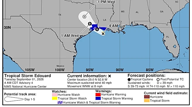
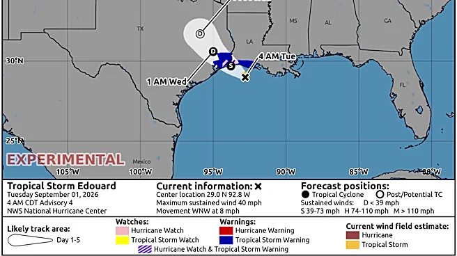
With Edouard dissipating, the Atlantic is now devoid of tropical cyclone activity as of Sept. 2. Top forecasters from Colorado State University, in a two-week forecast released Sept. 2, said the quiet trend should continue: "We are strongly favoring below-normal activity during the next two weeks. There are currently no active TCs (tropical cyclones), and the National Hurricane Center is not monitoring areas for TC formation in the next week."
"Global model signals for TC development in the next two weeks are remarkably weak, given the next two weeks include the climatological peak of the season," the forecast said.
The typical peak of the Atlantic hurricane season is around Sept. 10, according to NOAA.
Tiny Tropical Storm Edouard brought big rain
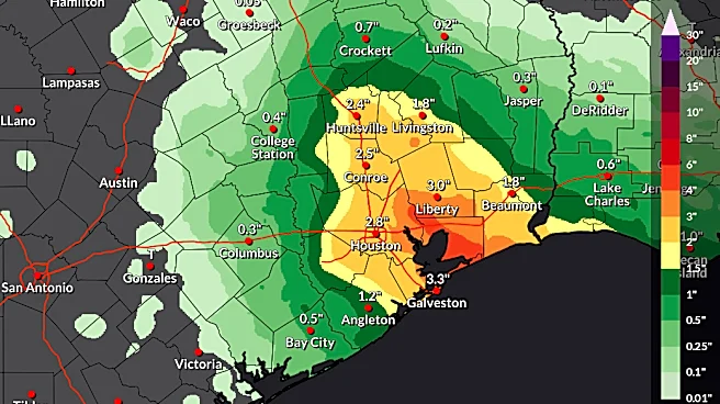
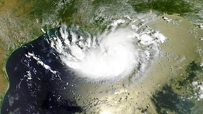

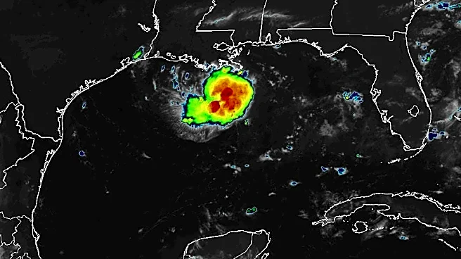
Even though Tropical Storm Edouard was small, it proved to be quite a rainmaker over some parts of south Texas. A day after making landfall, the storm was still dumping rain in parts of Texas.
On the morning of Sept. 2, a rain gauge at Little Pine Island Bayou, Texas, northwest of Beaumont, recorded 5.96 inches of rain in one hour, said Joe Rua, a meteorologist with the weather service in Lake Charles, Louisiana. In total, the gauge showed 13.51 inches of rain in the four hours between 3 and 7 a.m.
The highest gust reported in the region was 90 mph in Port Arthur, Texas.
Doyle Rice and Dinah Voyles Pulver are national correspondents for USA TODAY, with a focus on weather and climate.
This article originally appeared on USA TODAY: Could hurricanes impact Hawaii, California? Forecast updates