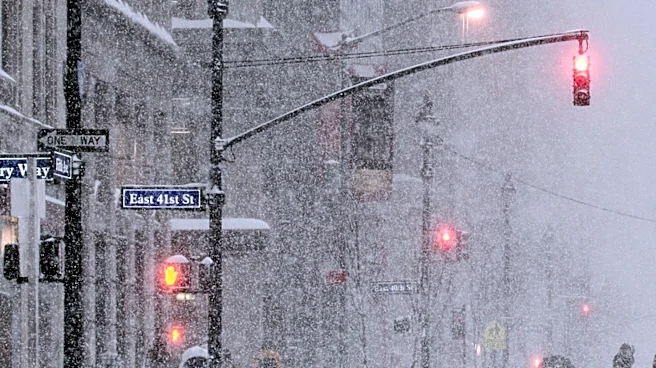






The first widespread cold snap of the season will remind the eastern half of the country that winter is coming – and some will even see their first snowflakes of the year.
"For nearly every state along and east of the Mississippi River, the upcoming pattern this weekend will bring the lowest temperatures of the season so far," said AccuWeather meteorologist Alex Sosnowski in an online forecast.
Snow will also make news at higher elevations of the eastern U.S. and in some of the Great Lakes snow belts, forecasters said.
But El Niño is starting to take over U.S. weather, and unusually mild temperatures will soon return to the forecast for many by next week. A forecast map from NOAA's Climate Prediction Center shows warmer-than-average temperatures are
expected later next week for most of the nation east of the Rockies.
How much snow will fall?
The snow accumulation over the next few days will depend heavily on elevation, temperatures and snowfall rates, according to AccuWeather.
"Many higher-elevation areas can expect a slushy coating to a couple of inches, mainly on grass and other unpaved surfaces, with greater amounts possible on the highest ridges," Sosnowski said.
"Higher-elevation communities such as Elkins, West Virginia; Mount Pocono, Pennsylvania; and Saranac Lake, New York, could receive a slushy coating to a few inches of wet snow," he added.

Snow accumulation by region
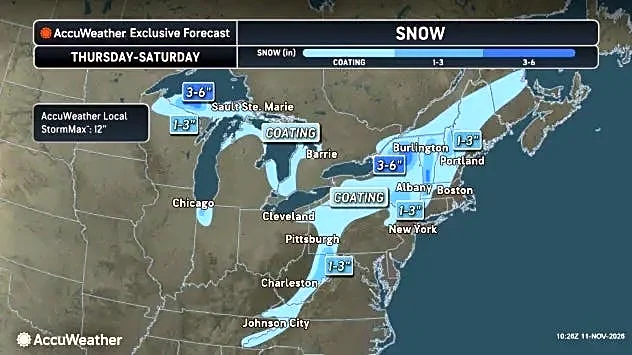
According to Weather.com, the best chance of accumulating wet snow will be in the hills and mountain locations of the interior Northeast and some Great Lakes snowbelt locations, including:
- The Green and White Mountains of Vermont and New Hampshire (1-3 inches, according to the National Weather Service.)
- The Berkshires of western Massachusetts (around 0.5 inch)
- The Adirondacks and Catskills of upstate New York (3 to as much as 6 inches in spots).
- The Appalachians from West Virginia to western North Carolina and eastern Tennessee (1-3 inches).
- Parts of western upper Michigan, especially away from the immediate lakeshore (4-8 inches).
Map shows snowfall accumulation
First frosts, freezes of the season

Chillier air will be pulled southward, deep into the Southeast, beginning Thursday, Nov. 12, Weather.com reported.
By this weekend, the first freeze of the season could happen as far south as much of the Carolinas, northern and central Georgia and northern and central Alabama, according to Weather.com meteorologists Rob Shackelford and Jonathan Erdman.
And according to AccuWeather's Sosnowski, "some damage to summer season flowers and vegetable plants is likely in some areas extending from northeastern Texas to northern Florida and the Interstate 95 corridor of the Carolinas. Temperatures in this zone will generally drop into the lower to mid-30s."
Snow forecast map
Warmer weather in forecast for mid-November

There should be a slow moderating trend towards early next week, NOAA's Weather Prediction Center said in an online forecast discussion.
Warmth from El Niño will help: AccuWeather meteorologist Chad Merrill told USA TODAY last week that the strong El Niño was expected to continue to flood much of the U.S. with warmer-than-average temperatures throughout November.
Doyle Rice is a national correspondent for USA TODAY, with a focus on weather and climate.
This article originally appeared on USA TODAY: A wintry forecast of snow and cold is about to take a turn