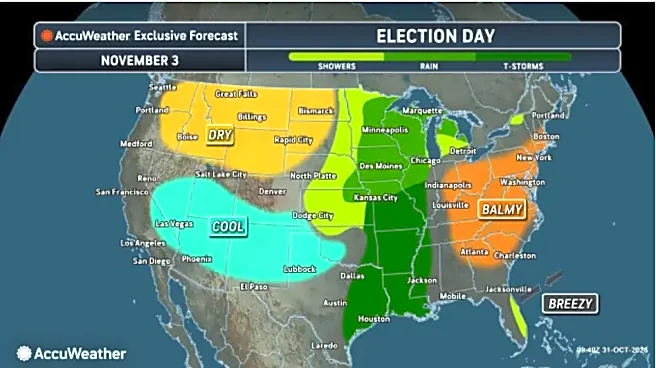





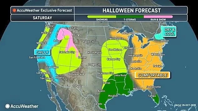


Millions of Americans heading to the polls for midterm elections on Tuesday, Nov. 3, could encounter rain, thunderstorms and gusty winds as a powerful storm system moves across the central United States.
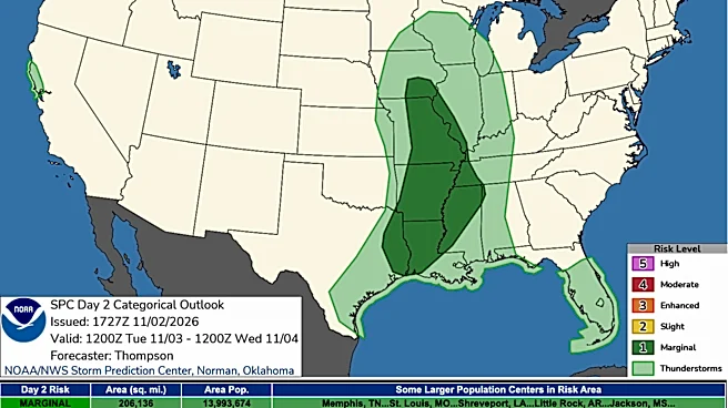
The greatest threat for severe weather is expected across the lower and middle Mississippi Valley, where thunderstorms could produce damaging wind gusts and a few tornadoes. The threat extends from parts of East Texas and the Ark-La-Miss region northward into the Mid-Mississippi Valley.
"Scattered storms will occur from the Sabine and Lower Mississippi Valleys northward into the Mid Mississippi Valley on Tuesday," the Storm Prediction Center wrote in its day 2 forecast. A few thunderstorms may produce damaging gusts and a couple of tornadoes.
Meanwhile, much of the Northeast and mid-Atlantic should see dry, mild conditions, while parts of Florida face another round of heavy rainfall Monday.
Here's what to expect across the country on Election Day.
Ark-La-Miss and Mississippi Valley: Severe storms, isolated tornadoes possible
The lower and middle Mississippi Valley could see some of the most disruptive weather Tuesday, Nov. 3, as a cold front moves eastward across the region.
The National Weather Service's Storm Prediction Center has outlined a marginal risk of severe thunderstorms across parts of East Texas and central Louisiana into southeastern Missouri and southwestern Illinois.
Scattered thunderstorms are expected from the Sabine and lower Mississippi valleys northward into the Mid-Mississippi Valley. Some storms could produce damaging wind gusts, and a brief tornado or two cannot be ruled out.
The greatest concern for rotating storms is across the Ark-La-Miss region, where atmospheric conditions could support embedded storms capable of producing tornadoes and isolated wind damage. The severe threat could continue into Tuesday night across parts of northern Mississippi and surrounding areas.
Widespread clouds and rainfall are expected to limit the overall instability available to fuel storms, but forecasters caution that isolated severe weather remains possible.
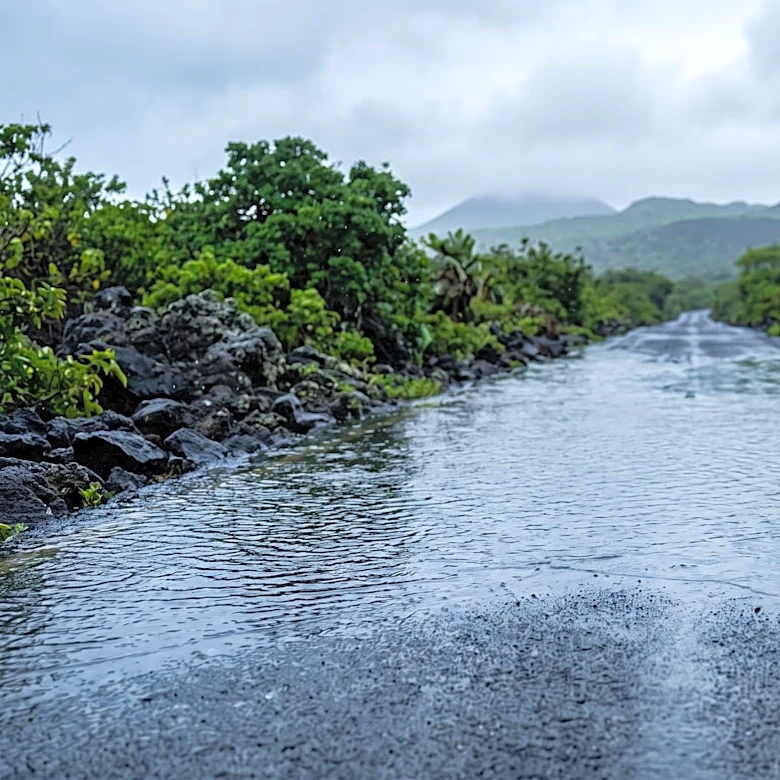
Heavy rainfall also could create localized flash flooding, particularly where thunderstorms repeatedly move over the same areas.

Plains and Midwest: Heavy rain, flash flooding possible
An intensifying storm system will bring widespread rain and thunderstorms across portions of the Plains and Midwest, with some communities facing a risk of flash flooding.
The Weather Prediction Center has expanded its Slight Risk of excessive rainfall to include northwestern Missouri and southern Iowa, where rainfall totals of 1.5 to 2 inches are forecast on average. Some locations could receive more than 2 inches, with isolated totals exceeding 3 inches.
A separate marginal risk of excessive rainfall extends across western Kansas into southern Nebraska, where thunderstorms could develop along the advancing cold front.
Farther north, portions of the Dakotas and Minnesota could see 1 to 2 inches of rain. However, forecasters do not currently expect widespread flash flooding in those areas.
Florida: Flash flooding underway after up to 15 inches of rain
Parts of Florida are already experiencing widespread flash flooding Monday after a narrow band of heavy rain dumped as much as 5 to 15 inches between Melbourne and just north of Fort Pierce.
The National Weather Service's Weather Prediction Center has issued a moderate risk of excessive rainfall for the area, warning that additional heavy rainfall could worsen flooding.
Another 2 to 4 inches of rain is possible along the east-central coast, with isolated amounts as high as 8 inches, according to the WPC. The heaviest rainfall is expected to continue through the first half of Monday afternoon before gradually weakening.
Areas northwest of Lake Okeechobee also have experienced significant rainfall, with radar estimates indicating 4 to 8 inches in some locations.
Although the heaviest rainfall is expected to taper off before Election Day, additional localized downpours could cause isolated flash flooding Tuesday, particularly in urban areas and communities already affected by flooding.

Northeast and mid-Atlantic: Dry, mild weather expected
Voters across much of the Northeast and mid-Atlantic should have more favorable weather conditions Tuesday.
A large area of high pressure moving off the East Coast will help maintain dry and mild conditions across much of the region.
Unlike portions of the central United States, widespread rain and thunderstorms are not expected to be a significant concern for the Northeast and mid-Atlantic on Election Day.
The relatively quiet weather pattern should provide favorable conditions for people traveling to polling locations.
West: An approaching storm system brings changes to the forecast
A deep upper-level trough over the western United States is helping drive the developing storm system across the Plains.
However, the main areas of concern for heavy rain and severe thunderstorms are expected farther east, across the Plains and Mississippi Valley.
Conditions will vary across the West, and voters should check their local National Weather Service forecasts for any region-specific rain, wind or temperature concerns.
Brandi D. Addison covers weather nationwide as the Weather Connect reporter for the USA TODAY Network and contributes to Texas Connect coverage statewide. She can be reached at baddison@usatodayco.com. Follow her on Facebook here.
This article originally appeared on USA TODAY: Election Day forecast for severe storms to threaten 13M across US