




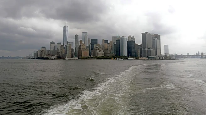
A stormy weekend predicted across the Northeast could impact millions of people and the National Weather Service is warning to brace for its impact in the coming days.
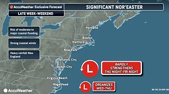
A late-September nor'easter, a strong, large-scale low-pressure storm system that forms along the East Coast, is expected to slam the region. A multi-day threat of strong winds, pounding surf and significant coastal flooding is forecast through Sept. 27, according to the weather service and Accuweather.
Nor'easters are named for the strong northeasterly winds that blow in from the Atlantic Ocean and blow across coastal states.
Major cities expected to bear the brunt of the worst of the storm include New York, Boston andWashington, DC.
Forecasters are calling for heavy rain and high
water in those cities, with the massive storm potentially hitting as far south as North and South Carolina.
Accuweather reported the most significant impacts will take place Sept. 25-27 across the Northeast.
"Given that the developing nor'easter will be slowly moving over the very warm water of the Gulf Stream for two or three days, the storm may take on some characteristics that would resemble a tropical storm," AccuWeather chief meteorologist Jonathan Porter said Sept. 23. "Such hybrid storms are called subtropical storms. If that occurs, the storm could be assigned a name by the National Hurricane Center."

On Sept. 23, the North Carolina Department of Public Safety issued an hazardous weather update with damaging wind gusts and flash flooding possible for the western part of the state.
"The greatest risk of localized flash flooding through Wednesday evening will extend from the North Carolina mountains to West Virginia, but isolated urban flooding is possible anywhere in the rain zone," Accuweather said.
❗️Hazardous Weather Update for 9/23/26 ❗️
— NC Emergency Management (@NCEmergency) September 23, 2026
Isolated severe storms capable of damaging wind gusts and instances of flash flooding are forecast Wednesday for western NC. A level 2 of 4 threat for excessive rainfall is in place across the mountains. If you are in a flood-prone area,… pic.twitter.com/z3FlnZRekf
Strengthening and persistent northeast winds along the coast from northeastern North Carolina and southeastern Virginia northward are expected to intensify offshore beginning Sept. 23, according to forecasters.
Major flooding during high-tide cycles was also expected in southeastern Virginia and northeastern North Carolina, starting that same day, and was expected through Sept. 25, Accuweather reported.
In Boston, the National Weather Service said winds as strong as 40 mph and waves as high as 20 feet could slam the coast.

Up to 4 inches of rain was forecast to fall over the southeastern half of New England from the storm from Sept. 25-27.
A zone in southeastern Massachusetts and part of Rhode Island is expected to pick up 4-8 inches of rain.
"People who live along the coast or who have property or vacation plans should treat this situation as a major nor'easter or strong tropical storm," Accuweather reported.
Is a tropical storm headed south of New England?
Earlier this week, the weather service called for rain and thunderstorms across the Central and Eastern U.S. as a storm system traveled toward the Mid-Atlantic and Northeast.
Forecasters predicted there was a chance the system could morph into a tropical storm by the weekend.
Natalie Neysa Alund covers breaking and trending news for USA TODAY. Reach her at nalund@usatoday.com and follow her on Twitter @nataliealund.
This article originally appeared on USA TODAY: Powerful nor'easter to slam Northeast, waves up to 20 feet expected