


A search and rescue team with Miami-Dade Fire Rescue will assist in Hurricane Isaias response efforts, according to the agency.
The 88 members of the Urban Search and Rescue Florida Task Force One are expected to set up in Tallahassee to "assist residents and other local and state agencies with storm relief efforts," according to an Oct. 7 press release by Miami-Dade Fire Rescue.
The task force is intended to respond to "natural and man-made disasters" by providing support in search and rescue, medical efforts, communications, damage assessment and supply coordination.
It is equipped with flood and high water rescue capability, according to the release, and will be "canvassing the impacted areas to conduct search and rescue missions, disaster recovery
and damage assessments following the storm."
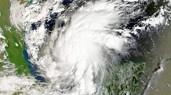
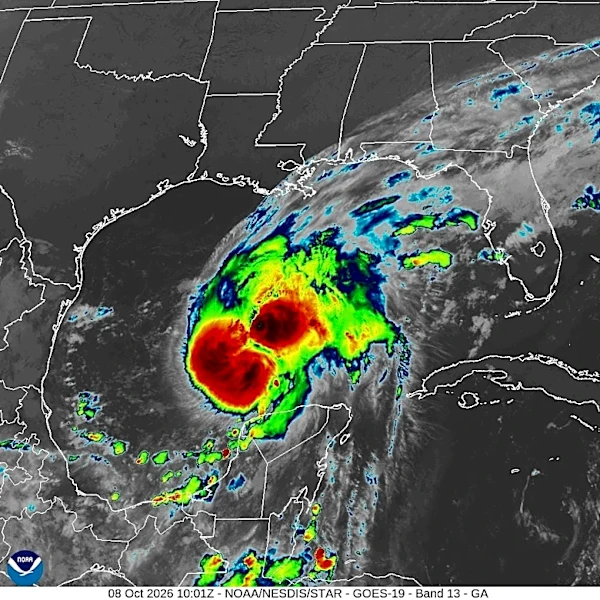
Isaias strengthened into hurricane
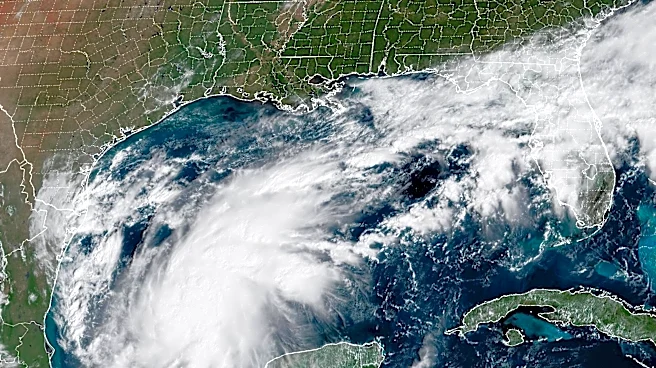
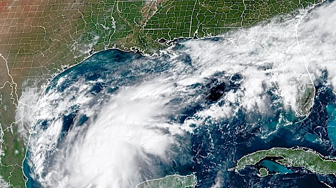
As expected, Isaias strengthened and became a hurricane shortly before midnight on Oct. 7.
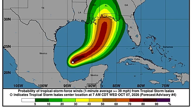
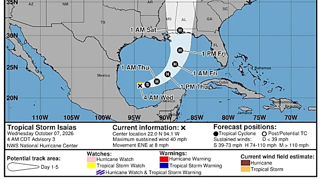
The National Hurricane Center warned Isaias is expected to be a "strong hurricane" when it "approaches the northern Gulf Coast on Friday."
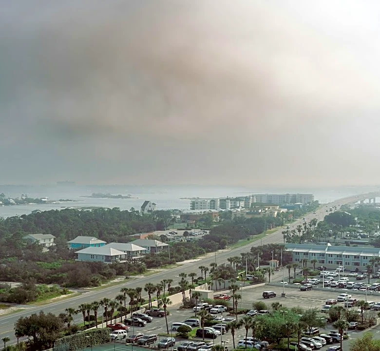
Life-threatening storm surge is expected along a portion of the northern Gulf Coast, along with damaging hurricane-force winds and heavy rain. Residents in southern Alabama, southern Mississippi and Florida's Panhandle were advised to prepare for the possibility of long-term power outages.
Gov. Ron DeSantis on Oct. 6 declared a state of emergency in 25 North Florida counties, from Escambia to Baker, as Isaias is forecast to strengthen and threaten parts of the Gulf Coast later this week and into the weekend.
Where is Hurricane Isaias and where is it going?
Special note on the NHC cone: The forecast track shows the most likely path of the center of the storm. It does not illustrate the full width of the storm or its impacts, and the center of the storm could travel outside the cone. In 2026, the Hurricane Center is experimenting with a new cone to include 90% of forecast track possibilities instead of the previous 67% forecast error.
Spaghetti models for Hurricane Isaias
Special note about spaghetti models: Spaghetti model illustrations include an array of forecast tools and models, and not all are created equal. The Hurricane Center uses only the top four or five highest performing models to help make its forecasts.
➤ Track Hurricane Isaias
What impacts could Hurricane Isaias have on Florida?
Isaias is strengthening, and most models put Isaias as a Category 2 hurricane at landfall, with winds between 96 and 110 mph when it makes landfall Friday night or early Saturday.
Some are saying Isaias could be a major hurricane, which is a Category 3 or stronger, with maximum sustained winds of at least 111 mph.
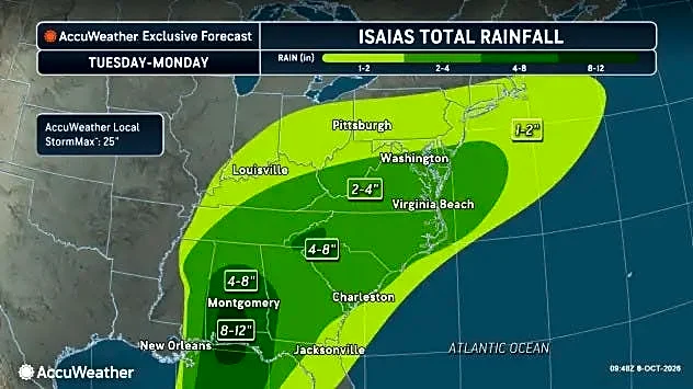
"Slamming headlong into a shear wall just prior to landfall should bring down Isaias’ peak winds, but it will also result in a large, highly asymmetric storm with significant rainfall, wind, surge and tornado impacts extending hundreds of miles east from the landfall point, plus well inland over the weekend," said Ryan Truchelut, chief meteorologist at WeatherTiger, who works with the USA TODAY Network.
Florida weather radar

Sarah Perkel is a South Florida Connect Reporter for the USA TODAY Network's Florida Connect team. You can get all of Florida’s best content directly in your inbox each weekday day by signing up for the free newsletter, Florida TODAY.
This article originally appeared on USA TODAY: South Florida team to assist with Hurricane Isaias response efforts