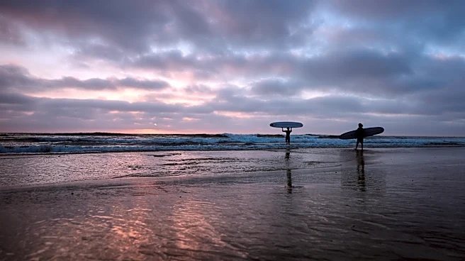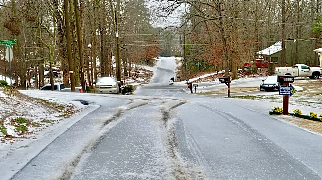



The infamous and often misunderstood polar vortex got off to a powerful start in 2026, but don't rush out to buy a parka.
First of all, a strong polar vortex signals a milder winter (hence it being often misunderstood).
Secondly, the vortex has already evolved since its start in late summer.
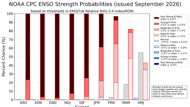
And finally, forecasters aren't yet ready to issue a winter outlook, but they're closely watching for clues about what's in store for a season that will likely be shaped by a historic El Niño.
One of the biggest questions: Which Americans will experience a generally mild winter and who will suffer periods of intense cold?
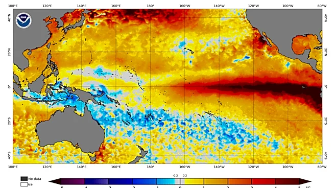
A powerful El Niño makes the mild winter scenario more likely for most Americans.
"We have a super El Niño this winter and that has blotted
out the sun for the forecast community," said Judah Cohen, a climatologist at the Massachusetts Institute of Technology.
A strong polar vortex would also make mild weather more likely. When it's strong, the intense cold of the polar regions stays bottled up in the Arctic.
But if disrupted by chaotic climate forces, a disturbed polar vortex could still help send freezing air into the nation.
"If El Niño is a full-length movie, then the polar vortex might be a scene within the movie, and the characters are the day-to-day weather systems," said Simon Lee, an atmospheric scientist at St. Andrews University in Scotland.
Milder winter? Forecasters watch 2 key forces
El Niño will loom large in this year's winter weather outlook, said several scientists contacted by USA TODAY.
It's already among the strongest on record and still strengthening, said Jon Gottschalck of NOAA's Climate Prediction Center. The temperature and precipitation outlooks for the winter are consistent with the impacts "often observed for strong eastern Pacific El Niño events."
MIT's Cohen said "every forecast I have seen, pretty much 100% follows the El Niño script with a nod to the warming trends we have observed over the observational record. If anyone else is considering anything else, I haven’t seen it."
Meanwhile, the polar vortex got out of the gates "record strong" this year, Cohen said.
The polar vortex formed around the end of August, as expected, as the amount of sunlight reaching the North Pole started to decrease, said Amy Butler, an atmospheric scientist at NOAA.
However, the quick-to-change polar vortex has since morphed back to a bit weaker state, Cohen added: "The polar vortex is no longer record strong and it is actually a bit weaker than normal as it is undergoing a polar vortex stretch."
He said the stretch will take place all this week before snapping back to a more normal configuration or state. "It looks like that over the next two weeks the PV will be near normal or slightly weaker than normal," Cohen said.
If the vortex weakens during the heart of winter, it can allow bitterly cold air to slosh down into the central and eastern United States.
The wintertime phenomenon is a key feature forecasters look at to understand how the weather can vary from week to week, Lee said. It’s a bit different from something like El Niño, which tells us more about how the average weather will likely evolve for the winter as a whole.
It's too early in the season for the vortex to have had much impact, Lee said. "Forecasters will start looking toward the vortex from around November onwards."

How El Niño and the polar vortex may interact
One of the wild cards in the winter forecast is how El Niño will affect the polar vortex.
The relationship between the vortex and the El Niño Southern Oscillation – the pattern that includes both El Niño, La Niña and a neutral phase – is not yet well understood and doesn’t appear to be particularly strong, Cohen said.
During the three previous strongest El Niños, there weren’t polar vortex disruptions, Butler said. A strong El Niño this winter could raise questions about its influence on the stratosphere, where the polar vortex lives.
The scientists will be watching development of repeated high- and low-pressure systems, to see if strong low pressure systems amplify waves into the stratosphere that could disrupt the polar vortex. A disruption of the polar vortex is a weakening, stretching or displacement of the stratospheric circulation that can allow frigid Arctic air to spill southward and raise the risk of cold outbreaks and winter storms.
Because the typical El Niño brings warmer-than-normal conditions to much of North America, Lee said it could help to weaken the polar vortex and raise the odds of colder conditions later in the season.
Even if the relationship between the two atmospheric influencers starts one way, it can flip in early winter, compared to late winter, Butler said, from a stronger polar vortex in early winter to a weaker one later.
When could we begin to see El Niño’s influence in our winter weather?
El Niño already is influencing weather and climate, especially in the tropics where there have been 18 named tropical cyclones in the eastern Pacific, said Gottschalck.
Now forecasters will be watching for changes at higher latitudes, which typically begin in late autumn and peak in mid-winter, he said.
El Niño episodes tend to lead to deeper than normal low-pressure systems in the North Pacific, driving a stronger jet stream that brings stormier and wetter conditions to the West Coast, said Lee.
If storms start lining up one after another to slam California later this fall and especially into late December, then the impacts of El Niño would be on track, Cohen said. If that doesn’t happen, he said, “there could be some big surprises in store.”
Unfortunately, according to Butler, while we can get a sense even now of how El Niño may affect the polar vortex, we can't predict a polar vortex disruption earlier than 10-14 days ahead of time.
That window "limits our ability to incorporate stratospheric information into the winter outlook to some extent, because the timing of the colder weather risk is linked to when the polar vortex disruption actually occurs," Butler said.
Cohen said that "For me, October is a critical month but I don’t want to get too far over my skiis and don’t want to speculate too much."
Is climate change a factor?
One thing to remember is that all the seasonal factors, such as El Niño and the polar vortex, are occurring against the backdrop of a world that's warming over decades due to human-caused climate change.
"It’s important to recognize that climate change means cold episodes in winter are much warmer than they would otherwise have been," said Lee. "Our rapidly warming climate also means that what may seem cold now would often have been relatively normal just a few decades ago."
Dinah Voyles Pulver and Doyle Rice are national correspondents for USA TODAY, focused on climate and weather. Reach them at dpulver@usatoday.com and drice@usatoday.com.
This article originally appeared on USA TODAY: Ready for winter? Polar vortex spins up, spews forecast uncertainty