


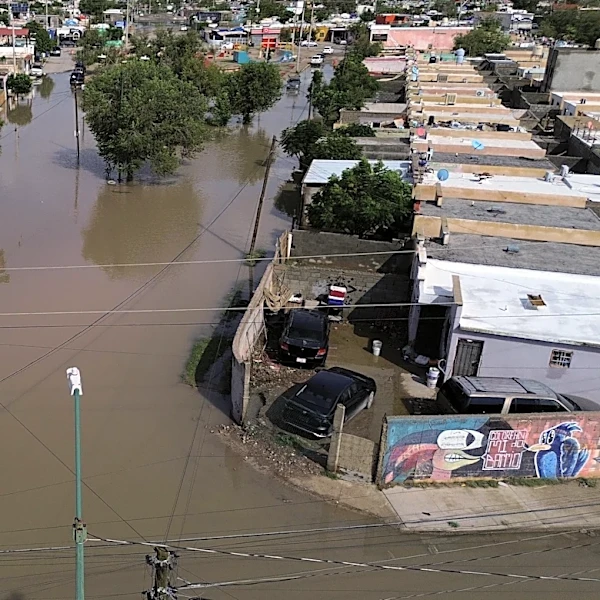



Tens of millions of people across the central United States were under flood advisories on Sept. 30 as the remnants of Hurricane Polo and other weather systems moved over the region, bringing heavy rain and the threat of dangerous flash floods, forecasters say.
"Pacific tropical moisture wrapping into a storm will continue a multi-day heavy rainfall event this week that will impact the Southwest into the Plains," the National Weather Service said in an online forecast.
In addition to the flooding, scattered severe thunderstorms capable of mainly severe wind gusts appear possible across portions of the southern Plains this afternoon (Sept. 30) into tonight, the weather service said. There is also a risk of isolated severe winds gusts and tornadoes
in Kansas into Nebraska.
A 'three-pronged' flood threat
From Arizona and Texas to Iowa and Nebraska, the sprawling "hybrid" storm is expected to dump upwards of 2 to 4 inches of rain across multiple states, posing a major threat to already rain-soaked areas across the Southwest.
The storm is a combination of remnants of Polo, moisture from Hurricane Odalys and another storm system moving in from the west, according to AccuWeather. The three-pronged flood threat has already begun to wreak havoc in some states.
"Rainfall rates within the most intense bouts of rainfall [this week] can reach 2-3 inches per hour, which can create a life-threatening situation," explained AccuWeather meteorologist Brandon Buckingham.

New Mexico, Texas see flooding
On Sept. 29, officials in Texas reported road closures due to flooding on major thoroughfares, including I-40, which runs across the state's Panhandle.
In southwestern New Mexico, authorities ordered evacuations after floodwaters breached the 20-foot McLeod Dam. A "flash flood emergency" was issued by the weather service on Sept. 29 because of the potential failure of the McLeod Dam on the McLeod Arroyo in northwest Doña Ana County.
Crews also rescued motorists stranded in floodwaters in Nevada.
Texas Gov. Greg Abbott ordered state emergency responders to support areas impacted by severe weather and flooding. The governor's office said more than 1,900 state responders and over 1,500 pieces of equipment were being made available.

Trillions of gallons of water
According to WeatherCity, about 53.8 trillion gallons of rainwater is forecast to fall on the Lower 48 over the next seven days – which is enough to fill 81,502,459 Olympic-sized swimming pools.
In fact, the amount of moisture being lofted over southern Arizona, New Mexico and far west Texas is near or slightly surpassing that in the historical records, Weather.com reported. And it won't stop as the remnants of Polo fizzle out.
Numerous flash floods possible
The Weather Prediction Center issued a "Moderate Risk (level 3/4)" of excessive rain over the High Plains and Mississippi Valley on Sept. 30.
"Numerous flash flooding events are possible," the National Weather Service said in a severe weather outlook. "In addition, many streams may flood, potentially affecting larger rivers. The flooding may include debris flows in or near recently burned areas."
Massive storm to move east
The massive storm system is expected to move eastward over the next several days, bringing heavy bouts of rainfall to Texas and Illinois before it barrels through the Gulf states, including Mississippi and Alabama. According to AccuWeather, wind gusts from the potent storms could reach 50 to 60 mph from southwestern Texas to northern Kansas.
While the most intense rain is expected in the South, states such as New York and Vermont could see impacts near the start of the weekend.
This article originally appeared on USA TODAY: Sprawling 'hybrid' storm begins; multi-day deluge in forecast