

Hawaii often enjoys powerful protection during hurricane season, but 2026 appears different.
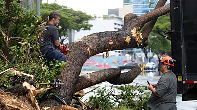
In August, two storms – Lala and Moke – affected the Hawaiian Islands. Lala came closest, missing a direct landfall by 50 miles or so on Aug. 15. Although not a direct hit, Lala dumped nearly 3 feet of rain on the Big Island, bringing widespread havoc.
Now, in September, a new pair of tropical systems is coming near the Hawaiian Islands: Karina and Lowell, likely both as hurricanes. While both may pass within a safe distance from Hawaii, their closeness to the islands is unnerving.
Those four storms are already quadruple the number of storms that usually come close to Hawaii each year: National Weather Service lead hurricane forecaster Matthew Rosencrans
told CNN that the typical annual average for storms that come close to Hawaii is just one per season.
Cooler sea water around the islands usually serves as a shield to protect them from the onslaught of tropical storms and hurricanes, which typically need warm water of at least 80 degrees to form and strengthen.
When sea surface temperatures are below that, "hurricanes struggle to support strong thunderstorm activity," Colorado State University hurricane researcher Phil Klotzbach told USA TODAY via email.
"This is why it is so hard for Hawaii to have landfalling hurricanes," said AccuWeather hurricane expert Alex DaSilva in an email to USA TODAY.
Why is Hawaii in the crosshairs, all of a sudden?
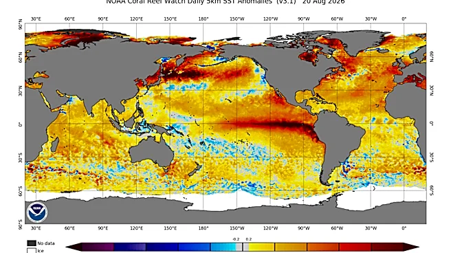
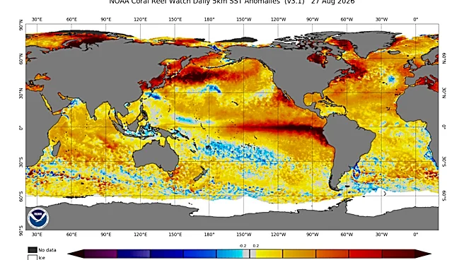
Blame El Niño, everyone's favorite climate troublemaker.
"The central North Pacific tends to be quite a bit busier in El Niño years," Klotzbach said.

Klotzbach said that in an average year, water temperatures are usually pretty marginal for storm development: 78 degrees just east of Hawaii, for example. But now, thanks to El Niño, sea surface temperatures in that area are in the 80-82 degree range, which is "plenty warm to support hurricanes," he said.
In addition, in a normal year, "the cooler water causes tropical systems to lose their wind intensity as they approach. This year, however, the waters even east of Hawaii are warm enough to support tropical development and intensification," DaSilva added.
Usually, hurricanes that hit Hawaii have to move up from the south since they will be over warmer water, he said. In fact, the Big Island has never had a hurricane make landfall on it since records have been kept. A lot of times approaching storms lose wind intensity and either go north or south of Hawaii.
Wind shear also a factor
Lower-than-normal vertical wind shear is also a factor that can be linked to El Niño. The shear near Hawaii has been well below normal over the past month, Klotzbach said.
Typically, he said, vertical wind shear near Hawaii is quite strong due to extensive upper-level low activity.
Strong vertical wind shear acts to shred developing storms before they can become hurricanes, which is what has been happening recently in the Atlantic basin.
El Niños typically yield lesser periods of wind shear (or hostile winds) in the central and eastern Pacific, DaSilva said. Lower wind shear can allow tropical storms and hurricanes to have a better chance of reaching Hawaii.
Hawaii hurricane-free since 1992
Hurricane Lala came close to making landfall on the Big Island, but the center remained just offshore of the island’s southern tip, keeping alive Hawaii’s streak of zero hurricane landfalls since Kauai was struck from the southwest by the devastating Category 4 Hurricane Iniki in 1992, CNN said.
What's the forecast for the rest of the season?
Klotzbach said that given the continued low shear forecast across most of the eastern and central tropical Pacific, it looks like the busy period will continue for a while.
"It looks like Hawaii will have to keep their guard up for the rest of hurricane season," DaSilva said.
Doyle Rice is a national correspondent for USA TODAY, with a focus on weather and climate.
This article originally appeared on USA TODAY: Hurricanes, tropical storms are doing something odd in 2026