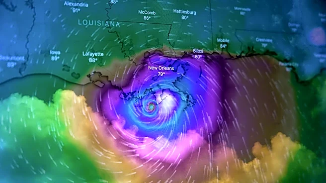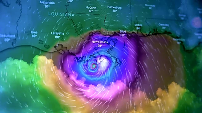

Hurricane Lowell continued its trek near the Hawaiian Islands early Saturday morning, Sept. 5. The storm, a Category 4 with 155 mph winds, is forecast to approach the western Hawaiian island of Kauai on Monday,
Labor Day. Fortunately, the center of the hurricane is expected to miss Kauai.
The storm, now moving west at just 7 mph, is forecast to slow and turn sharply northward or north-northeastward by Sunday, Sept. 6 and accelerate, the National Hurricane Center said.
Lowell is expected to be "near major hurricane strength when makes its closest approach to the Hawaiian Islands," the hurricane center said. A major hurricane has winds of at least 111 mph; Category 3, 4 and 5 storms are classified as major hurricanes.
"Any deviation eastward from its forecast track could bring more severe wind impacts, especially to Kauai County," the National Weather Service in Honolulu said. The weather service expects to discuss the need for potential watches and warnings later in the day on Sept. 5.
Where is Hurricane Lowell now?
As of 5 a.m. ET on Saturday, the center of Lowell was located about 610 miles south-southwest of Honolulu and 620 miles south-southwest of Lihue on Kauai. The storm had maximum sustained winds of 155 mph, making it a Category 4 storm.
The hurricane briefly restrengthened to a Category 5 storm on Friday, Sept. 4, with maximum sustained winds of 160 mph. Fluctuations in intensity are possible through Sunday, Sept. 6.
Lowell's hurricane-force winds extend outward up to 60 miles from the center, and tropical storm-force winds extend outward up to 160 miles.

Hawaii rainfall forecast for Lowell
The hurricane center said Lowell is expected to produce rainfall totals of 3 to 6 inches, with maximum totals exceeding 10 inches possible, for Kauai and the Big Island. For Maui, 2 to 4 inches of rain is expected, with isolated maximum totals of 8 inches possible.
Across the remaining islands, rainfall of 1 to 2 inches with maximum amounts of 4 inches is possible.
This rainfall may produce flash flooding and mudslides, especially in areas of steep terrain.
Rough surf also expected
Swells from two storms are expected to affect the Hawaiian Islands over Saturday and Sunday and early in the week.
Swells from Lowell are expected to cause life-threatening surf and rip current conditions in portions of the Hawaiian Islands during the next several days. These swells are likely to increase early next week.
An east swell from the gale from the remnants of former Hurricane Karina is expected through Sunday, with higher seas, winds and chances of rain on Monday night and Tuesday as that gale moves through the area, said the National Weather Service office in Honolulu.
Track Lowell
Beware the right-front quadrant
The current projected path of Lowell shows it zooming to the north, likely impacting Kauai on Monday. This will bring the storm's right front quadrant towards Kauai.
Why is this important? "The winds, storm surge and even tornadic activity tend to be more extreme or prevalent in the right-front quadrant," said University of Georgia meteorologist Marshall Shepherd recently in Forbes magazine.
This is because the storm's forward motion adds to its rotating winds, producing the highest wind speeds and often the worst surge and tornado threat, according to Weather.com meteorologist Chris Dolce.
Two storms to impact Hawaii
Hurricane Karina is forecast to disintegrate into a gale, low-pressure system but its influence will be felt in the islands as well, with an area of moisture moving through on Sept. 9. the weather service said.
Hurricane safety tips
This weekend would be a good time for Hawaii residents to review hurricane safety plans.
The weather service notes that storm surge and inland flooding remain the deadliest hurricane hazards and urged people to know their evacuation zone, follow evacuation orders and never drive on flooded roads. Several storm-related fatalities in 2026 have been linked to motorists attempting to cross flooded roadways.
The National Oceanic and Atmospheric Administration also recommends assembling an emergency kit that includes at least three days of water (1 gallon per person per day), nonperishable food, medications, flashlights, batteries, cash and a battery-powered or hand-cranked weather radio.
NOAA further advises having multiple ways to receive emergency warnings rather than relying solely on a cellphone. Options include weather radios, emergency alert systems, television and radio broadcasts, and trusted weather apps.
This article originally appeared on USA TODAY: Hurricane Lowell forecast to pass near Kauai on Labor Day