



ORLANDO, FL — If you're confused about where the potentially record strong El Niño stands at the moment, you're not alone.
While you've been hearing about the climate pattern along the equator since spring, its full impacts on the nation's weather are arriving on a more gradual basis. It's not like a bright light suddenly flips on announcing its arrival.
Significant El Niño impacts have been seen in both the Pacific and Atlantic oceans, but the mainland United States hasn't yet experienced the direct weather impacts. Those are expected to arrive in the weeks ahead, meteorologists told USA TODAY.
California has seen El Niño impacts at the coast, including higher sea levels associated with Kelvin waves, a rare tropical storm warning, warm waters
and a parade of unusual tropical sea life offshore. But the rest of the country is still waiting to see what a strong or very strong El Niño could mean in terms of wet and severe weather.
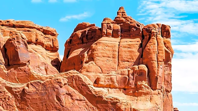
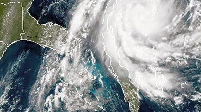
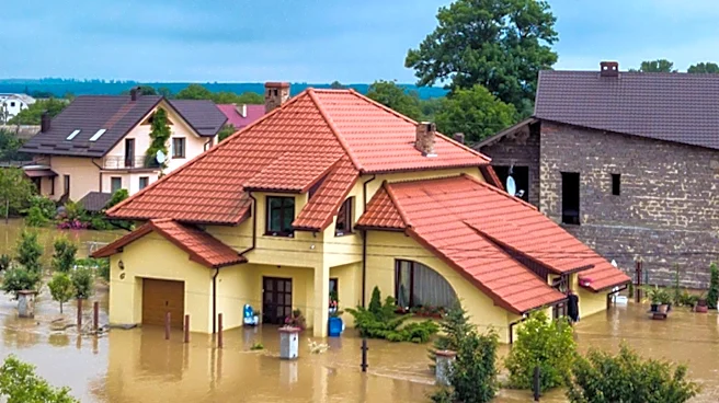
Neither the catastrophic flooding in the Four Corners region or the two feet of rain that fell in Florida over the first two days of November are direct impacts from El Niño, said Lindsay Long, a National Weather Service meteorologist who serves on the agency's seasonal outlook teams.
"We can't really attribute any of the current weather patterns to the strengthening El Niño yet," Long told USA TODAY on Nov. 2. "We haven't quite seen the connection yet."
That's expected to begin changing soon. Meteorologists say some of the typical effects of El Niño could appear over parts of the mainland U.S. within the next week or so.
What can we expect to see from El Niño, and when?
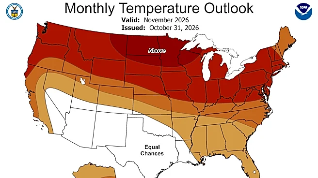
In the latest climate outlook for November, issued Oct. 31, the Climate Prediction Center decreased probabilities for the El Niño-driven response in the atmosphere in early November in the Southeast. Now the center expects to see a more classic El Niño response by the end of November.
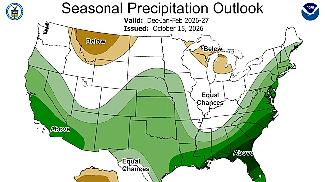
That typically means increased odds for rainfall in California, the South and especially Florida. Over California, a strong El Niño could produce a conveyor belt of intense atmospheric rivers over the winter. In Florida, El Niño tends to bring more frequent storms and violent tornadoes.
Those effects typically begin to occur as the subtropical jet stream over the U.S. starts to extend further south and east, with strong air flowing in from the west, Long said.
In California and along the Pacific Coast, that flip to wetter, more El Niño-like influences could begin over the next week or so, with increased chances for atmospheric rivers, Long said.
The biggest impacts of El Niño may not arrive in California until later in December or January, lagging until after the El Niño is forecast to peak in intensity in December or January, said Daniel Swain, a climate scientist with the University of California Agriculture and Natural Resources.

To prepare for what's likely to be a very wet and stormy winter across the southern tier of the U.S., weather service field offices have been meeting with local emergency management officials.
"This winter is going to look a lot different from last winter," Will Ulrich, the warning coordination meteorologist for the weather service in Melbourne, Florida, told a crowded room of emergency managers in Orlando in late October.
"Since 1950, roughly 70% of El Niño winters have been associated with wetter than normal conditions in Central Florida." The correlation is even higher when you single out just strong El Niño events, he said. Those past El Niño events have produced some of the state's worst tornado outbreaks and flooding.
A similar briefing to Southern California emergency managers emphasized that El Niño is not a storm itself, and does not indicate the timing, track or intensity of weather systems. "It sets the stage," said Todd Hall, the warning coordination meteorologist for the weather service in Los Angeles.
In regions facing higher-than-normal chances of a wet winter, "preparation is essential," the weather service said.
Climate scientists and meteorologists are warning that there's no guarantees this El Niño will look like El Niños of the past, even though it's forecast to be a strong event.

El Niño and weather events to be studied later
It is possible that additional analysis later could find some indications of the El Niño in the most recent weather, Long said. After the fact, scientists will be looking at how much the rain in the Four Corners area might have been amplified by warm temperatures by climate change or warmer sea surface temperatures.
Both of the flooding events – in the Four Corners and Florida – are very likely to be more extreme because of warmer ocean temperatures generally, and not specifically linked to El Niño, said Nathan Lenssen, a scientist at the National Center for Atmospheric Research and an assistant professor at Colorado School of Mines.
In Florida, for example, the oceans on either side of the state are much warmer than normal, Lenssen said. "These warmer temperatures are making these events more extreme."
"For all of the storms that we experience in North America, all El Niño can do is stack the deck. It may make a type of event more likely, or more likely to happen in a different place at a slightly higher rate," Lenssen said. "It's not causing any single individual event directly."
Many areas of the world's oceans – under the influence of El Niño and climate change – are warmer than they've ever been at this time of year, Swain told listeners during his Nov. 6 "Weather West" podcast. "It's incredible, and not in a good way."
El Niño's ocean impacts arrived months ago, with unusual sea life
El Niño is part of a three-phase natural climate cycle that also includes La Niña and a neutral phase. The first signals of this El Niño phase started earlier this year as a pool of warm water moved eastward in the Pacific along the equator.
Sea surface temperatures rose dramatically in the eastern and central Pacific and have been setting daily records for months. That influence over the oceans and tropics brought a wild flurry of tropical activity to the Hawaiian Islands and the eastern Pacific over the summer.
El Niño's connection with the atmosphere over the Pacific also delivered strong shearing winds to the Atlantic Ocean, which helped limit activity during the 2026 Atlantic hurricane season.
The changes in sea surface temperatures in the Pacific tend to send some of the tropical marine life northward along the Pacific coast in search of food. So far this year, sightings include red-footed boobies, a sea bird usually found much farther south, warm water sharks such as hammerheads and whale sharks, and even venomous yellow sea snakes.
"We're seeing reports of some remarkable changes in marine life along the Pacific coast, including species appearing in places where they're not typically found," said Jeni Smith, curator and rescue supervisor at SeaWorld San Diego.

"Seabirds can be an early warning sign of what's happening beneath the surface," Smith said. "Our rescue team has been responding to a significant increase in seabirds and shorebirds, many of which are arriving severely underweight and struggling to find food."
In all of 2025, the team rescued 408 birds, and already this year it has seen 488 rescues, she said. "We're also seeing particularly concerning numbers of common murres arriving emaciated, which tells us these animals are having a difficult time finding the food they need to survive."

Dinah Voyles Pulver covers climate change, weather and environmental issues for USA TODAY, topics she's been covering for more than 30 years. Reach her at dpulver@usatoday.com.
This article originally appeared on USA TODAY: El Niño is coming for your 5-day weather forecast