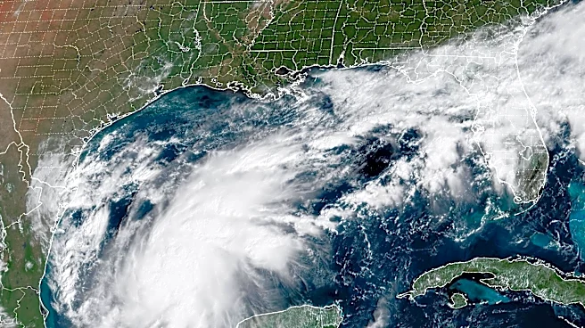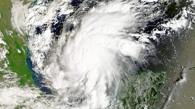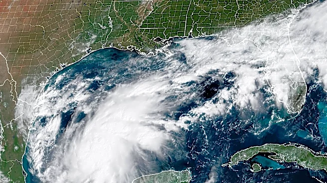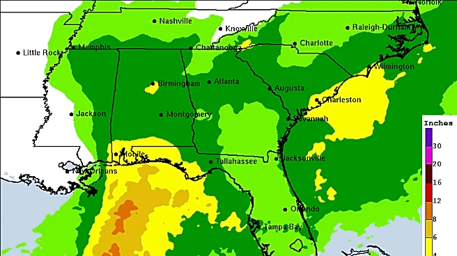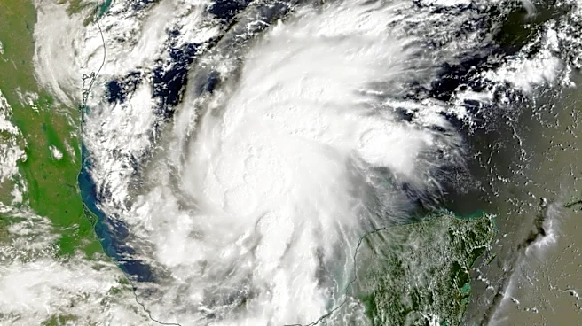

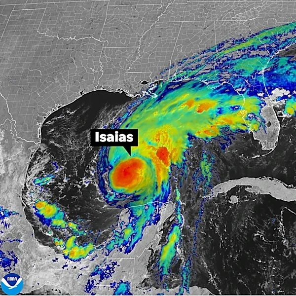
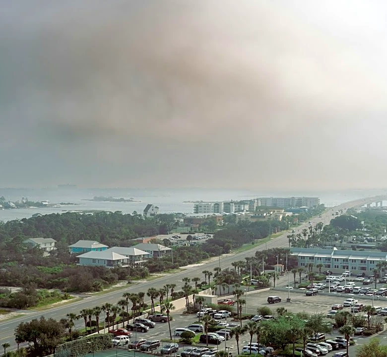



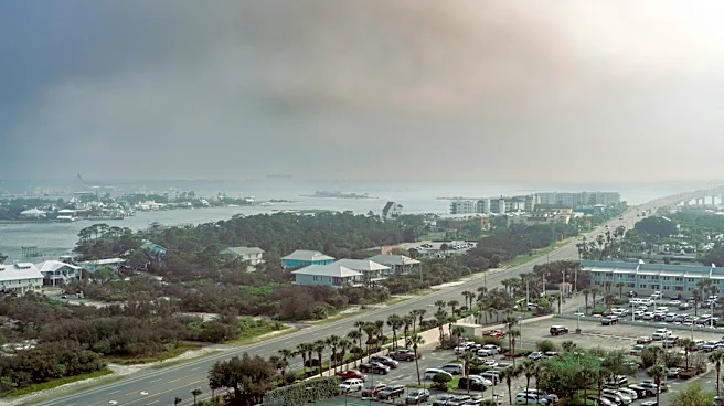
Imagery provided by NASA shows Isaias as the first hurricane of 2026 barrels toward the United States ahead of an imminent landfall.
From hundreds of miles above Earth, the powerful storm can be seen churning and swirling in the Atlantic Ocean as it makes its fateful approach toward the Gulf Coast for what is poised to be a catastrophic landfall.
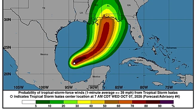
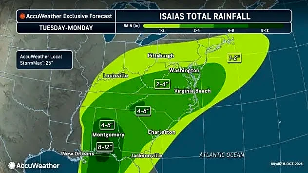
The ninth named storm of the season, Isaias is expected to bring damaging winds and flooding rain as it reaches anywhere from Mississippi to Florida.
Here's a quick look at what the hurricane looks like from space.
NASA images show Hurricane Isaias from space

Worldview, NASA's free online interactive tool to browse and download full-resolution satellite images of Earth in real-time, shows Hurricane Isaias off the Atlantic coast.
The interface includes
1,000 satellite layers from NASA and the National Ocean and Atmospheric Administration (NOAA) to monitor Earth's land and ocean. In this case, a NASA spokesperson told the USA TODAY Network that resources from two different instruments were used to capture the above image.
Those instruments were the MODIS (Moderate Resolution Imaging Spectroradiometer,) which flies on NASA's Terra and Aqua satellites launched in 1999 and 2002, respectively; as well as VIIRS (Visible Infrared Imaging Radiometer Suite) that flies on joint NASA and NOAA satellites.
Astronauts often photograph storms, hurricanes from ISS
Orbiting at about 250 miles high, the International Space Station provides something of a birds-eye view of Earth to the astronauts on board. That means that anything from harmless auroras to dangerous storms developing, the station's crew has a unique vantage from which to witness and document the phenomena.
Astronauts on the ISS have captured images and video of hurricanes before, including Hurricane Milton, which in 2024 was the last to strike the United States. But none of those currently at the station have shared views of Hurricane Isaias on social media as of Thursday, Oct. 8.
Isaias strengthens to hurricane as it prepares for landfall
Isaias, which strengthened to a hurricane late Wednesday, Oct. 7, is expected to bring life-threatening as it barrels its way toward the U.S. Gulf Coast.
Located about 385 miles south-southwest of the mouth of the Mississippi River as of 8 a.m. ET, the Category 1 hurricane is only expected to strengthen before it reaches the coast Friday, Oct. 9. The National Hurricane Center expects it to make landfall that evening with more than 100 mph winds somewhere between Pascagoula, Mississippi, and Panama City Beach, Florida.
After bringing strong winds and flooding rain to the coast, Isaias is then expected to weaken.
Contributing: Doyle Rice, Dinah Voyles Pulver, Jeanine Santucci, USA TODAY
Eric Lagatta is the Space Connect reporter for the USA TODAY Network. Reach him at elagatta@usatodayco.com
This article originally appeared on USA TODAY: NASA, NOAA images show Hurricane Isaias churning toward Gulf Coast