






The Simple Answer: Four Districts
Let's get the first question out of the way: Arkansas has four congressional districts. This number was unchanged by the 2020 U.S. Census, meaning the state's population grew at a rate that didn't warrant gaining or losing a seat in the U.S. House of Representatives. For over 60 years, since the state downsized from six districts after the 1960 Census, its representation in the House has held steady at four members. Currently, all four of these seats are held by Republicans. This setup means each representative speaks for roughly 750,000 Arkansans.
How the Maps Are Drawn
So, if the number of districts didn't change, did the maps? Yes, they did, and understanding how is key. Every 10 years, states use new census data to redraw their congressional and state legislative
districts to ensure each one has a nearly equal population. In Arkansas, the state legislature is responsible for drawing the congressional map, a process that unfolds like any other piece of legislation and is subject to the governor's veto. This differs from the process for state-level districts, which are handled by a three-person panel called the Board of Apportionment (composed of the governor, attorney general, and secretary of state). Following the 2020 Census, the Republican-controlled legislature took up this task in late 2021.
The Big Change: Splitting Pulaski County
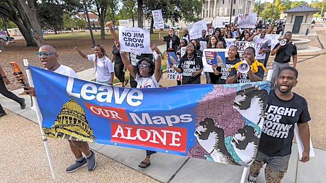
The most significant and controversial change in the new map, which went into effect for the 2022 elections, centered on Pulaski County. As the state’s most populous county and home to Little Rock, it has long been the anchor of the 2nd Congressional District and the state’s primary Democratic stronghold. The new map, passed by the legislature in October 2021, split Pulaski County three ways. Portions of the county, particularly Democratic-leaning and heavily Black neighborhoods in Little Rock and North Little Rock, were carved out of the 2nd District and moved into the staunchly Republican 1st and 4th Districts. To balance the population, the 2nd District absorbed all of Cleburne County, a reliably Republican area.
Accusations of Gerrymandering
The move to divide Pulaski County immediately drew accusations of racial and partisan gerrymandering. Democrats and civil rights groups argued that the map was a textbook example of “cracking,” a tactic where a concentrated bloc of voters from one party or demographic is split into multiple districts to dilute their collective voting power. Opponents claimed the new lines intentionally disenfranchised Black voters, whose influence would be diminished in all three districts. Then-Governor Asa Hutchinson, a Republican, expressed his concerns and allowed the map to become law without his signature, a symbolic show of disapproval. Proponents of the map defended it by arguing that it was necessary to equalize populations and that it actually reduced the number of split counties statewide from five to two. Some also claimed that giving Pulaski County residents three representatives instead of one was a benefit.
The Court Battles and Final Outcome
Multiple lawsuits were filed to block the new congressional map, alleging it violated the Voting Rights Act and the U.S. Constitution by discriminating against Black voters. One lawsuit filed by the Christian Ministerial Alliance, for example, argued the 2nd District was a racial gerrymander. However, these legal challenges were ultimately unsuccessful. Courts dismissed the cases, with a three-judge federal panel ruling in June 2025 that there was not enough evidence to prove the legislature was motivated by racial discrimination when it drew the lines. While some cases saw appeals and were sent back by the Supreme Court for reconsideration based on other rulings, the map has remained in effect. As a result, the congressional districts approved in 2021 are the ones Arkansas is using for the remainder of the decade.