





Arizona, along with the whole Southwest, is waking up to the beginning of a rainfall and flooding event spurred on by tropical moisture from Hurricanes Polo and Odalys.
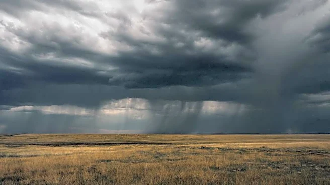
What began as a cloudy Sunday, Sept. 27 with some light showers from a decaying Hurricane Odalys will turn into showers and storms dropping heavy rainfall that could lead to flash flooding between Monday and Tuesday, Sept. 28 and 29. Expect waves of activity throughout both days.
Rainfall totals could push 1.5 inches in the Valley and other lower elevations, or closer to 3 inches or more in high elevations in eastern and northern Arizona. All of Arizona is under flood risk of some level: On Monday, a majority of the high terrain and the northern half of Arizona is marked for a 40%
or higher chance for flash flooding; south-central and southeastern Arizona, including Phoenix and Tucson, have a slight risk of flooding; far southwestern Arizona has the lowest risk. On Tuesday, the highest risk shifts eastward.
Grand Canyon National Park is being watched closely due to the risk of debris flows from burn scars, especially given the late-August flash flooding.
Nearly all of Arizona is under a flood watch in anticipation of heavy rainfall rates of 1 to 2 inches per hour that can cause flooding; most of the alerts last until Tuesday night, Sept. 29. You're encouraged to avoid low-lying areas and roadways, washes and creeks, and don't drive through floodwaters.
This includes parts of northern Maricopa County and metro Phoenix, from Surprise, over to Deer Valley, the edges of North Scottsdale and around to Apache Junction. The only parts of the state not under a watch are inner metro Phoenix and western Maricopa County down to Yuma County, but that doesn’t mean flooding can’t occur. Caution is still advised, especially during heavy traffic and the daily commutes.
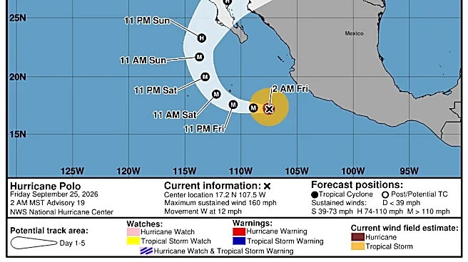
On Monday, Sept. 28, Polo will make its turn to the northeast, pulled inland by a low pressure trough that’s rolling into California. This will lead to Polo’s first landfall on Baja California Monday afternoon or evening, then a second landfall on northwestern mainland Mexico later that night or early Tuesday morning, Sept. 29.
Meanwhile that constant stream of moisture will create near-constant rain throughout parts of Arizona. Earlier plumes of moisture from Odalys have focused on southeastern California, southwestern Arizona and northern Arizona, but by Monday afternoon, the stream from Polo will enter the picture, expanding rainfall east to the rest of the state and New Mexico.
Rain will begin as bands of lighter showers, but as better instability and upper level support develop Monday evening, more thunderstorms become possible through Tuesday. There may be varying lulls in activity based on the area, but this all continues through Tuesday night, slowly quieting as drier air begins to filter in by Wednesday, Sept. 30.
From there, the strong low pressure system and abundant moisture continue into central parts of the country. For the latter half of the week, the potentially high rainfall totals and concerning flood risk shift to the southern Plains, another region that’s been struck by disastrous flooding in recent years, including this summer.
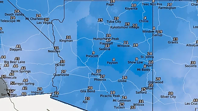
Back in Arizona, cooler temperatures are expected as a result of the rain and cloud cover: Daytime highs should only reach the mid 80s through Wednesday, Sept. 30, delivering a real fall feeling. More average temperatures return heading into the weekend.
Meteorologist Tevian Whitehurst covers extreme weather and climate for The Arizona Republic and azcentral.com. Follow him at @TevianWX on Instagram and Facebook (Meteorologist Tevian Whitehurst).
We want to see your weather photos: Send to weatherpix@arizonarepublic.com, or on Instagram @azcentral or TikTok @azcentral. Attach your photos and tell us all about what's pictured. They may appear in an online story or in the newspaper.
This article originally appeared on Arizona Republic: How Hurricanes Polo and Odalys could drench Arizona with rain, floods