
Welcome to fall, Arizona. It’s now officially autumn meteorologically and astronomically. But of course, in Phoenix, “fall” is a term used loosely until daily temperatures stay below 100 degrees, which, in recent years, hasn’t come until mid-October.
Forecasts from the Climate Prediction Center have consistently displayed increased probabilities for above-average rainfall and temperatures in Arizona. That remains true for the most recent forecast, valid for October through December, and includes the rest of fall and the beginning of winter, both in the meteorological and astronomical sense.
So far, those forecasts have held up during the month of September. Most days have been a few degrees above average, even above 100 degrees, and rainfall has
been near or above average in most of the state. Much of September’s rainfall in the Southwest has been encouraged by tropical moisture surging from disturbances in the equatorial Pacific.
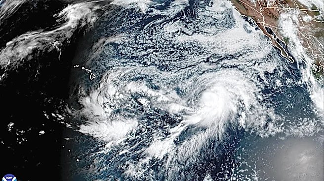
Another prime example is on the way in the new Category 5 Hurricane Polo: It’s a common occurrence in the late monsoon, but also something that’s exacerbated by El Niño.
El Niño’s impact in Arizona
This year will continue to make headlines because of the now-strongest El Niño in recorded history. Ocean temperatures in the monitored region of the Pacific are 3.05 degrees Celsius (5.49 degrees Fahrenheit) warmer than normal — this is 0.03 degrees Celsius (0.054F) warmer than the previous strongest El Niño back in 2015. That’s not a very large gap right now, but the kicker is that there are still two months until the peak is expected.
After months of talking about El Niño, we’re finally entering the seasons when impacts are the most pronounced. The intensification of El Niño will continuously play a large part in long range fall/winter forecasts and large scale weather patterns. While a particularly strong El Niño does not equate to the most powerful impacts we’ve ever seen, this event is paired with human-induced climate change and already warmer-than-ever ocean temperatures across the globe, leading many researchers to expect unforeseen surprises.
During an El Niño winter, the subtropical jet stream usually ramps up across the southern United States, from Southern California to the Southeast. This creates a temperature gradient and draws disturbances along these states, producing an active weather pattern and wetter-than-normal conditions.
If you compare the typical El Niño pattern in the United States to the Climate Prediction Center’s fall outlook, they appear similar.
On a global scale, El Niño pumps large amounts of warm water vapor into the atmosphere that spreads across the world, which is part of what’s led to such intense downpours during weather events — especially in the Southwest.
That is expected to continue heading into the region’s hopefully wet winter, including rainfall for lower elevations and snowfall for the high elevations — something that was completely missing from the 2025-2026 winter. Most of the Rocky Mountain West had a minuscule fraction of the usual snowpack due to little precipitation and abnormally hot temperatures.
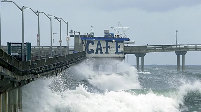
Some states, like California, are getting ahead of the curve: Gov. Gavin Newsom declared a state of emergency, which will allow local and state agencies to plan ahead for the impacts they’ll face, including increased rainfall, snowfall and higher wave heights along the coastline from El Niño-induced Kelvin waves.
How long does El Niño last?
Both extremes of the ENSO pattern see their peak during the winter and lulls heading into the spring and summer. That’s part of the reason this year’s El Niño has been such a big deal — usually such high temperature anomalies aren’t seen until late fall, let alone the middle of summer. However, in regards to timing, the peak of this El Niño is no different.
The Climate Prediction Center’s strength probability forecast shows that El Niño will most likely fall out of the “very strong” levels by March and could even become weak or ENSO-neutral by April or May.
Meteorologist Tevian Whitehurst covers extreme weather and climate for The Arizona Republic and azcentral.com. Follow him at @TevianWX on Instagram and Facebook (Meteorologist Tevian Whitehurst).
We want to see your weather photos: Send to weatherpix@arizonarepublic.com, or on Instagram @azcentral or TikTok @azcentral. Attach your photos and tell us all about what's pictured. They may appear in an online story or in the newspaper.
This article originally appeared on Arizona Republic: Fall arrives in Arizona, with a strong El Niño — and Hurricane Polo