




On Nov. 11, 1926, travel in the U.S. changed forever, not because of air travel or any technology advancements but by one road.
“All of these roads ultimately have their roots in November 1926,” said Sean Evans, a scholar, historian and writer. “Route 66 is, in itself, a history of American roadbuilding and American travel.”
The nation will celebrate the 100-year anniversary of Route 66 in November.
The 2,448-mile road was among the nation’s first federally numbered highways. It connected the Midwest, a farming and manufacturing powerhouse, to the ports on the West Coast, carrying thousands of jobseekers. It witnessed and propelled much of modern American history, from the Dust Bowl migration to segregation, and eventually became synonymous with
the freedom of the open road.
Route 66 also brought prosperity to communities along the way. The range of a car dictated where gas stations were needed. Where a gas pump went, a town followed. Where towns went, tourists came.
But over time, the road of dreams crumbled. Many segments and towns were abandoned.

As it approaches its centennial, Route 66 appears frozen in time. It looks much like it did 70 years ago, historians said: the rolling hills between Flagstaff and Kingman; the twists and turns snaking around a mountain on the way to Oatman; the backdrop of copper-streaked cliffs along the Arizona-New Mexico border.
Arizona’s section of Route 66 is unique — about 250 miles of the 385-mile roadway is drivable. It is still used today in places like Flagstaff by commuters to get across town and places like Winslow as Main Street. Bikers seeking a thrill ride drive the 8-mile Arizona Sidewinder section with 191 hairpin turns outside Oatman, in northwest Arizona.
To some, though, Route 66 is more than a road.
Route 66 “is not unique, terribly,” Evans said. But “it is a lens through which we can look at Arizona and American history.”
The historic birth of The Mother Road
History paved the path of Route 66. It began as an Indigenous trade route along the 35th parallel, and later, Spanish and American explorers used those paths. The Atchison, Topeka & Santa Fe Railroad traced the route, which became the first alignment of Route 66 through Arizona and New Mexico.
A traveler in a horse-drawn carriage would take just about a week to travel 160 miles between Flagstaff and Kingman along that route.
Then came the car.
At its birth in 1926, Route 66 was a patchwork of existing state, county and city roads, paved and unpaved, Evans said. Government engineers labeled the existing main streets of Winslow, Seligman and Flagstaff as part of the route.
"Route 66 was an intellectual construct. There was very little road building to make Route 66 happen," Evans said. "You drew the road — you didn't build the road."
By then, a Ford Model T, the most popular car in 1926, could make the trip between Flagstaff and Kingman in six to 10 hours.
But what leaders didn’t foresee was just how important the route would be, not only as a trade route but as a route for freedom.
“It’s the road of dreams. It always has been,” said Jim Hinckley, an internationally renowned Route 66 historian and author based in Kingman.
The two-lane road carried an estimated 200,000 to 250,000 farmers seeking a better life during the Dust Bowl, and the road was not fully paved until 1938. A year later, John Steinbeck's classic novel, "The Grapes of Wrath," cemented its importance in the popular imagination with the moniker The Mother Road.
Route 66 brought tanks across the nation during World War II. Later, it propelled a new dream: the leisurely freedom of the open road.

The heyday of Route 66
After World War II, millions of Americans took to the open road, ringing in the heyday of the road trip.
Route 66 cut through the heart of many small towns across America. In Arizona, it brought travelers and customers right to Angel Delgadillo’s doorstep in the small, sleepy northwest Arizona town of Seligman.
“I could see the traffic up and down, and I could see the people up and down” the road, Delgadillo said. “I’ve been seeing it forever.”
Route 66 fueled the creation of towns along the way, like Truxton, as entrepreneurs cashed in on travelers' need for gas, food and lodging.
By 1955, the most popular car, a Chevrolet Bel Air, could go about 180 miles without stopping for a fill-up.
Authorities didn't record precise traffic counts in the 1950s and 1960s, but estimates of the number of Route 66 motorists in Arizona are in the millions. Road trips became a staple of the American family as an affordable way to travel and as families enjoyed more disposable income.
“It was a very car-culture environment” back then, Evans said, “and (Route 66) just fed all of that.”
Delgadillo, born in 1927 in Seligman, has lived his entire life along the route. A barber by trade, he opened his father’s pool hall in 1950 and worked shaving and cutting hair. Next door, his brother, Juan, opened the now-iconic Delgadillo’s Snow Cap, a burger and ice cream joint. Another brother ran a garage and service station.
At its peak, 9,000 cars passed through Seligman a day. Evans put that estimate between 10,000 to 12,000 for other towns along the road, like Flagstaff.
But the road wasn't designed or built to handle the travel boom in the late 1940s through the 1970s. Route 66 took a beating.

The federal government acted. Inspired by Germany’s autobahns, President Dwight Eisenhower and Congress passed a plan in 1956 to create a national superhighway system. Interstate 40 would replace much of Route 66 through the western U.S., leaving a trail of abandonment in its wake.
Interstate 40, a 'devastating' but necessary 'evil'
Delgadillo, at 99, remembers the day I-40 opened like it was yesterday.
“Everything was going beautiful,” he recalled. “But on September 22, 1978, at 2:30 in the afternoon,” he paused, clapping his hands once, “traffic stopped.”
I-40, which stretches across northern Arizona from the New Mexico border to the California border, took about 25 years to be completed, with the last stretch bypassing Williams in 1984.
The four-lane, fully paved highway mostly sits atop Route 66 between the New Mexico border and Ash Fork, 50 miles west of Flagstaff. West of Ash Fork, I-40 diverts from Route 66, forming the longest section of Route 66 remaining in the nation today, a 160-mile arc from Ash Fork to the California border.

On I-40, drivers could now get from Flagstaff to Kingman in 1985 in 2 1/2 hours, a quarter of the time needed when Route 66 opened. Cars not only went faster, they also reached farther on a tank. They didn't need to stop in the towns. The Chevrolet Cavalier, that year's most popular model, could make 305 miles on single tank.
Delgadillo called the interstate "devastating." Hinckley said it was a “necessary evil" because crumbling Route 66 was riddled with potholes and gaping fissures.
By the time the last section was bypassed in 1984, the entirety of old, winding Route 66 was outdated, poorly maintained and functionally obsolete, the National Park Service said.
Route 66 lost its federal recognition in 1985. The responsibility for the road's maintenance fell to state and local governments.
What Route 66 looks like on its 100th birthday
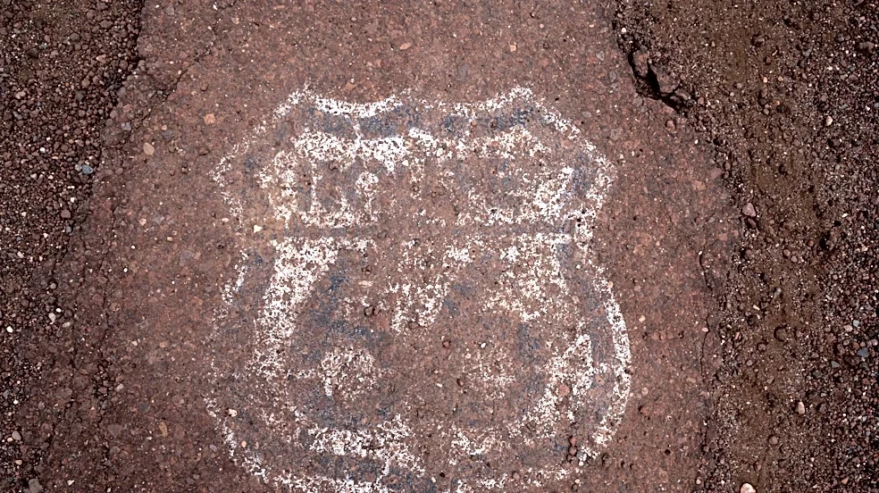
In Arizona, parts of Route 66 between the New Mexico border and Flagstaff lay abandoned next to I-40, mirroring the curves of the freeway and train tracks, the reddish pavement lined with cracks from age and wear. Some sections start and end with seemingly no rhyme or reason, and other alignments were never paved.
West of Flagstaff, Route 66 loops across mountain ranges, touches the southern tip of the Hualapai Indian Reservation and continues down through Kingman and the Black Mountains on the way to the California border.
Route 66 still exists thanks to Delgadillo. In 1987, he became the first in the nation to urge the government to preserve Route 66. He helped secure the road’s historic designation, starting with a 92-mile stretch between Seligman and Kingman.
Efforts to preserve Route 66 ramped up in the 1990s with a National Park Service Route 66 Corridor Preservation Program. States, counties, cities and nonprofits work to preserve and improve the roadway today.
About 250 miles of the original 385-mile highway are drivable in Arizona through local roads, state highways, historic alignments or old pavements. The rest is inaccessible or impassible.
The Arizona Department of Transportation maintains the part of Route 66 between Kingman and Seligman, which wasn’t absorbed by I-40, a hilly two-lane road that winds north through Peach Springs with few potholes.
But much of the road’s upkeep falls to local governments, typically as local commuter routes.
Coconino County invested $1.7 million to repave the road and widen the shoulder near Parks, 23 miles west of Flagstaff, ahead of the centennial.

In Flagstaff, Route 66 moves between 20,000 and 40,000 daily commuters, students and visitors across town. In Parks, children walk along the two-lane road to get to school, dirt and evergreens lining the street. In Peach Springs, Route 66 is the gateway to the Hualapai Nation and connects visitors to the Grand Canyon.
The electric future of Route 66
The road made famous by gas-guzzlers is going green, ushering in its next chapter and its second century.
Route 66 has been a proving ground for alternative-fuel vehicles since the early 2000s, Evans said, because it wasn't terribly hilly and didn't have major elevation changes.
Communities along the way have embraced electric vehicles. Drivers can find vehicle chargers across the entirety of Route 66 in Arizona from as far west as Kingman to as far east as Holbrook. The longest stretch without a charging station is the 110 miles between Ash Fork and Kingman, less than the full range of a Tesla Model Y, the most popular electric vehicle.
That car can go more than 300 miles on a full charge. A full charge takes between 30 minutes and 24 hours depending on what type of charger is used.
"Even the mom-and-pop motels are starting to get charging stations," Evans said. "The demand is rising, and the market is providing.
Route 66's stories, though, still connect the communities along it and capture the imagination of children and adults alike.
“People are rediscovering America,” Hinckley said. “When you turn off the TV and get away from people selling division, you realize how much we have in common. We start visiting with people, (and) we start discovering our heritage. You start discovering all kinds of surprises.”
Lauren De Young covers transportation for The Arizona Republic. Reach her at ldeyoung@azcentral.com.
This article originally appeared on Arizona Republic: Route 66's legacy is more than just neon lights. It changed travel forever