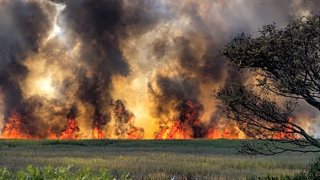



The Campwood Fire, burning six miles northeast of the small copper mining community of Bagdad, west of Prescott, dropped off the Blue Mountain ridgeline on August 26 into heavier fuels, sparking flames 100 feet in length.
Firefighters are now working in steep, difficult terrain to control the blaze, which is estimated to span 176 acres, according to a 10 a.m. update from the Arizona Department of Forestry and Fire Management.
Aerial ignitions to conduct preventative burning in inaccessible terrain are scheduled for the early afternoon on Aug. 26, weather permitting. A scheduled helicopter flight will also map the perimeter and gain additional intel for aerial firing operations.
The fire is currently 0% contained. It was sparked on Sunday, August
23, when a storm passed through the area.
Exceptionally dry fuels and soils, exacerbated by a multi-decadal drought across the Southwest, have contributed to a record year of ignitions and acres burned across the West. Abnormally high temperatures related to global climate change have also allowed fires to burn faster, hotter and more intensely, causing more lasting damage to landscapes. All of this has taken place at the same time that unprecedented cuts to federal funding by the Trump administration have strained Forest Service staff and fire prevention research and activities.
The Campwood Fire is burning through chaparral and pinyon-juniper vegetation. These are fire-adapted plants that typically grow in areas where wildfire is a natural part of the ecosystem, though on a smaller scale than what has been seen in recent years. This shrubby vegetation is often difficult for firefighters to access and move through.
In 2013, the Yarnell Hill Fire in similar habitat caused the deaths of all but one member of the Prescott-based Granite Mountain Interagency Hotshots elite firefighting crew when it erupted and overtook them on a shrubby slope. That memorial site, now at the end of a 3.5-mile trail near Yarnell, is about 30 miles from the active Campwood Fire.
In light of these risks to firefighter safety, the department is focused on using aerial operations to help "bring the fire down into more manageable terrain and lighter fuels allowing resources to work safely along the fire's edge." The department also emphasized that, even though the fire remains at 0% containment after three days, "that does not mean firefighters are not making progress."
As of 7:15 p.m. on August 25, approximately 130 personnel were assigned to the incident, according to the department. These included the Navajo Hotshot team, hand crews, engines, medical staff and others. These crews have successfully established and improved containment and control lines in preparation for aerial activities.
No injuries or burned structures have been reported, though the department did note the Campwood Fire's proximity to two ranches. On August 25, firefighters were "improving structure protection efforts, setting up hose lays and sprinklers, around structures associated with the Wildhorse Ranch to the northeast of the fire."
The department did not immediately respond to requests from The Arizona Republic for additional context, details on firefighting operations or more recent updates on the status of threatened structures or number of assigned personnel.
Joan Meiners is the climate news and storytelling reporter at The Arizona Republic and azcentral.com. Send tips or questions to joan.meiners@arizonarepublic.com or follow her work on Instagram at @joan_bikes_arizona.
This article originally appeared on Arizona Republic: Campwood Fire in Yavapai County enters tricky terrain, is 0% contained