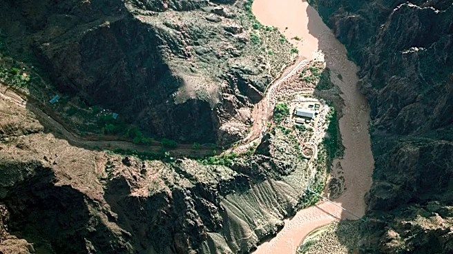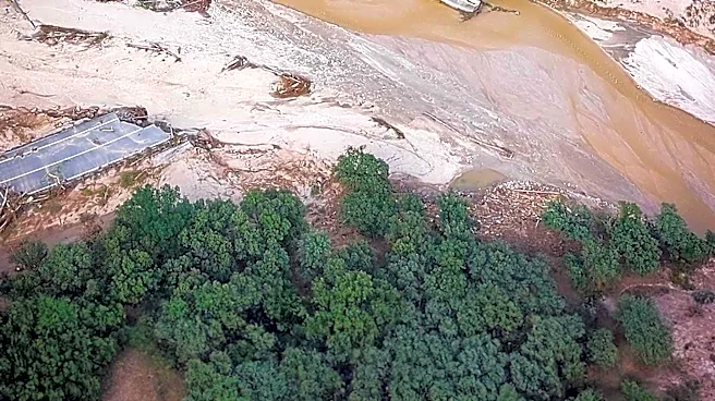

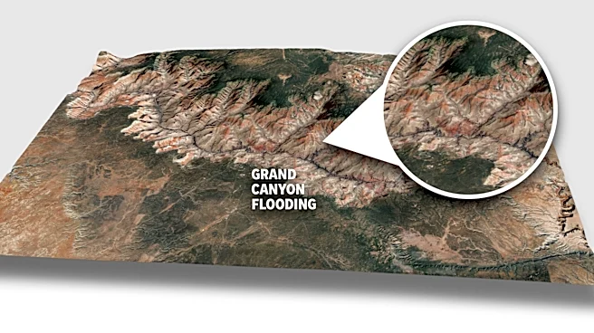
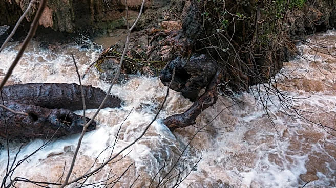
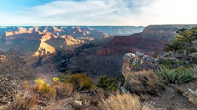
GRAND CANYON NATIONAL PARK — On Aug. 29, a flash flood that scientists had been warning about since the Dragon Bravo wildfire scorched the North Rim of the Grand Canyon last summer pushed sooty mud and fire debris down Bright Angel Creek and over the top of Phantom Ranch, the historic refuge for hikers and river rafters at the bottom of the Canyon.
The violent rush of water also caused two deaths. More than 80 people were evacuated from Phantom Ranch and the North Kaibab Trail, and initially a search was launched for more than 20 missing people. As of Sept. 2, one person remained missing.
On Aug. 31, I hiked to the bottom of the Canyon to see the damage and report on it for The Arizona Republic. We were the first news outlet to get close to and photograph
the flooding damage. What I experienced became one more chapter in my years of reporting on environmental change across the Southwest.
Going in, I knew the flood area and inner canyon were inaccessible from the North Rim but would be possible and safer to approach from the south. I have hiked and backpacked through this Canyon many times as a local, so I knew the challenge. My experiencing traversing all of Arizona on my mountain bike in 2025 while writing about it for The Republic also helped boost my confidence that I could get to the bottom and back safely.
As I write this, the entire North Kaibab Trail and Phantom Ranch ranger station and campground — where generations of boaters and hikers have refueled at the snack bar with a glass of cold lemonade before the hike back up or the journey down the lower Colorado River — remains off-limits. Footbridges crisscrossing Bright Angel Creek through "The Box" and other pinch points have reportedly been washed away. The South Rim is navigating new water shortages after damage to the pipeline system by calling for restrictions and temporarily shuttering lodging options.
But the Mather Campground and trails into the Canyon from the South Rim as well as trails and viewpoints up top on both sides remain open. Amenities outside the park in the small towns of Tusayan to the south and Jacob Lake to the north are also fully available.
Starting from a South Rim more somber and quiet than I've ever seen it, I ended up spending eight hours completely alone in the Canyon and emerged that night to report here what I saw.
Starting in the rain, in a world of canceled adventure plans
It rained on and off as I descended the South Kaibab Trail. I passed one ranger heading up who asked how far down I planned to go and told me that, as long as I liked hiking in the rain, I would have a good time. After that, I saw only a handful of people all day — an experience I could never have imagined in one of the world's most popular tourist destinations.
In some spots, the trail resembled a river or a lake. In others, careful design and laborious rock work had drained and held it together well. I walked along boulders lining the trail at spots, sending my thanks to generations of Grand Canyon trail crews. In a switchback section, I stepped over a large, uprooted pricky pear cactus across the trail.
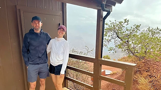
At the Cedar Ridge bathroom a couple of miles in, I met a couple from Austria. We talked about the weather and our hiking plans while huddling under the bathroom roof as a heavier storm cell passed overhead. With my metal hiking poles strapped to my backpack, I was cautious in active lightning lest the rescue crews and rangers have yet another distressed visitor.
Yannick Schneider, 35, had been to the Canyon three times before and hiked rim-to-rim in 2013. But it was a first visit for his partner, Alena Manstein, 31. Taking shelter from the rain under a bathroom roof at Cedar Ridge on the South Kaibab Trail, she was upbeat but shared her disappointment that the modern reality of extreme weather events is restricting options for adventure travelers.
"We knew we wanted to come here, but we weren't quite sure when because we like to be quite spontaneous with our travel," Manstein said. "We originally planned to hike down and camp at Phantom Ranch for a night. Then we found out about the flood and the closures."

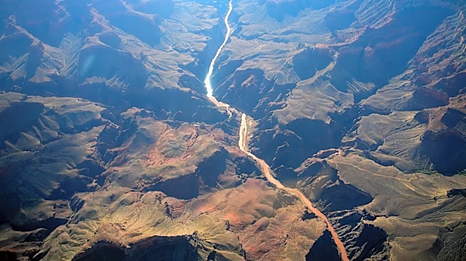
We commiserated about the difficulty of planning out a vacation, let alone a life, in a climate-destabilized world. Then I continued on to Skeleton Point, which offered the first view of where Bright Angel Creek meets the Colorado River after twisting its way down the Canyon's north side. The delta at the confluence looked more full of boulders and logs (drowning hazard "strainers" to a river rafter) than when I had last seen it on the same hike in March.
In this vast natural wonder shaped by the sometimes-violent forces of water over eons, flash floods and the debris they carry into the river are not unusual or concerning — they are part of what gave us this unrivaled, magnificent landscape and the thrilling joy of running a rocky river rapid.
But the magnitude of these storms and their consequences has been rising like these flash floodwaters. In Nepal, just a few days before the flooding down Bright Angel Creek wiped out long-standing infrastructure in the Grand Canyon, a flash flood on a far larger scale killed hundreds of people and swept away homes, bridges and infrastructure. In Texas, communities have still not recovered from unexpected flooding last year that devastated a girls summer camp.
In Zion National Park, simultaneous flooding struck the gateway town of Springdale and favorite tourist spots there. When I posted about hiking to see the flood damage, friends in Utah thought I was heading to Zion.

Age-old natural forces exceed normal in a warmed world
None of this is normal. Yes, massive flash floods in the Grand Canyon, even in Bright Angel Canyon specifically, have happened before. But none quite like this. That's what I learned from park reports, and directly from the man who knows the park water system and Bright Angel Canyon best.
On the evening of Sunday, Aug. 30, as I prepared to hike into the canyon the next day, I met with Bruce Aiken in Flagstaff. Aiken lived at the Roaring Springs pumphouse below the North Rim in Bright Angel Canyon for 33 years, until 2006. He raised his three kids there with his wife, Mary. And he spent the time he wasn't maintaining the water system gaining fame as an artist by capturing the canyon in paint on more than 300 canvases.
One flood in 1966, Aiken told me, approached the destruction level of this disaster 60 years later. Another caused damage to water infrastructure and trails on the north side of the canyon in 1995.
His daughter, Shirley Jo, grew up swimming with her two siblings in Bright Angel Canyon's best water holes and drying off on its best sandstone boulders. They have seen flooding and fire and change in the canyon. But this, they told me, is on another level.
"If the fires had not taken place, I believe that the forest could have absorbed the rain, and the floods would not have happened," Shirley Jo Aiken told me in Flagstaff. "There's a consequence, and ultimately it's going to come back to climate change. We understand that fires and floods are going to happen, but this is just beyond."
Early reports from the park estimate that 40% of the Transcanyon Waterline that Bruce Aiken worked on, a massive 1960s infrastructure project to transport water 12.5-miles to the South Rim from the Roaring Springs pumphouse, was taken out by the flood. It has been the only source of water throughout the park, and necessitated water restrictions and lodging closures on the South Rim (though businesses, campgrounds and trails in the area remain open). Damage to the $208 million replacement project, now three years in the works and just shy of completion, is yet unclear.
“This flood would not have happened without the fire," Bruce Aiken agreed. "It took out so much vegetation that would have held more of that water."
This is also what I heard from scientists after the Dragon Bravo wildfire scorched 150,000 acres of ponderosa and pinyon-juniper forest on the North Rim in the summer of 2025. A warmed atmosphere — that scientists have traced with certainty to the heat-trapping effect of greenhouse gases released by humans burning fossil fuels for energy —has dried out vegetation, making it more likely to ignite and burn faster, hotter and farther. And, with more water vapor in warmer air, rainstorms fall heavier and run off faster over heat-hardened soil.
Climate change is also making wildfires more difficult for firefighters to contain and more damaging to landscapes that, in cooler times, were well-adapted to recover from occasional burns that served to clear out dead brush. While management failures and an overgrown forest didn't help, experts say it was a layered disaster.
“We all know that fire seasons are getting longer and more intense," Don Falk, a wildfire expert and professor at the University of Arizona, told me last year about the Dragon Bravo fire and wildfire patterns across the West. "But that’s kind of the month-to-month seasonal cycle. This is the daily, 24-hour cycle. And what’s been happening now is the nighttime temperatures don’t drop as much. It stays hot, and that is very undeniably a climate change impact."
Falk and others, including the Burn Emergency Area Response team, knew then that the charred trees and soil would someday soon succumb to a monsoon flood, unable to absorb and hold the rainfall back as they had in decades past.

I can already feel the mail flooding into my inbox from Arizona climate deniers. So let me be clear: No one is saying that climate change started this fire (it was started by lightning). No one is saying that flash floods or flooding events are a result of climate change. I was evacuated by boat from a backpacking trip in Yosemite about 15 years ago when heavy rainfall made the trail around Hetch Hetchy Reservoir impassable. Strong weather events have disrupted plans and vacations and lives forever.
But many scientists around the world agree that climate change is making not-so-natural disasters like wildfires and flooding worse. The U.S. West logged its worst wildfire summer in recorded history — at the same time that the Trump administration has upended staffing, organization and funding for firefighting agencies and research into wildfire control and prevention.
And dendrochronologists at the University of Arizona know from the pre-human history recorded in tree rings that we are experiencing a new, supercharged wildfire reality. More damaging wildfires are often followed by more damaging floods.
In early June, I hiked into North Canyon along the East Rim of the Grand Canyon north of the main corridor with a team of hydrologists from Northern Arizona University. They were trekking to stream monitoring equipment that their boss, NAU professor Abe Springer, has had in place for decades.
Much of the trail these field researchers typically follow to access where springs emerge from underground or return there had vanished beneath a pile of ash. We trudged on as if walking through last night's campfire. Blackened sticks towered above, the sunshine reaching us through what a year prior would have been tree shade.
Scientists have not yet had a chance to analyze the Aug. 29 flash flooding event. Teams of researcher will likely work on teasing out cause and effect details for years to come. Most won't venture now to say exactly what the role of climate change here was — though I hear the U.S. Geological Survey office in Flagstaff already has a media interview request list a mile long.
But all of the experts and lifelong observers would agree that climate change played a role and that, while the Grand Canyon's beauty and enormity can withstand these forces and more, the human experience in these places is changing.

Onward to the bottom, then back up in darkness
After I said goodbye and good luck to the couple from Austria, I did not see another human on the trail for eight hours. I descended through more rain, down switchbacks, past pour-overs where water trickles down normally dry washes. I scrambled over rock slides obscuring the trail, one with a bundle of maintenance tools under a tarp nearby.
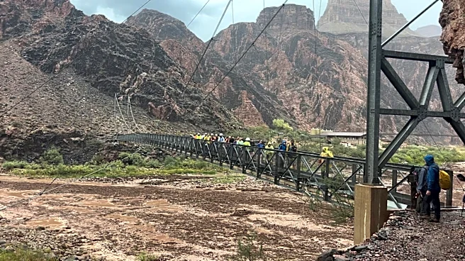
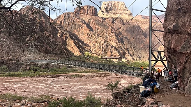
About 2 p.m., I arrived at the closest to Phantom Ranch that it's currently possible for nonemergency folks to access, across the Colorado River on its south side along the River Trail between the black and silver bridges.
In addition to the pile of boulders that had not been there in March, I immediately noticed a footbridge lying in the rubble near the confluence. Farther down the river, the remains of what appeared to be most of a building lay in the middle of the Colorado River. The roof of a bathhouse at Phantom Ranch appeared to still be mostly intact, and I could see the rock outlines of some of the trail meandering through the campground.

The recently built wastewater treatment facility on the banks of the Colorado River on the delta appeared largely unscathed. While I stood watching near the closed silver bridge, I saw a helicopter rev up and take off from there and zoom off south down the canyon, perhaps in search of the last missing hiker.
Out of cell service and alone, I recorded a news video, scripting from memory while holding my phone in selfie mode with Bright Angel Canyon in the background. Then I switched to shorts, pulled out my emergency reserve Red Bull, and started the long hike back up to the South Rim along the Bright Angel Trail about 4 p.m. Of course, after a rainy and chilly day, this is the moment the sun chose to emerge and resume August temperatures while I climbed.
At the Havasupai Gardens rest area (formerly Indian Gardens) with 4.5 miles to go, I passed a family in the campground making dinner. They stared at me, seemingly a bit surprised, then we waved to each other and I continued on.
With my neck and feet aching more at each switchback, I thought about Mindy Riesenberg, chief communications officer for the Grand Canyon Conservancy, cautioning me to be careful today and maybe stay near the rim when she sent a statement wishing safety and swift recovery for emergency responders and hikers in formidable conditions.
As the park's official nonprofit partner, the conservancy had already been immersed in the now-larger task of getting North Rim infrastructure, support systems and trail networks back online for visitors after the Dragon Bravo Fire. Amid a National Park Service maintenance backlog, staffing shortages and no federal relief lately, they will likely now need more help and funding.

I reached the 3-mile (to go) Resthouse just as the sun was fading behind Coconino sandstone cliffs. Then I hiked alone for another hour or so in the dark. When my headlight shone on Victor Vomit, the fan-favorite sign warning tourists of dehydration and heat exhaustion that is posted about a half-mile down into inner canyon trails, I knew I just had a few hundred more steep steps and then a shuttle ride to my car, the only one remaining in the visitor center parking lot.
As soon as I regained cell service, my editor texted concerns about me being out late and alone in the dark after a long day. I assured him I was tired but not unhappy with my day.
In the distance to the north, somewhere in the vicinity of Bright Angel Canyon, flickering lightning added mystery and comprehension to a sky filled with stars. Nothing can take away this canyon's grandeur. I hope we can take care of our ability to experience it.
Joan Meiners is the climate news and storytelling reporter at The Arizona Republic and azcentral.com. Her journalism for various outlets has won national awards for investigative reveals, feature writing, business reporting and innovative climate coverage. Before becoming a journalist, she completed a doctorate in ecology with a focus on native bees. Send tips or questions to joan.meiners@arizonarepublic.com or follow her work on Instagram at @joan_bikes_arizona.
This article originally appeared on Arizona Republic: After fatal flooding, reporter finds herself alone at Grand Canyon | Exclusive