



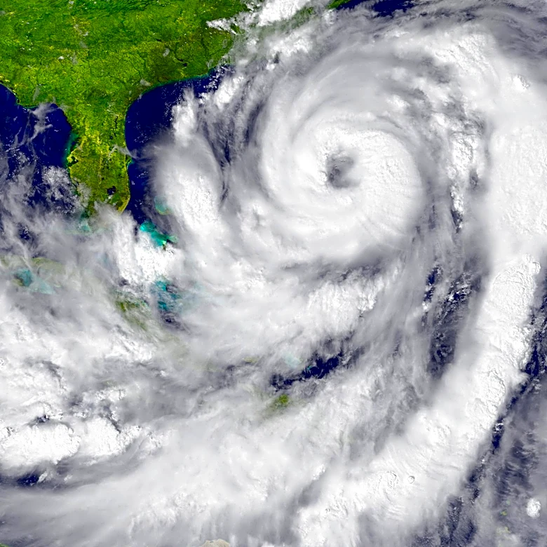

The National Hurricane Center is watching a knot of low pressure in the southwestern Gulf for potential development, giving it a 50% chance of becoming a tropical cyclone over seven days in waters that are record warm.
It's an area weather models have been sniffing around for days and a spot where tropical turbulence likes to brew this time of year with lax wind shear giving systems room to grow. NHC meteorologists on Monday, Oct. 5, said conditions are only marginally favorable for a budding storm but that the area of low pressure could become a tropical depression late this week as the system drifts east then north.
The next name on the 2026 hurricane list is Isaias, pronounced ees-ah-EE-ahs.
This year, anything trying to gain purchasein the
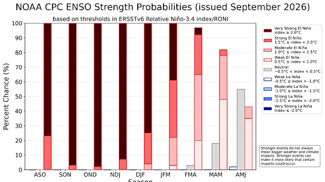
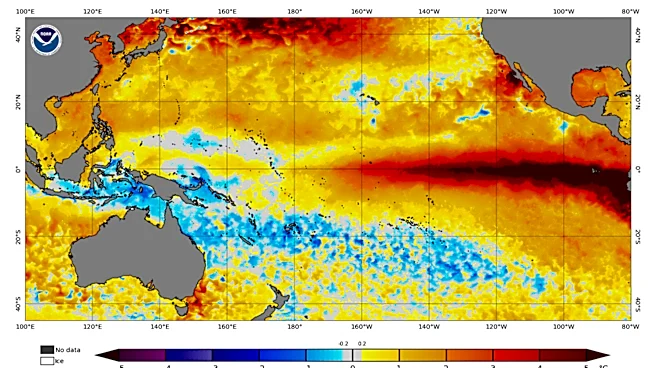
Bay of Campeche will contend with an increasingly potent El Niño, which has so far limited storm activity — both killing embryonic systems and reducing the lifespans of others.
Although eight named storms have formed, the Atlantic basin has had no hurricane this year.
And while hurricane experts were lukewarm late Sunday on whether a hurricane can form in the Gulf, they said the spot is worth watching.
A simmering area of low pressure could take advantage of the frontal boundary that is expected to stall across Central Florida and the Gulf later this week. The front, regardless of tropical tumult, may bring flooding rains to anywhere along the Gulf Coast for the coming weekend, including Florida.
"The bottom line is that's it's something to keep an eye on, but nothing major is likely to develop," said FOX Weather hurricane specialist Bryan Norcross in his Hurricane Intel blog Sunday. "And the odds of anything organized developing are low."
Jeff Berardelli, WFLA-TV chief meteorologist in Tampa Bay, agreed for the near term. He said on social mediathat the "general theme" is whatever forms stays relatively sloppy, broad and not very strong."

Berardelli said on Sunday that Google DeepMind, which was the breakout weather model last year, was giving the trough of low pressure a 56% chance for development with about a quarter of models pointing to a hurricane.
Several Google DeepMind models keep the system stuck in the southwestern Gulf with a track into Mexico, but models notoriously struggle with systems that haven't formed yet. Until an actual tropical cyclone forms with a closed center, track forecasts aren't considered reliable.
Florida is the most vulnerable state to hurricanes this month. Hurricanes Wilma, Michael and Milton all made October landfalls in Florida. Milton, which hit Florida's west coast as a Category 3 in 2024, grew in the same area in the Gulf being highlighted by the NHC.
Rick Knabb, on camera meteorologist and hurricane expert for The Weather Channel, noted that the Gulf has already produced three tropical storms this season — Arthur, Bertha and Edouard — all of which made Gulf Coast landfalls.
"If Edouard had more time over water that could have become a hurricane and that storm's formation was not forecast or anticipated several days in advance," Knabb said. "It quickly got its act together, and, conceivably, any October, including this one, we could be dealing with a hurricane in the gulf and maybe one that forms relatively quickly."
The last time the name Isaias was used was in 2020 when a storm that formed in the eastern Caribbean Sea took a swipe at Florida, coming within 40 nautical miles of West Palm Beach and Fort Lauderdale as a tropical storm. It made landfall as a Category 1 hurricane near Ocean Isle Beach, North Carolina late on Aug. 3.
Part of Florida's October vulnerability is geography. It dangles closer to the Caribbean than any other state, with its string of Keys nearly touching the Tropic of Cancer. Surrounded by water, a tropical cyclone can approach from the Gulf of Mexico or the Atlantic.
Part of it is seasonal. During the early days of hurricane season storms foment along lingering cold fronts that droop into the Gulf of Mexico, now referred to as the Gulf of America by the U.S. Government. It’s a time when Saharan dust and cool water dims hurricane chances in the bowling alley between Africa and the Caribbean and when tropical waves are still mustering strength before rolling off the continent in force.
By mid-October, the often busy runway in the tropical Atlantic gets muzzled by wind shear, leaving storms to grow in the sizzle of the Caribbean and Gulf. Once in the Gulf, fall cold fronts can pick storms up and fling them toward Florida.
Kimberly Miller is a journalist for the USA TODAY NETWORK FLORIDA. She covers weather, the environment and critters as the Embracing Florida reporter. If you have news tips, please send them to kmiller@pbpost.com. You can get all of Florida’s best content directly in your inbox each weekday by signing up for the free newsletter, Florida TODAY, at palmbeachpost.com/newsletters.
This article originally appeared on Palm Beach Post: Hurricane center watching area in the Gulf for possible development